
3D Geology
Digital geological 3D models are an important tool for visualising complex issues in the subsurface in a simple and understandable way. They make an important contribution to subsurface planning.
Geological 3D models show the nature and structure of the subsurface and are an important basis for gaining detailed knowledge that concerns subsurface planning. There are many uses (e.g. infrastructure, energy and raw material extraction), but the usable space is scarce. Any conflicts of use that arise can be visualised with 3D models.
swisstopo provides regional and national geological 3D models as a basis for detailed work by its clients:
swissBEDROCK3D
swissBEDROCK3D is a comprehensive dataset that provides detailed information on Switzerland’s bedrock surface. In addition to the bedrock elevation model (BEM), it includes information on the thickness of unconsolidated deposits (TMUD).
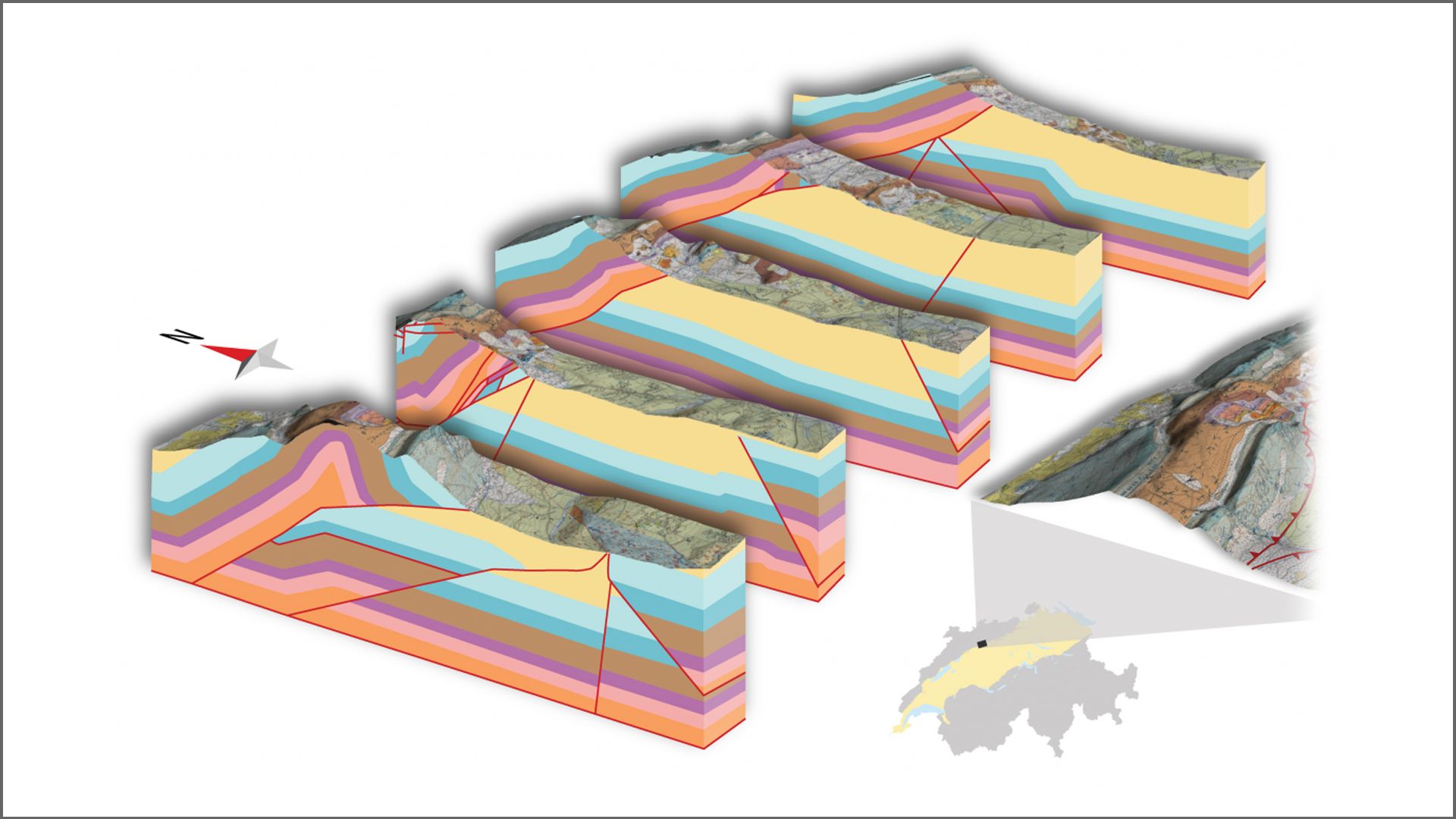
swissJURA3D
The 3D geological model swissJURA3D is a three dimensional representation of the subsurface of the Swiss Jura, from northwest of the Molasse Basin to the national border. It covers the Swiss part of the Jura (Internal and External Folded Jura) as well as the Swiss parts of the Haute-Saône Platform, the Upper Rhine Graben and the South German Platform.
The geological 3D models are standardized, stored and made available via the 3D viewer of swissgeol.ch.

The GEOL_BIM project
The innovation project GEOL_BIM complements building information with spatial geological data. The combination of diverse specialist information at an early stage promotes collaboration and safety in the planning and operational phases of buildings.