
Switzerland in high resolution
As the main input for the production of geodata, aerial images are the basis for products such as SWISSIMAGE or national maps. Thanks to a state-of-the-art photo sensor, swisstopo brings you Switzerland in high resolution.

At swisstopo, we have been photographing Switzerland from above since the mid-1920s. Several changes in equipment have made it possible to follow the technological evolution from black and white to colour, to add infrared information or to increase ground resolution. In 2005, the acquisition of aerial images entered the digital age.
State-of-the-art airborne technology
Since 2026, swisstopo has been using the Leica DMC-4S camera for the acquisition of its aerial imagery. Unlike along-track scanning sensors (used between 2005 and 2025), this next-generation digital camera is based on matrix technology composed of several synchronized sensors that simultaneously capture very high-resolution images.
During flights, images are taken with strong longitudinal and lateral overlap, allowing efficient coverage of large areas while ensuring precise geometry. The imagery is acquired in multiple spectral bands (red, green, blue, and near-infrared), providing extended analytical capabilities.
Thanks to the significant overlap between images, it is possible to reconstruct an accurate three-dimensional model of the observed surface. This process, known as photogrammetric processing, enables swisstopo to produce and update numerous datasets such as terrain models, landscape models, and national maps.

To ensure optimal coverage, the images are acquired with a lateral overlap of at least 55% and a longitudinal overlap of 80%.
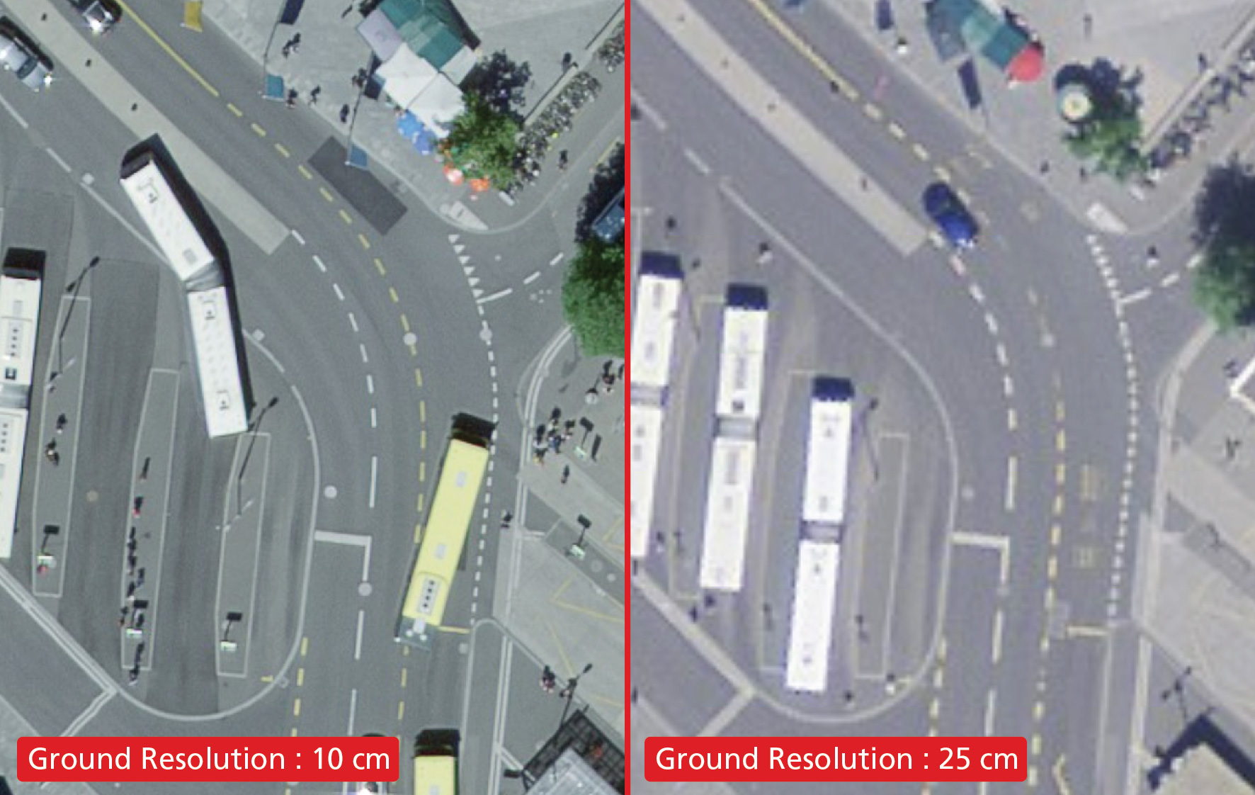
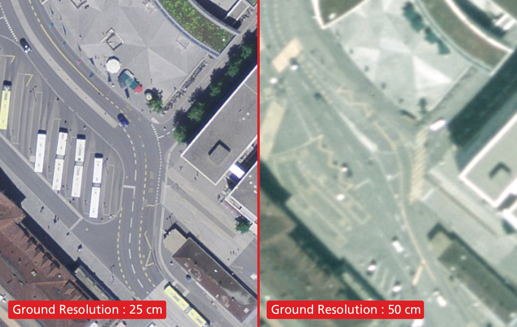
To guarantee the best possible quality of our products, from 2017 onwards all photographs will be taken with a ground resolution of 10 centimetres on the Swiss central plateau, in the Jura, in the south Tessin and in the two main Alpine valleys (the Rhone downstream from Brig and the Rhine downstream from Chur). With significant differences in altitude, the more complex topography of the Alps limits this ground resolution to 20 centimetres (from 2026 onwards; previously, the resolution was 25 cm).
The aircraft that acquires these images flies over the territory in an optimized way according to topography and weather conditions. The flight is conducted at approximately 2,850 m above ground to achieve a ground resolution of 10 cm, and at approximately 5,700 m above ground for a resolution of 20 cm.
Photography by region
swisstopo periodically flies over and photographs Switzerland and Liechtenstein. Since 2008, one-third of the territory has been photographed each year according to a defined regional division. As of 2017, the country has been divided into 3 regions based on cantonal boundaries.
- Western region (6 cantons: GE, VD, NE, FR, JU, VS) - First acquisition 2017, next acquisition every three years.
- Central region (10 cantons: BE, BL, BS, SO, AG, LU, OW, NW, UR, TI) - First acquisition 2018, next acquisition every three years.
- Eastern region (10 cantons: SH, ZH, TG, SG, AI, AR, SZ, GL, ZG, GR) and the Principality of Liechtenstein - First acquisition 2019, next acquisition every three years.
Thanks to this regional division, municipalities and cantons are always in possession of complete data from the same flight year for their entire sovereign territory.


More information
- Digital aerial images (coming soon)
- Digital image strips
- Scanned aerial images
- Flight service
- The flight service used for recording aerial images
Seftigenstrasse 264
3084 Wabern