
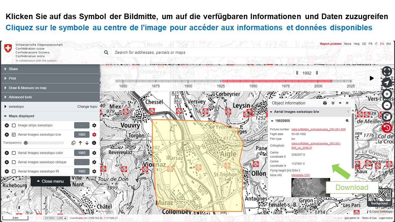
Individual aerial photographs over time
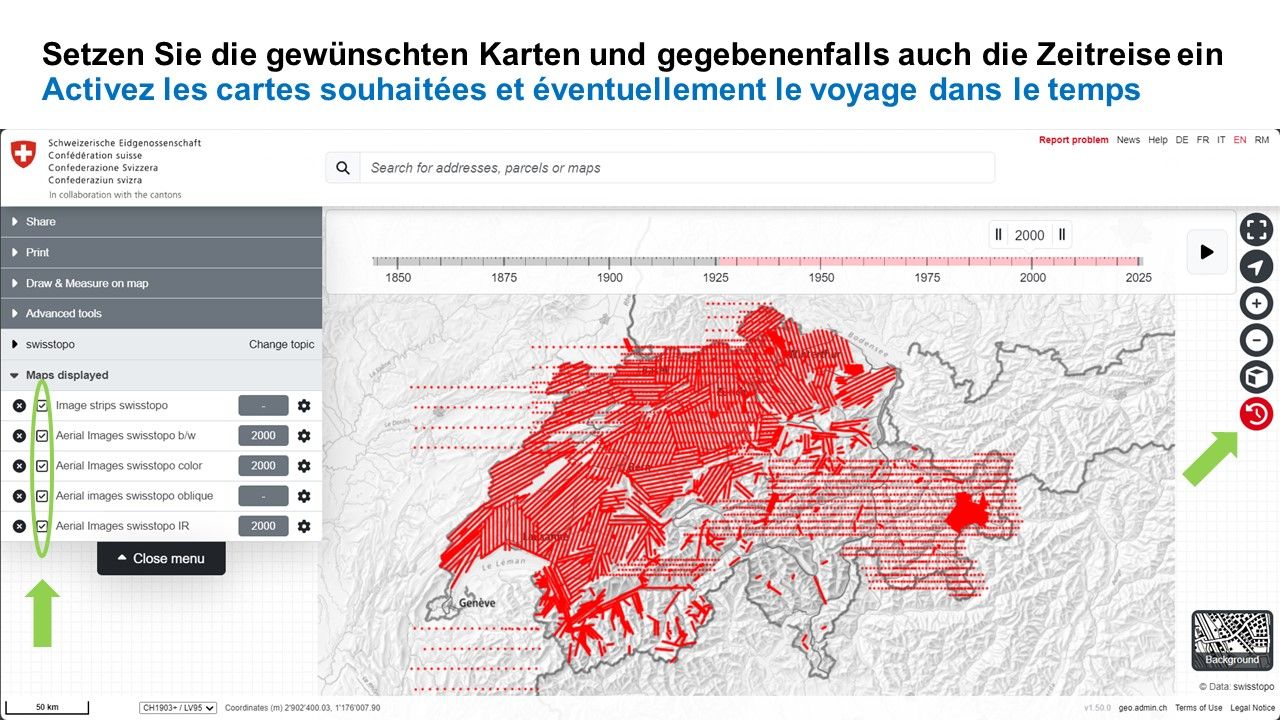
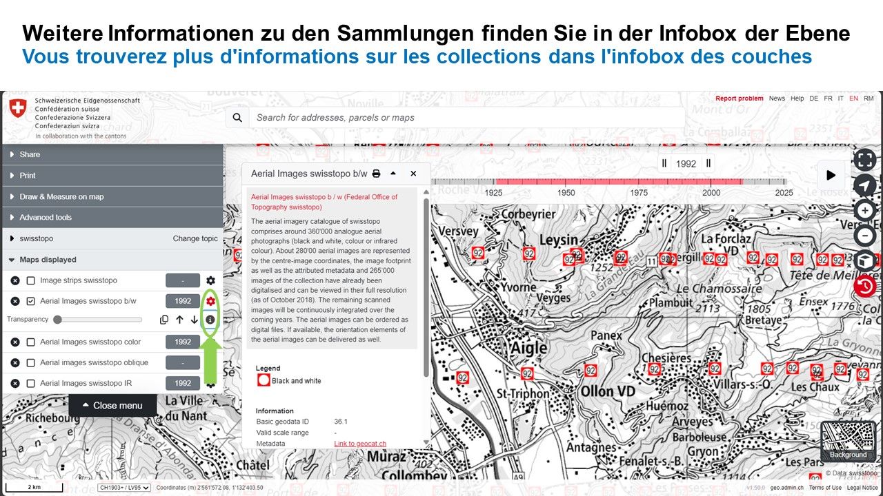
With the LUBIS viewer, you can search and display all terrestrial images, aerial photographs and aerial image strips registered in swisstopo’s LUBIS aerial imagery information system. The database is continually updated with historical images and newly surveyed aerial image strips.
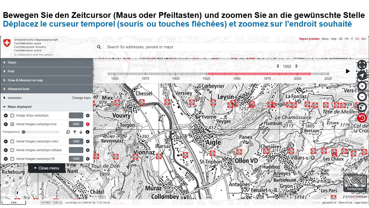
All terrestrial and aerial images on the interactive map are displayed as points using their centre-image coordinates. The aerial image strips show the corresponding flight lines. You can also view the footprints of the terrestrial and aerial photographs or the aerial image strips as well as other metadata.
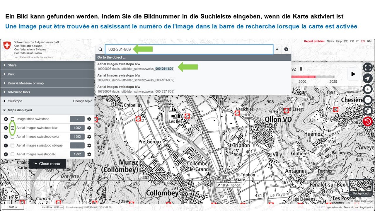
Terrestrial and aerial photographs that have already been scanned can be downloaded directly at full resolution and, where possible, also viewed directly in the map portal.

Help for LUBIS

Federal Office of Topography swisstopo
Seftigenstrasse 264
3084 Wabern