Geodata and Augmented Reality (AR) are ideally suited! AR transforms invisible geodata into visible information and allows virtual 3D models to be experienced anew in the real environment. swisstopo geodata products and services provide an optimal basis for AR applications.
Extending reality with geodata
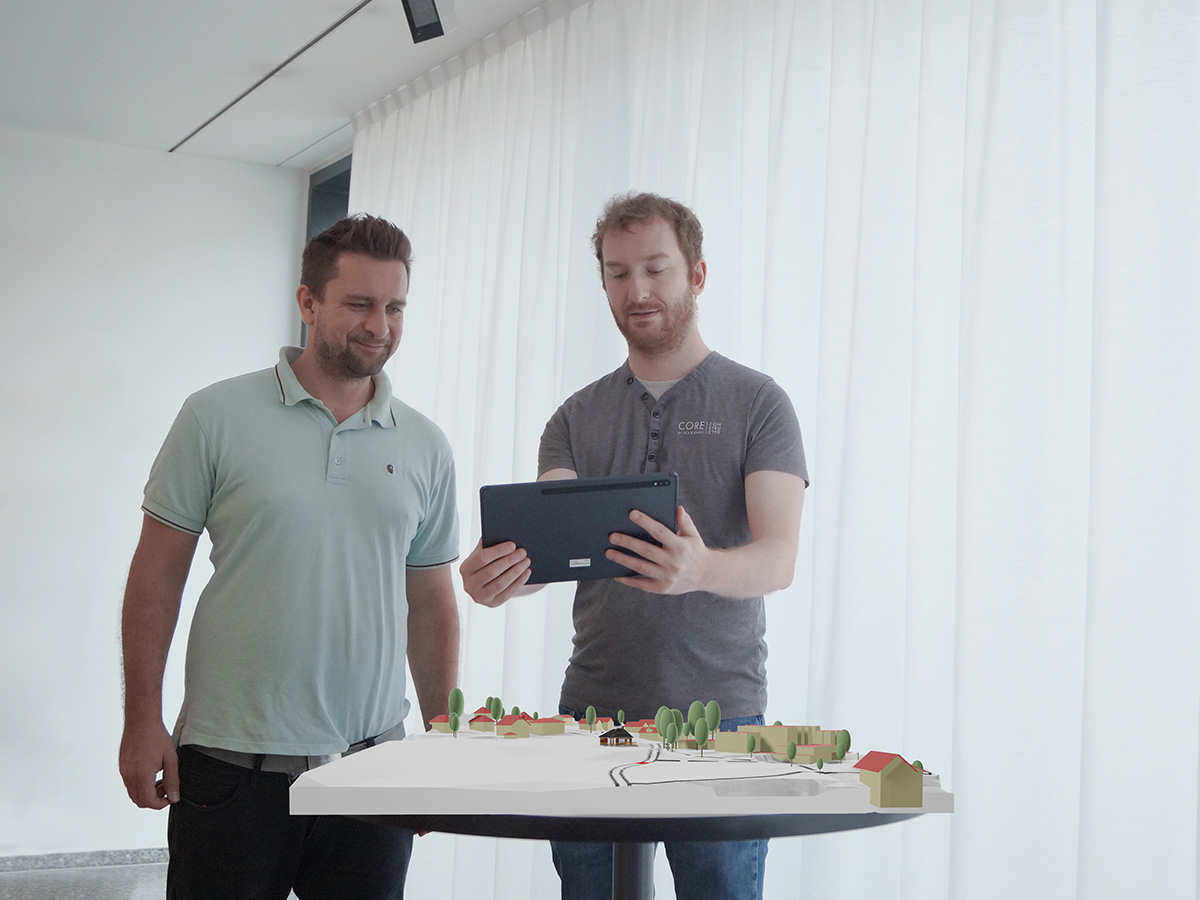
As the name "augmented reality" suggests, AR overlays reality with digital objects and information. Geodata contains spatial information that is often not visible in the real world. AR makes this visible on-site by adding, for example, borders, hiking trails, underground structures, lake depths or geographical names. AR also offers interesting visualisation experiences for the presentation of 3D models. Virtual 3D models can be placed on a table using standard mobile devices and experienced interactively with other people.
Gaining information through AR
AR combines reality with real-time digital information. This accessible source of information provides answers to spatially related questions and facilitates an assessment of the situation in many areas: stakeholders jointly evaluate construction projects in a room using a modelled 3D environment, hikers can identify the continued course of a hiking trail at a glance directly on the terrain through their smartphone and construction site personnel can use a tablet or AR glasses to determine the whereabouts of existing underground installations in real time. The application spectrum of AR with geodata is immense.
Geodata and services from swisstopo for AR
swisstopo offers various geodata products and geoservices that are suitable for the development of interesting AR applications. The wide range of products includes landscape and elevation models, aerial and ortho images, geological data and map products in various forms and at different time periods. The GeoAdmin services are documented in detail in a separate user environment.
In addition, swisstopo has prepared two of its products especially for AR based on additional 3D formats. This makes the data easier to use for AR developments.
The swissBUILDINGS3D 2.0 product includes all buildings in Switzerland and the Principality of Liechtenstein as 3D models. With the OBJ format extension, the AR community can benefit even more from this unique data set. The geometries are grouped by object as well as by type (roof and shell) and coloured separately.
The terrain represents the surface of the earth without vegetation and buildings. So far, elevation models, such as the swissALTI3D product, have mostly been used as raster data sets. Now the terrain is available as a 3D mesh in FBX format at different generalisation levels. This enables a wider and easier use in various development environments.
You can order the two new data sets by email to geodata@swisstopo.ch. Sample data for testing is available at the end of this website.
swisstopo geodata used for AR
Various AR applications contain geodata from swisstopo. The following picture gallery shows some examples. Let yourself be inspired!
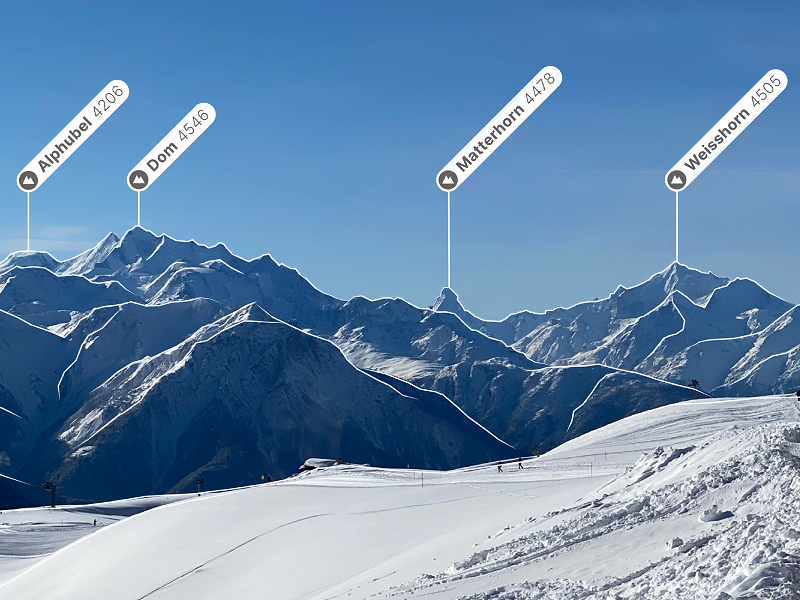
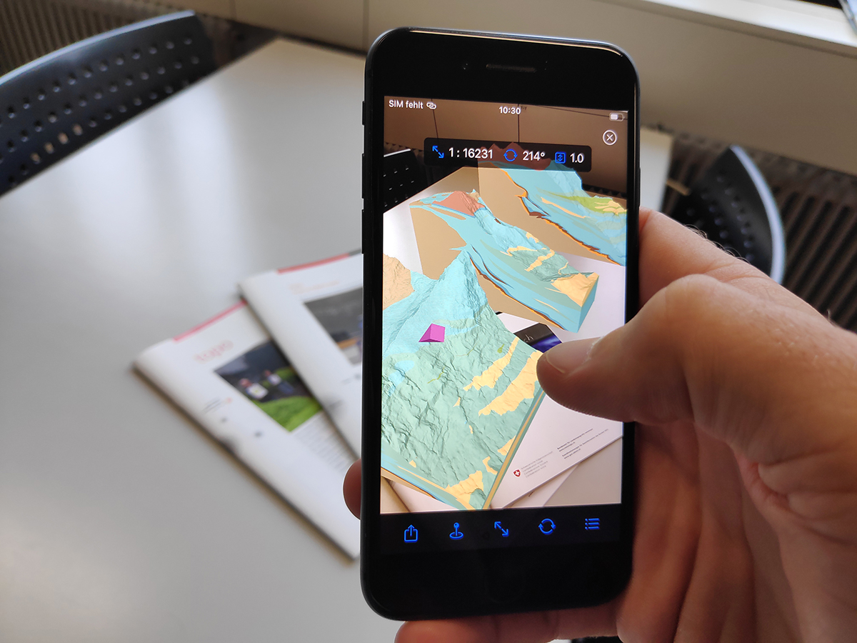
Panorama in swisstopo App: Overlay of the terrain contour inclusive labels
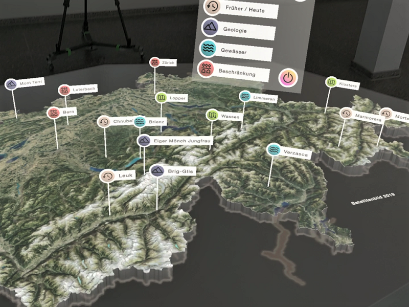
Mixed Reality App HoloLens: Overview of available models in the GeodataLab swisstopo
Web AR app Brienz: Explore the impressive lakebed of Lake Brienz (DE/FR) with your smartphone or tablet at https://bandara.app/swisstopo/ar-brienz/#de
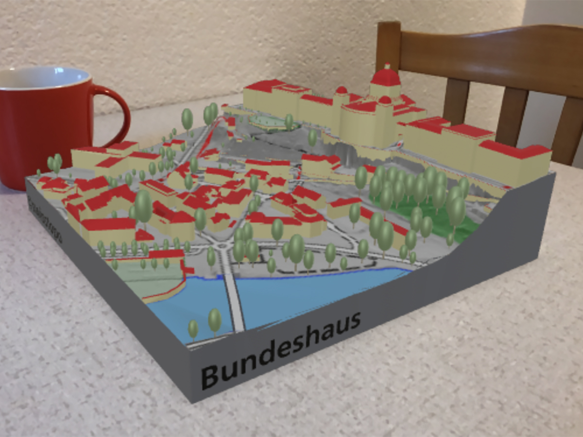
Web AR app Bern: Explore the imposing Federal Palace and the Marzili quarter (DE/FR) with your smartphone or tablet at https://bandara.app/swisstopo/ar-bern/#de
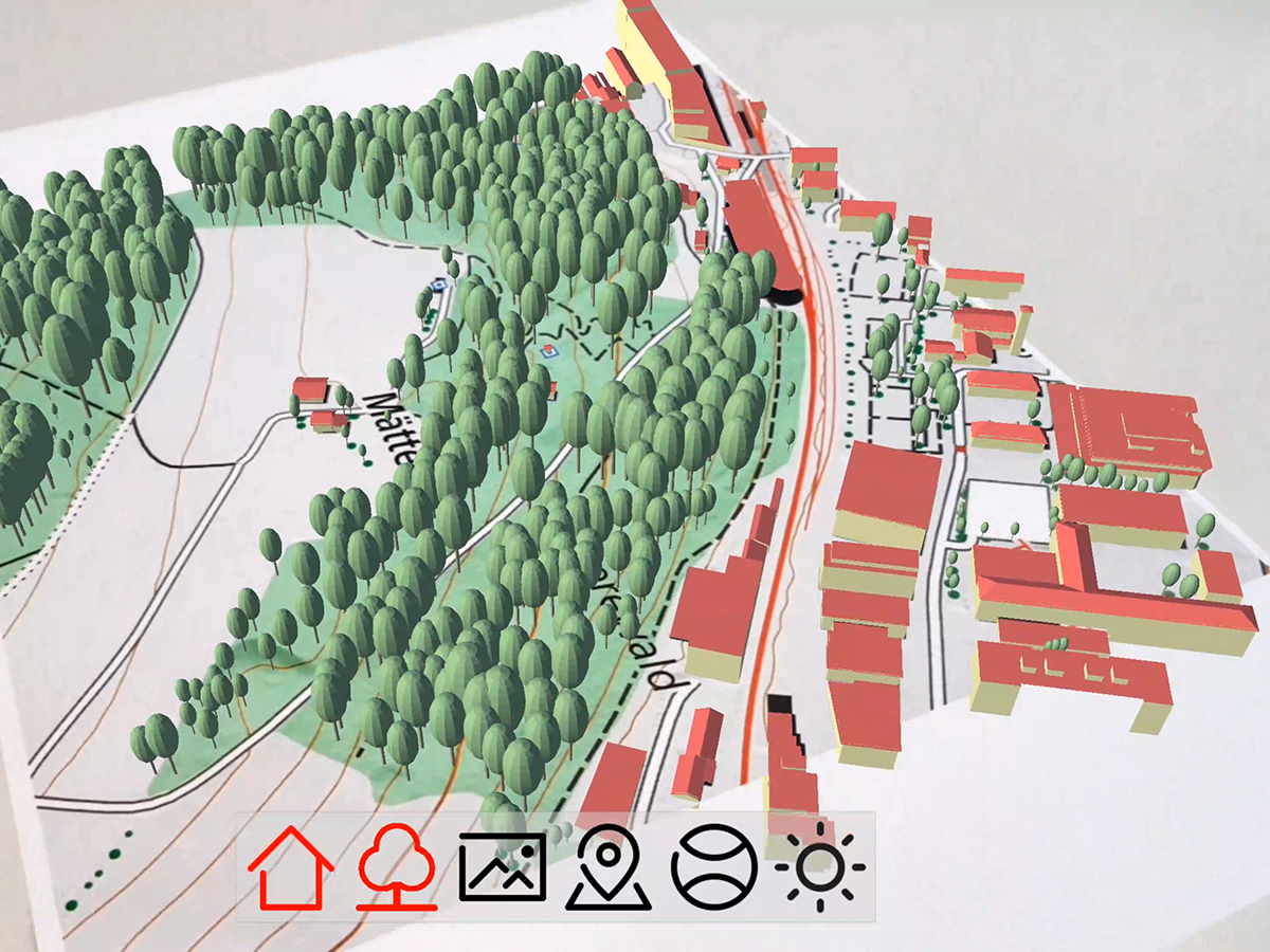
AR prototype map and 3D objects: Overlay of digital 3D objects (trees and buildings) on a physical map section
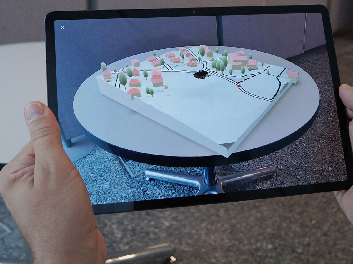
AR showcase: presentation building project — Embedding of a planned construction project in a three-dimensional environmental model
AR showcase: discovery the underground — Individually aggregated geological underground models as a basis for discussions
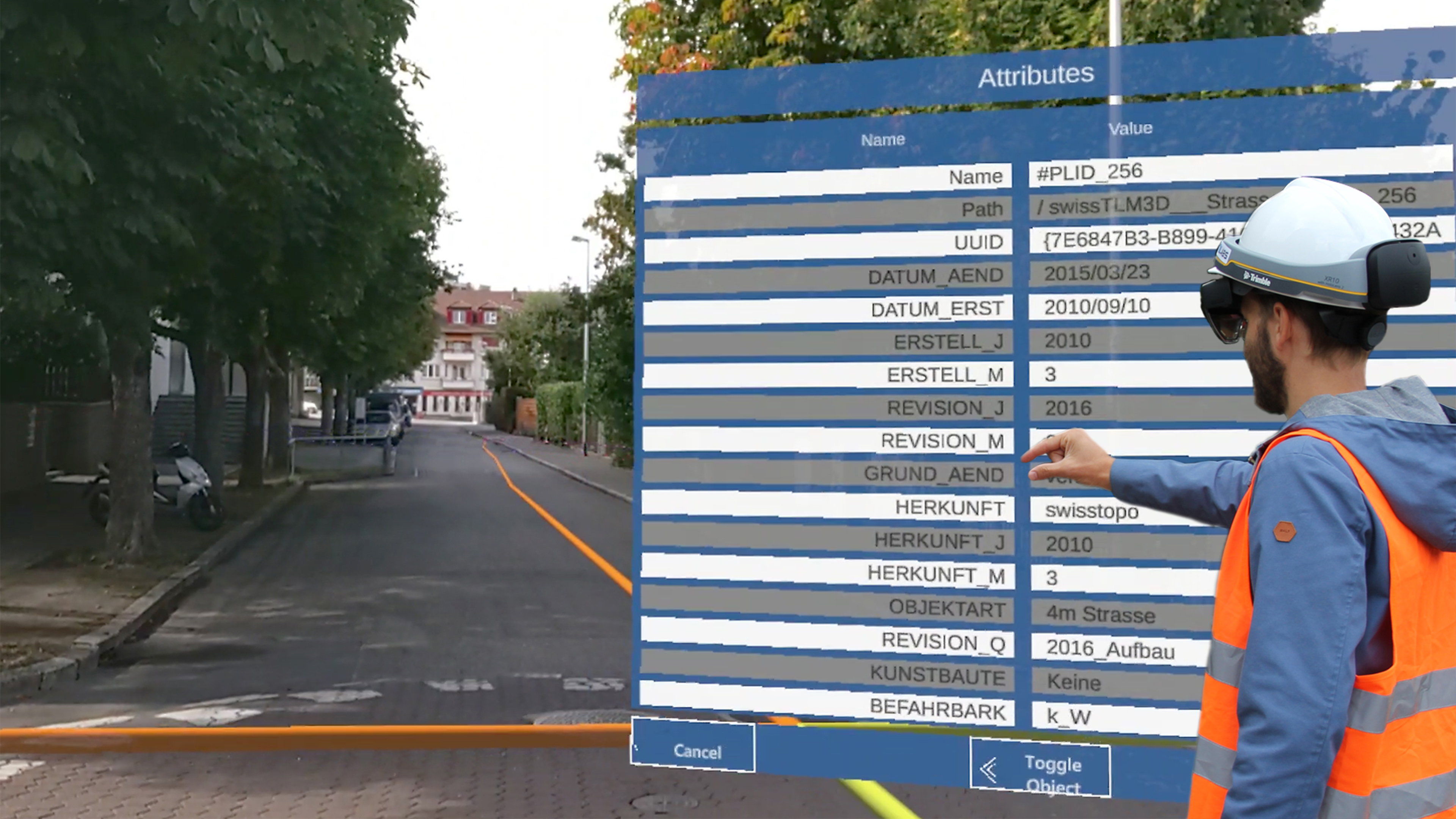
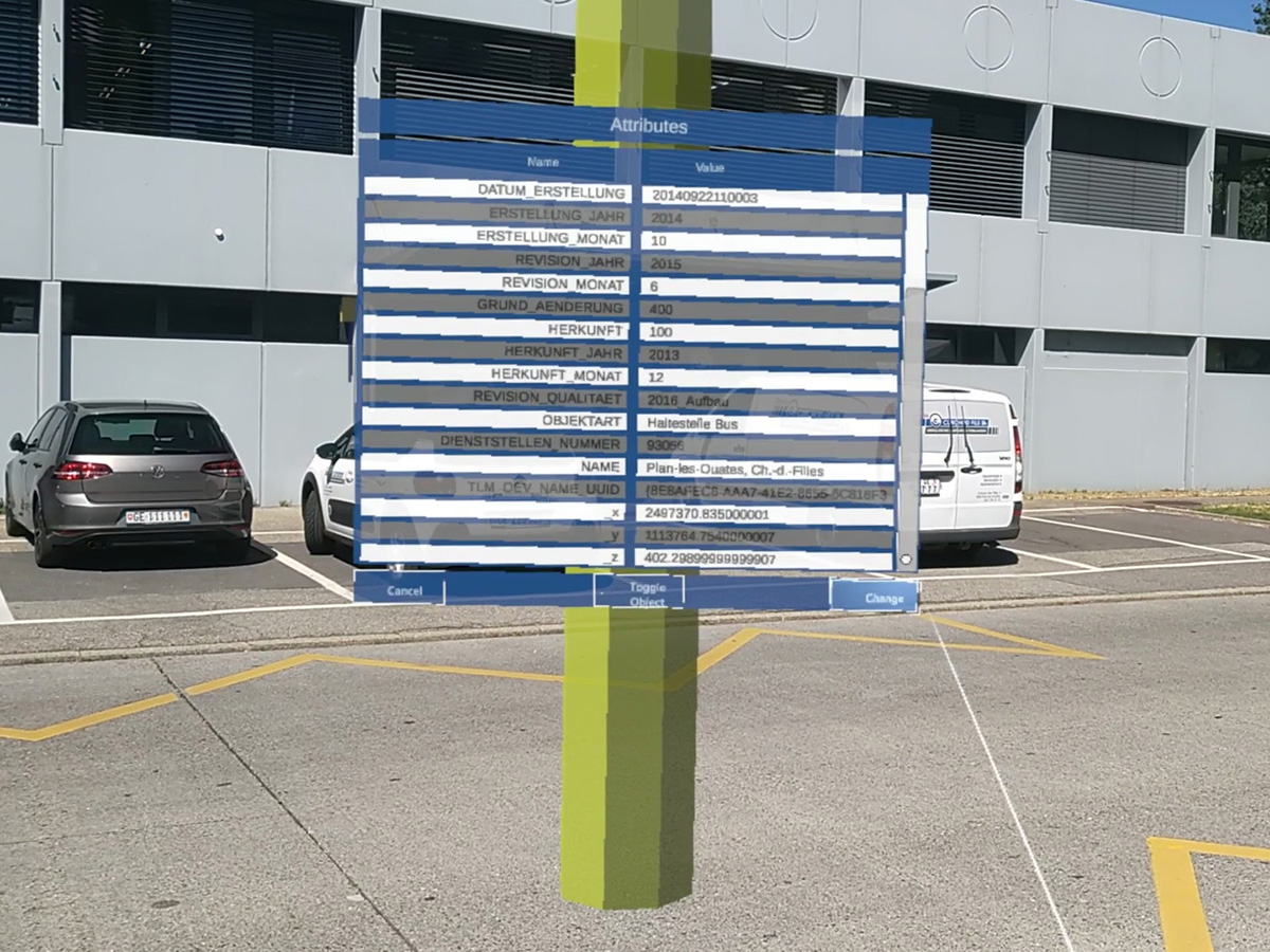
AR showcase: HoloLens and swipos — Outdoor geometry overlay and attribute query
AR Showcases
In collaboration with swisstopo, external partners have developed three AR showcases. With these concrete applications, swisstopo wants to make its geodata visible in AR applications on the one hand and subject it to practical testing in order to gain new insight on the other. Below we present three showcases (see also picture gallery above).
AR showcase: presentation building project
Construction projects often involve different players from the public and private sectors and the neighbourhood. AR technology can help to make construction projects easier to understand and accessible to all. In the implemented showcase, a planned construction project can be embedded in a three-dimensional environmental model from swisstopo. The virtual 3D model showing the new project can be shared with other stakeholders. Using the AR function, they can place the received model in the room and use it as a basis for discussion. The showcase is based on web technologies and can be used on Android devices without any installation.
AR showcase: discovery the underground
Geological models describe the events below the earth's surface. Only now and then are parts of them visible at the surface. The view down into these depths is all the more exciting. The application shows different geological layers which can be arranged as desired. By placing the models and linking several smartphones, all those involved can see the same 3D information on-site, no matter the perspective from which they view the 3D model. A virtual pointer ensures that discussions are held on the same object or the same section.
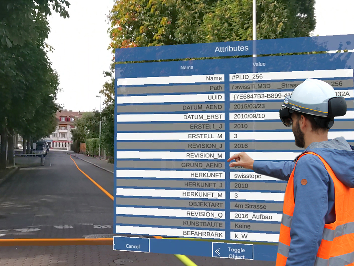
AR Showcase: HoloLens und swipos
Our environment is peppered with spatial information and objects that are often only partially or not at all visible. For example, administrative borders or underground utility lines remain largely hidden from us. Additional information on objects can also usually only be found and assigned in roundabout ways. With HoloLens 2, AR glasses from Microsoft, geodata can be overlaid with additional information at the correct position. In combination with the swipos positioning service from swisstopo, the accuracy is improved. This makes it possible to locate border points, mark out the course of utility lines or view a planned object in its real environment.
Application areas for AR projects with geodata
AR is trendy and will be increasingly used in many fields over the coming years. Rapid technical development, ease of use on a smartphone or tablet, the wide range of applications and the special AR experience hold great potential, including for the visualisation and integration of geodata. AR is used in combination with geodata in a wide variety of areas:
The sample data show their type and format. They are free of charge and may be used for test purposes only. It is not permitted to include them in a product.