
Bern
The Federal Office of Topography, founded in Geneva in 1838 by Guillaume-Henri Dufour as the Federal Topographical Bureau, is one of the oldest parts of the Swiss Federal Administration. The Dufour Map, a 1:100,000 topographic map of Switzerland and the first official nationwide map series, was published in 1845. The lease on the bureau’s premises in Geneva expired at the end of May 1865, after which a move to Bern was planned. Relocating to the Swiss capital marked the beginning of the Office’s nomadic existence, which was to last until 1941.
Ulmenweg 9
After leaving Geneva, the first Topographical Bureau set up in Bern. Dufour’s designated successor, Lieutenant Colonel Hermann Siegfried, and his colleagues at the Confederate Headquarters (Eidgenössisches Stabsbureau) worked at what was then Ulmenweg 9 from 1865 to 1867. The lower floor was also used as an apartment for one employee.
Bubenbergplatz 3
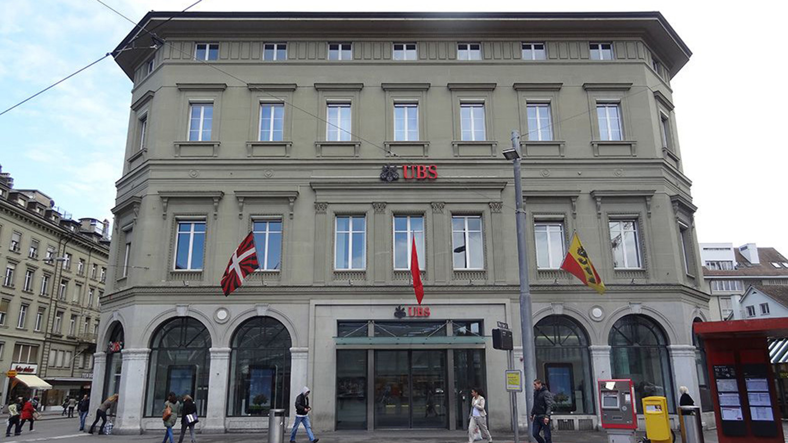
The Topographical Bureau’s second Bern base was the ground floor of what is now UBS, where it remained for 13 years from 1867. Still headed by Siegfried, the Bureau had already begun to be spread across several different locations: with no room left for the printing works, it moved to what is now Laupenstrasse 5.
Hochschulstrasse 6
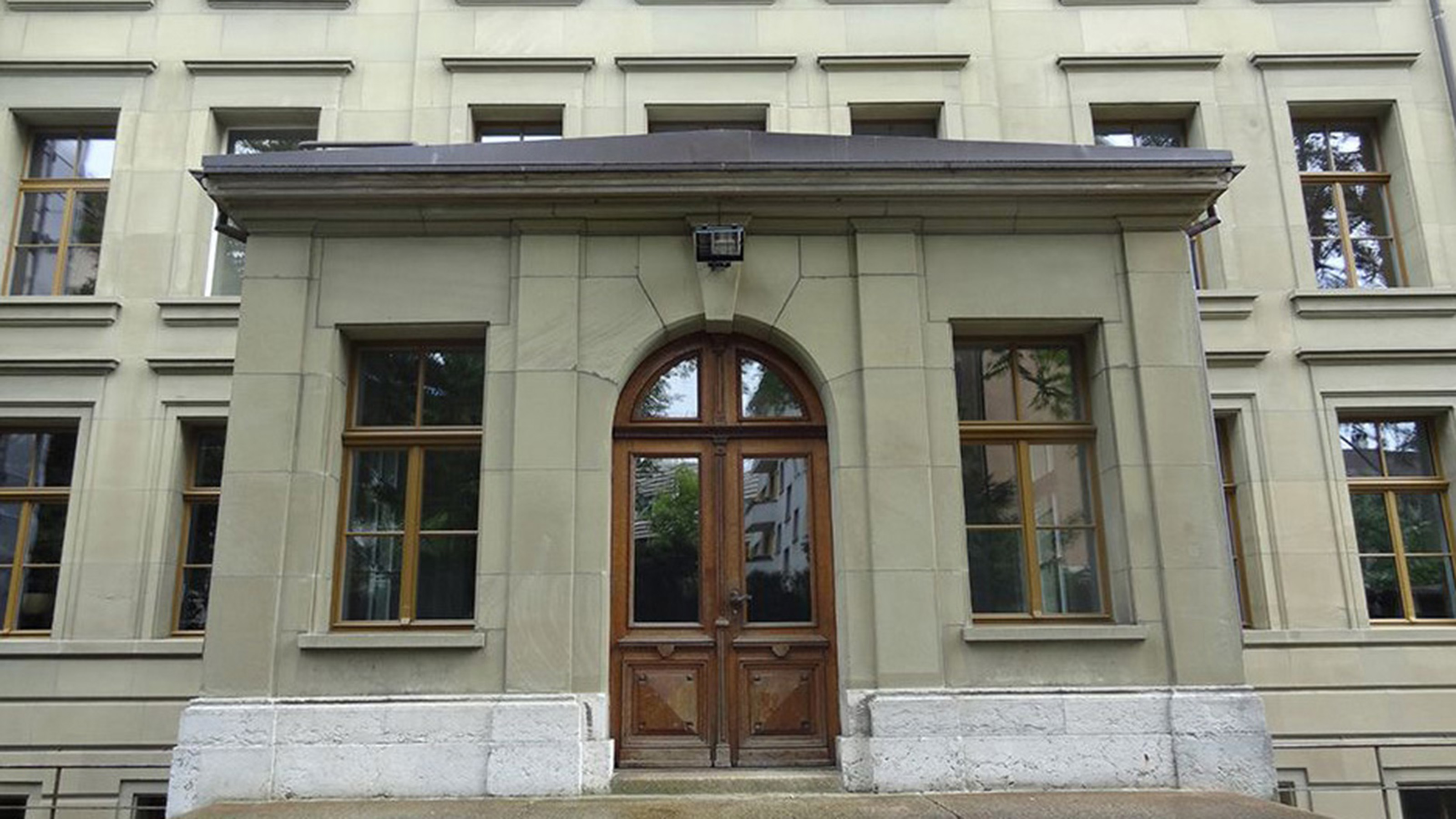
From 1880 to 1890, the Topographical Bureau was based at its third site in Bern, the second and top floors of Hochschulstrasse 6. From the end of 1879, the Bureau was headed by Jules Dumur, who was also instrumental in its move to the new premises.
Lorrainestrasse 3
Jumping forward in time, the Topographical Bureau spent just two years (1890-1892) at its fourth base in Bern, in what is now Lorrainestrasse 3. Colonel Jean-Jacques Lochmann headed up this Bureau. The building had been constructed in 1874 as an institute for the blind.
Federal Palace East Wing
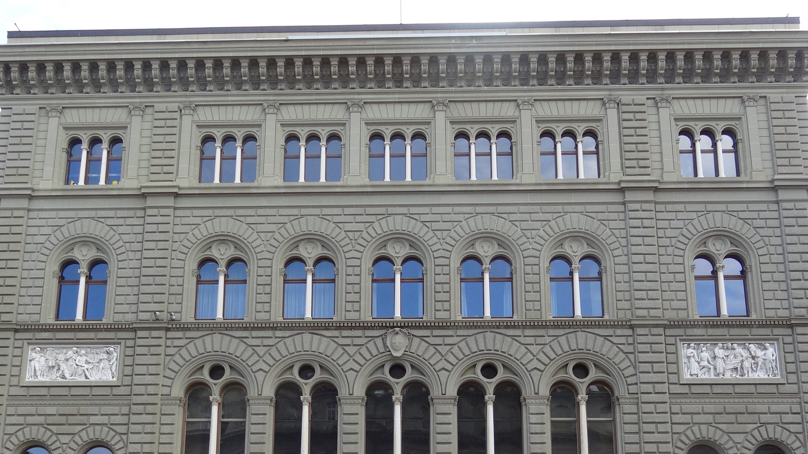
In 1892, the Topographical Bureau moved to the east wing of the Federal Palace. In the past, Siegfried had already tried hard to acquire premises in a newly constructed federal government building. Although communication channels were shorter, mainly technical work had to be outsourced, meaning that this location was not ideal either.
Hallwylstrasse 4
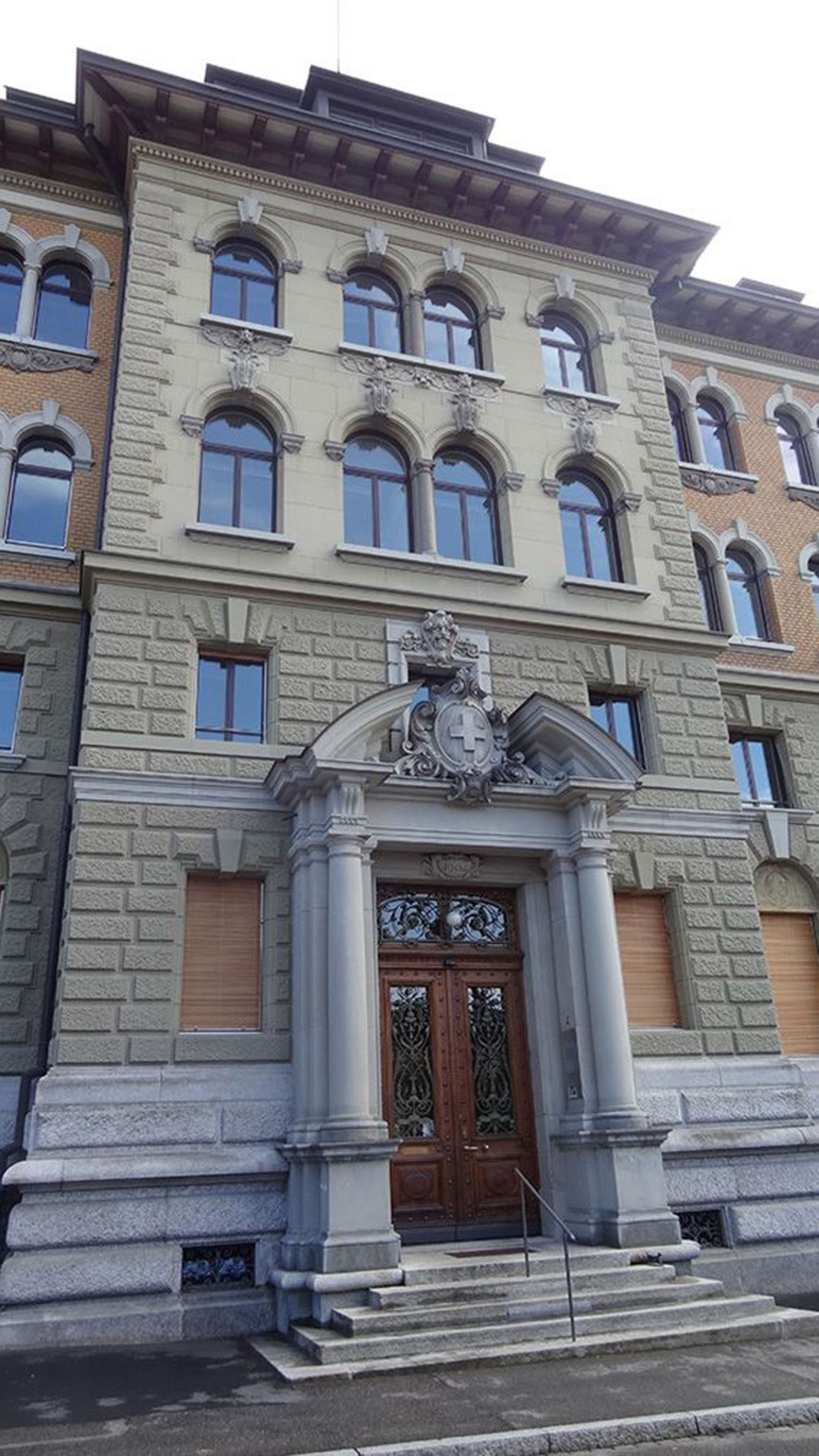
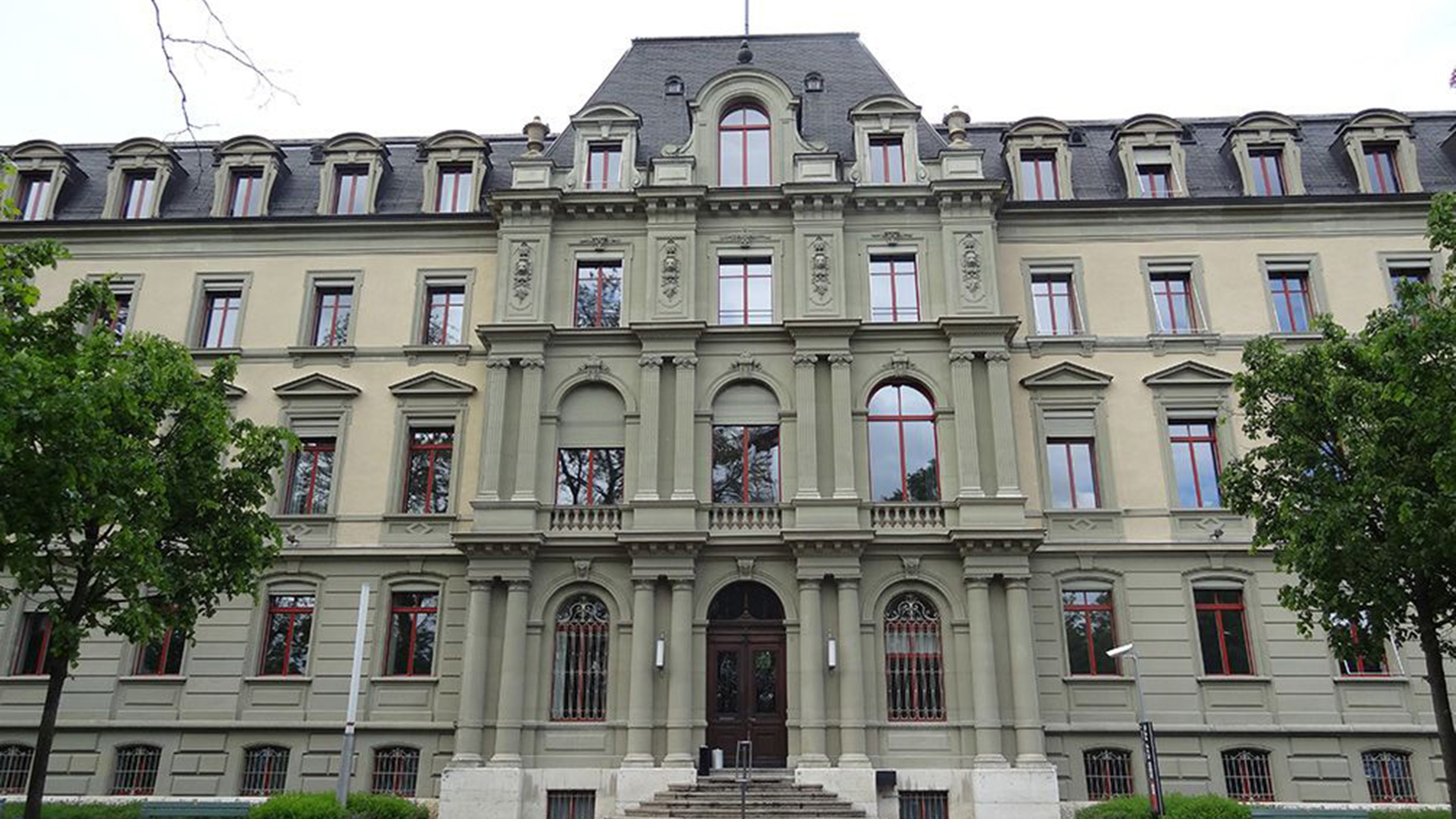
After the Topographical Survey of Switzerland was created as an independent organisational unit on 20 December 1901, the Swiss government approved a loan to purchase land for a new building. Leonz Held became the first director after the building was completed in 1904. After a few years, however, space once again ran out due to the increasing number of employees and the purchase of large-scale evaluation devices.
Seftigenstrasse 264
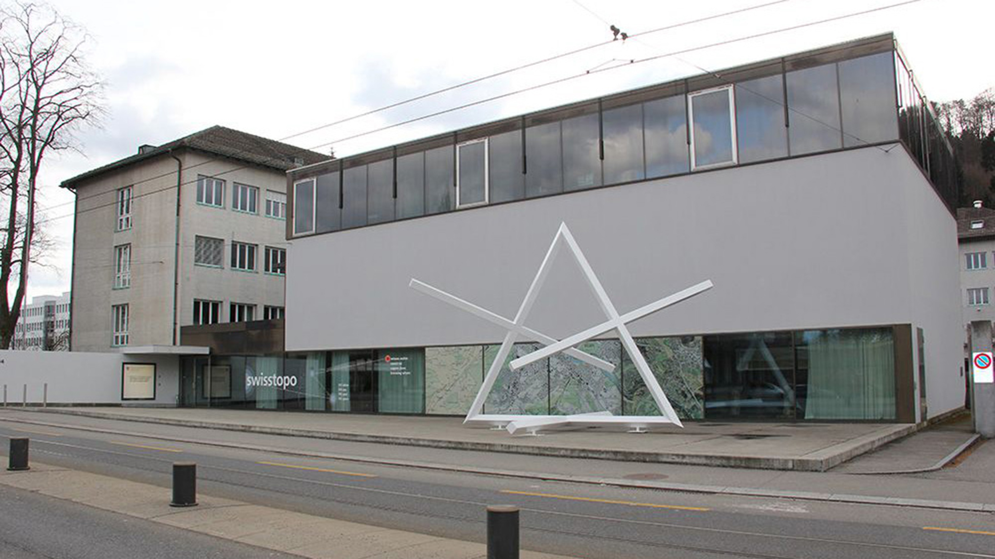
After spending some time searching for a suitable site for another new building, the Federal Office of Topography swisstopo moved to Seftigenstrasse 264. The new premises were built in 1941 and joined to the old spinning mill that occupied the site. This brought an end to around 100 years of nomadic existence, as all departments are now under the same roof – including the printers.
Federal Office of Topography swisstopo
Seftigenstrasse 264
3084 Wabern