
Chasseral - how Switzerland found its own level
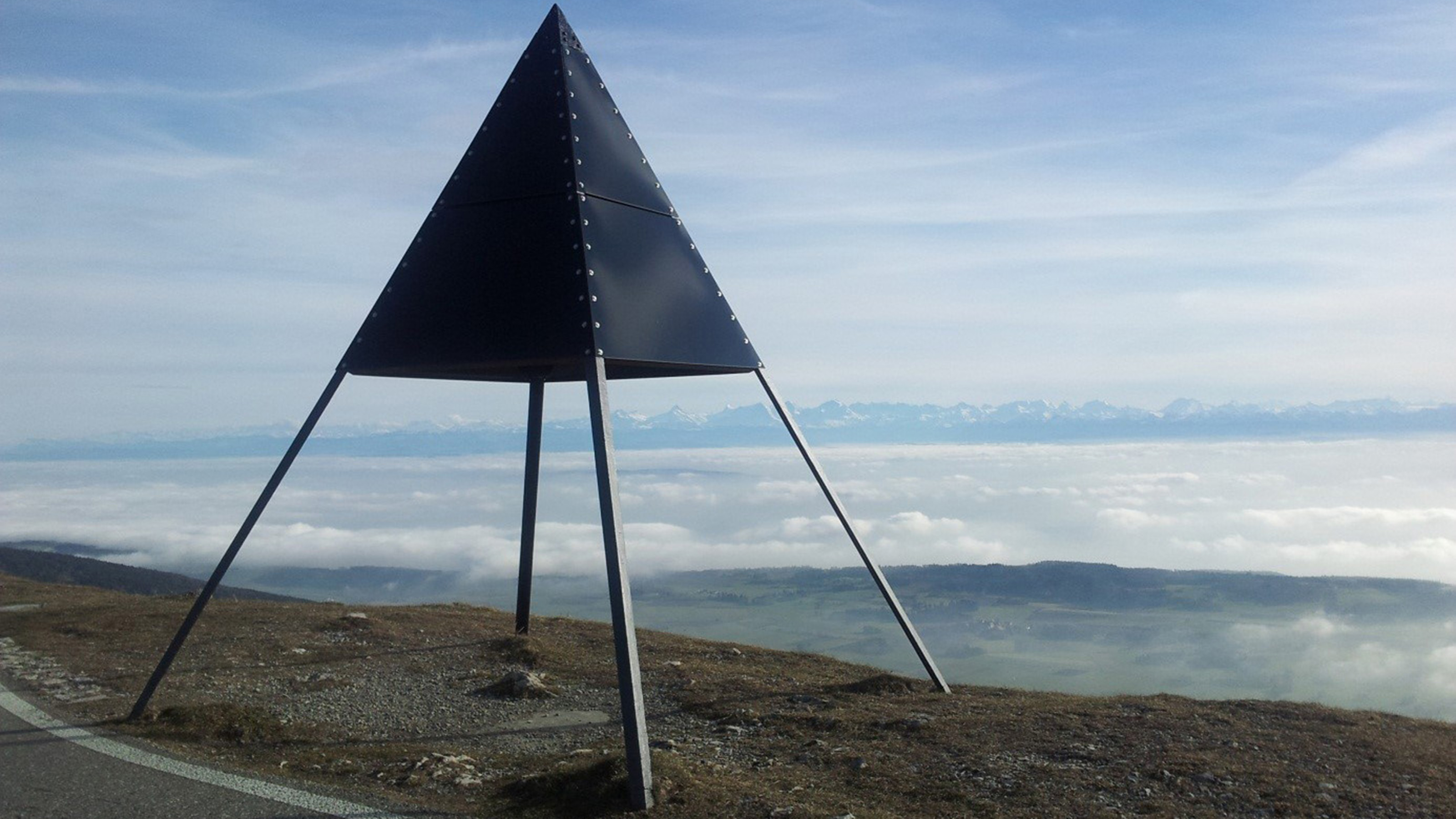
The iron surveying pyramid on the Chasseral underlines the importance of the prominent Jura peak for the national survey even today. Although situated at the highest point of the Bernese Jura, the pyramid has spent a humble existence in close proximity to the bulky transmitter since 1979. It is less well known that the marker on the Chasseral has symbolic significance in how “Niveau”, in the sense of topographic level, arrived in Switzerland The German word “Niveau” is primarily used in connection with “education” or “rank”. However, in the context of the 175th anniversary, questions about the “Niveau” of Switzerland may quite rightly be asked, since the expression is also a synonym for “altitude”.
We learn, almost from the cradle, that elevations are related to sea level and thus we refer to “heights above sea level”. What is less well known, however, is how our forefathers were able to establish heights above sea level with accuracy in the metre range in landlocked Switzerland over 175 years ago (and without the technology available to surveyors). After all, the nearest access to the sea is several hundred kilometres to the south of our country’s borders.
The first Swiss heights above sea level, which are only occasionally found on maps, relied on the comparative barometric measurements made by natural scientists in the 17th and 18th centuries. When the Dufour map was produced as the first official series of maps in Switzerland in 1832, questions naturally arose as to the definition of heights above sea level. Or, rather, a starting point inside Switzerland was sought whose elevation could be most reliably established relative to one or more sea levels. The French topographers who, following the collapse of the old Swiss confederation, went to work on Swiss territory, took over this task. After their departure, their work was assessed rather disparagingly by a chronicler:
Comparison of the measurement results
With this elevation starting point, Eschmann, in consultation with Dufour, calculated the altitudes of the survey points of his measurement grid – known as the first-order triangulation (‘triangulation primordiale’). This created the framework for the production of the Dufour map. At the same time, he established the elevation of a number of Swiss lakes, including Lake Geneva and, thus, indirectly, the height of 376.2 metres above sea level for the 'Repère Pierre du Niton' (RPN). This elevation mark on the smaller of the two granite boulders in the Geneva harbour remains the height datum for all national maps to this day.
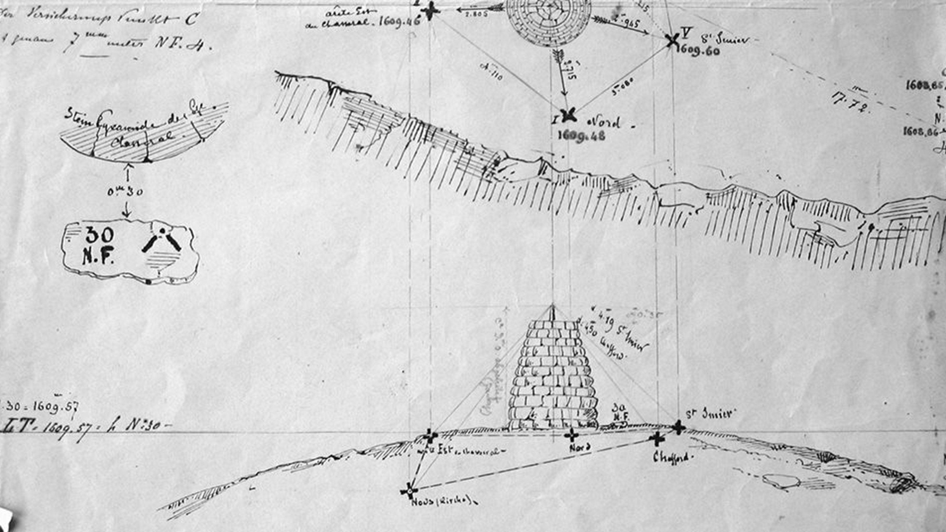
The question, though, still remains: how did the French achieve their link to the sea? All that can be ascertained about the first level at the Chasseral is that it was based on barometric height measurements in Strasbourg. The second level is based on pure trigonometric (angle) measurements from the Swiss border across France to the Atlantic coast near the Île de Noirmoutier.
At that point, the above level of the RPN, which was determined according to the best available knowledge, was 2.6 metres higher than today’s official figure of 373.6 metres above sea level, as is noted on every national map sheet. So what happened in the meantime?
In 1862, the determination of the elevation of our reference point in Geneva was carried out, based on the first French level. And relative to the level of the Mediterranean at Marseilles, the result was just below 374 metres above sea level. Apparently, the result attracted too little attention in Bern at the time or this would presumably have become the official height datum for all surveying activity in Switzerland.
In 1864, more accurate national level measurements were also started in Switzerland and, as the first stage, the link between Geneva and the Chasseral was measured. The resulting height difference tempted the then head of the Federal Office of Topography, Colonel Herrmann Siegfried (1819-1879), by retention of Eschmann’s elevation for Chasseral, to set the RPN at 376.86 metres above sea level. The Siegfried maps, the forerunners of our national maps, were based on this datum.
As early as 1902, detailed investigations of national topography led to the value used today for the RPN. It took decades, however, for the different maps and map-series to be converted or reworked to the 3.26 metres lower datum. Even today, questions arrive at our Office which arise from confusion over the two levels.
Datum levels for the main map series in Switzerland:
Federal Office of Topography swisstopo
Seftigenstrasse 264
3084 Wabern