
The chestnut wood – a remarkable symbol on the Siegfried Map
In 1914, an innovative symbol appeared on the Siegfried Map. The map started to distinguish between chestnut woods and general forest areas. What could have led the Federal Office of Topography to introduce a chestnut symbol?
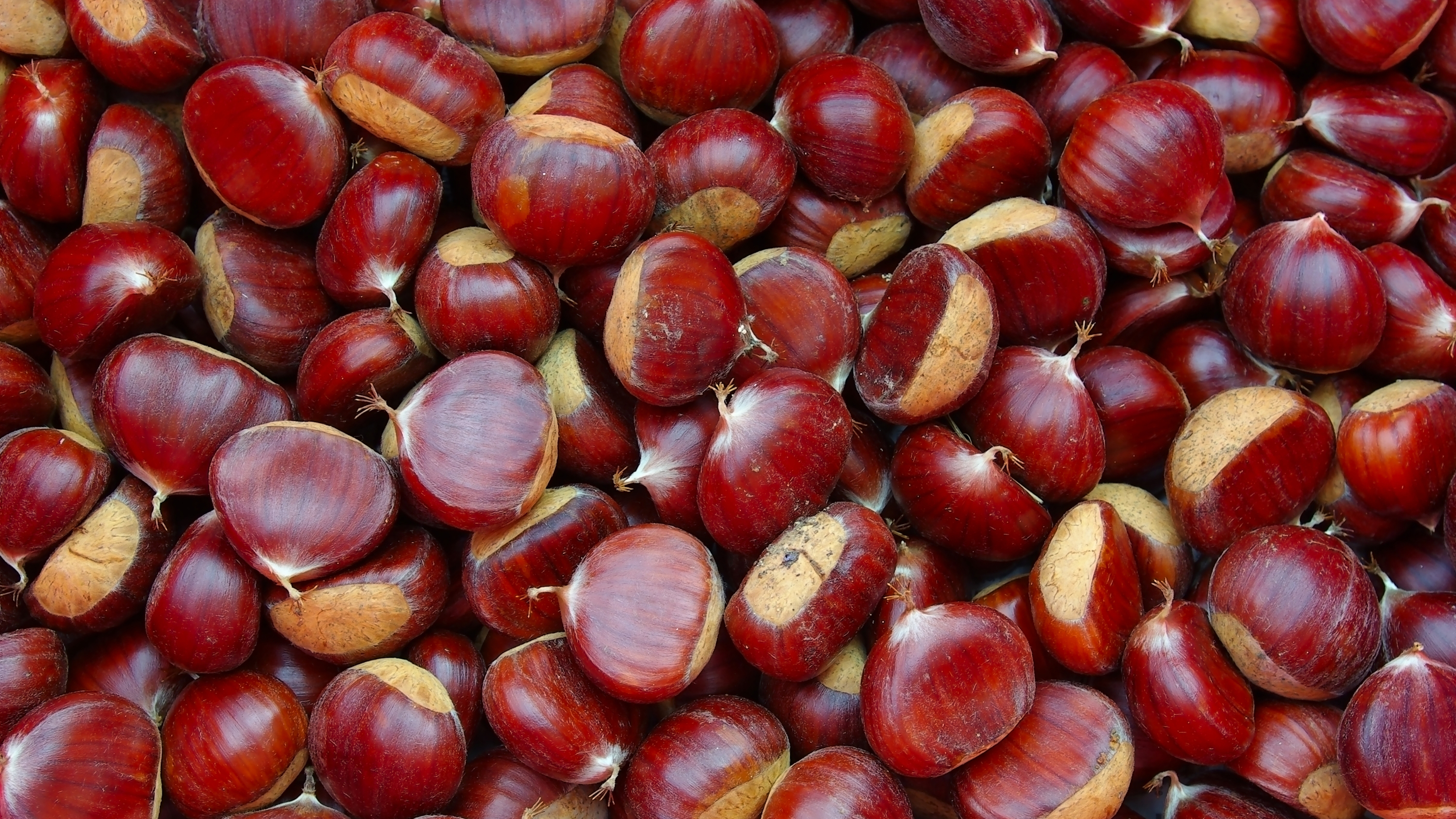
It is chestnut season again and the brown nut is very popular with the Swiss. This is clear from the Federal Customs Administration’s import statistics: in September, imports skyrocket from zero to around 900,000 tons of sweet chestnuts and chestnuts each year. Chestnuts served with game, on the street corner or in Vermicelles (a Swiss chestnut dessert) are part and parcel of autumn in this country.
An extraordinary interest in chestnuts is not only evidenced by the autumnal appetite. This food – or, more precisely, the trees it grows on – also played a prominent role at times in the preparation of official maps. The Topographic Atlas of Switzerland, better known as the Siegfried Map, immortalised Swiss chestnut woods on the map.
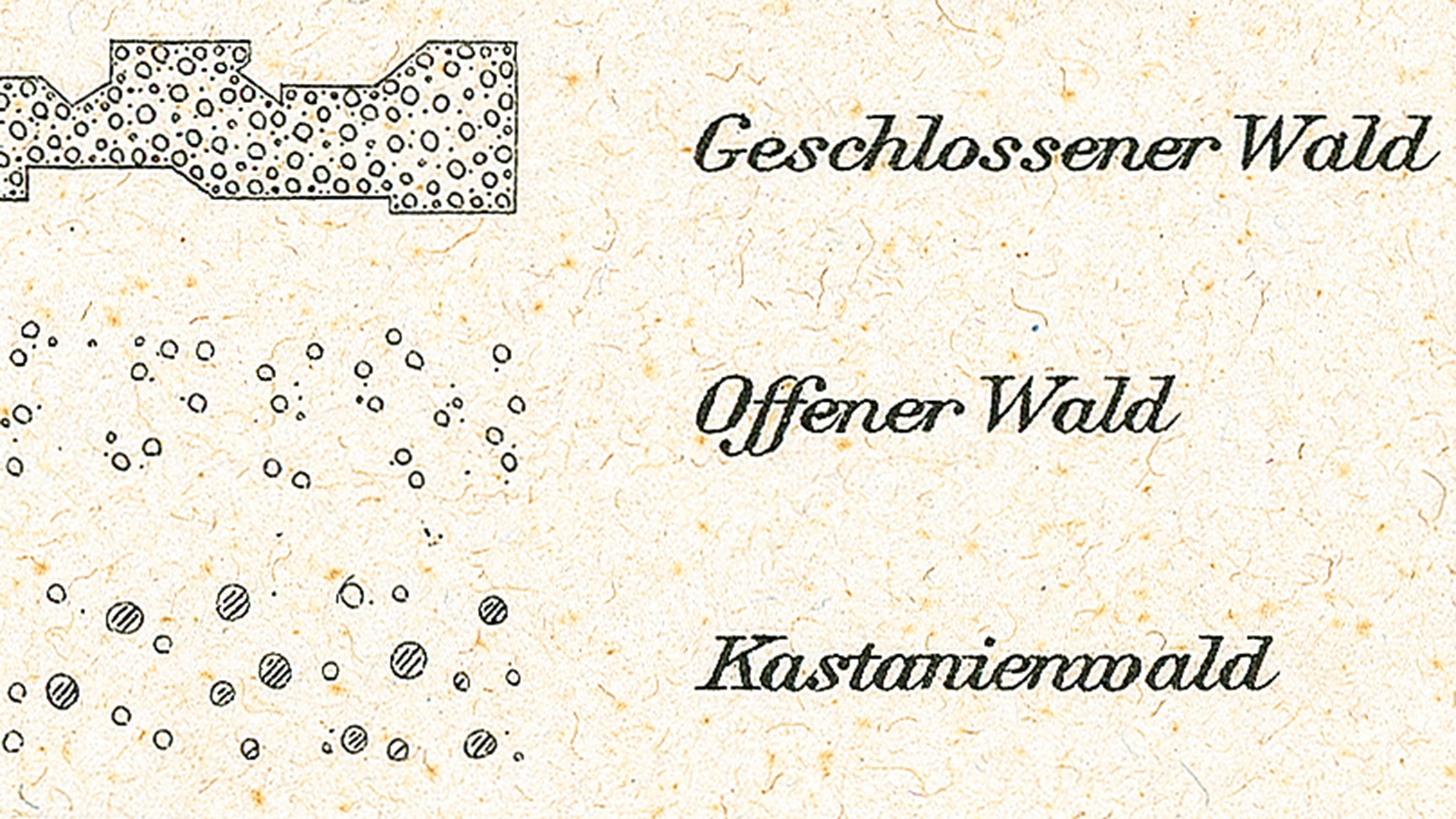
This is illustrated, for example, on pages 542 Ponte Tresa and 543 Melide of the Siegfried Map published in 1914. In contrast to their previous versions, they no longer depicted the forests around the picturesque village of Carona near Lugano using the usual forest symbols, instead specifying the kind of special tree species that grew around the village: from 1914, Siegfried map pages with chestnut symbols appeared in unpublished test prints and the Federal Office of Topography had even experimented with the new marking as early as 1910/11. In 1922, the chestnut symbol finally appeared in the map legend of the map series for the first time.
A successful new addition
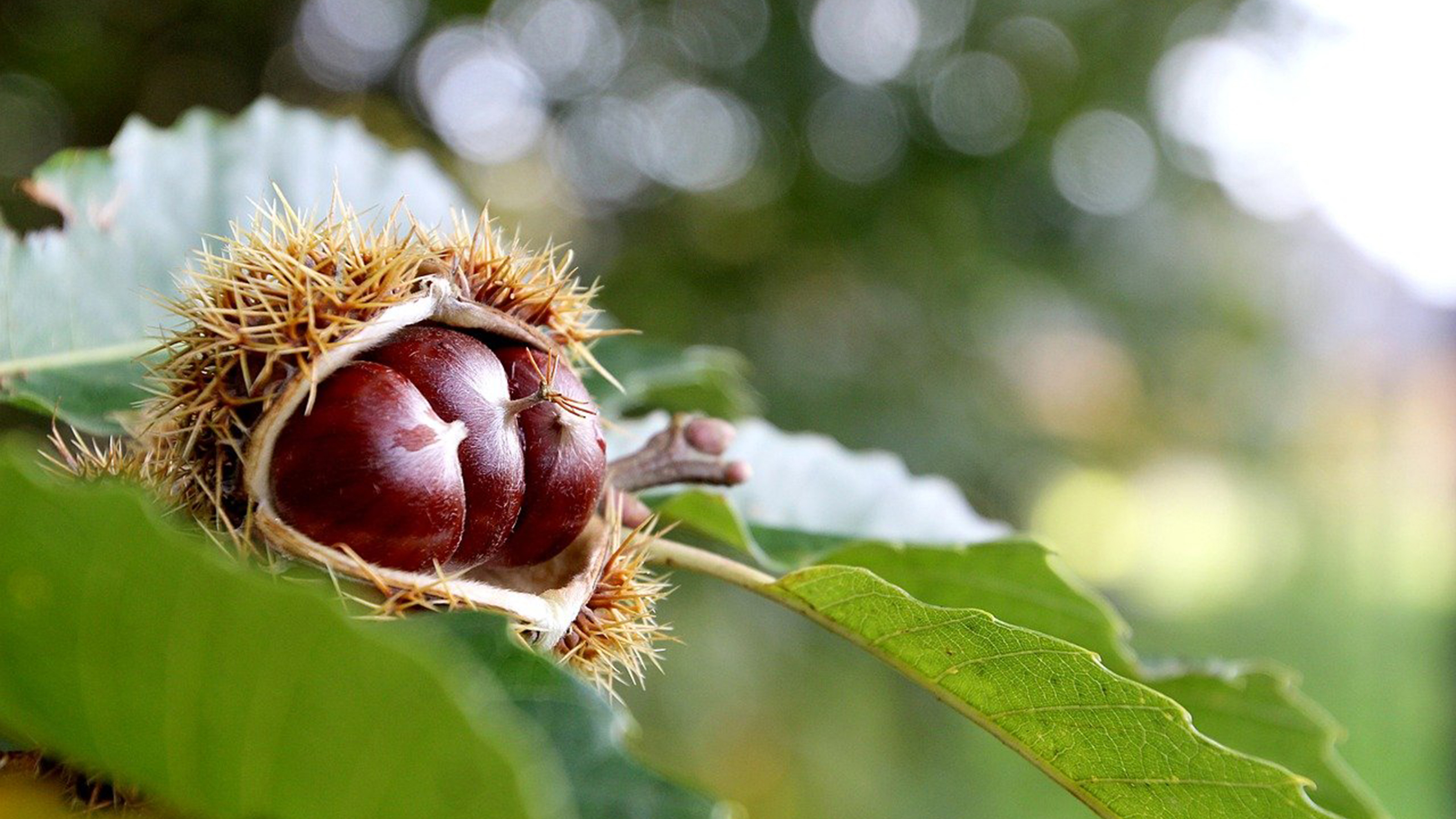
In order to understand why the sweet chestnut has been honoured with its own symbol, it is first necessary to take a look at its meteoric growth. The tree species was a botanical newcomer to the Swiss Southern Alps, only arriving in Roman times. It needs a warm climate, likes acidic soils and copes well with steep slopes which is why it has found a suitable home on the southern side of the Alps. Today, 98% of Swiss chestnut trees grow in this part of the country. However, the trees are not only dependent on the climate, but also on humans: “Without forest care, the sweet chestnut would gradually disappear, since it is not competitive compared to indigenous tree species”, as biologist Ursula Heiniger points out.
Thanks to active care and favourable climatic conditions, the sweet chestnut has over the centuries become an important source of vitamins and calories for humans and animals. People roasted their fruit, cooked them and used them to make flour and to fatten pigs. The wood from the trees can be used in house building and landscaping and the leaves can be fed to goats. Porcini mushrooms live symbiotically with chestnuts and are therefore more common in their vicinity. A chestnut grove – that is, a pure chestnut forest cared for by people – provided advantages on many levels.
Sweet chestnut in crisis
During the course of the 19th century, the sweet chestnut, despite its numerous advantages, went into decline. As Ursula Heiniger explains, the potato began to advance through the Swiss valleys in the 19th century and became a successful rival to the high-maintenance chestnut. In addition, the Gotthard Railway accelerated the cross-border exchange of goods from 1882 onwards, making rice and maize increasingly cheaper. This increased the competition with the chestnut even in the remote valleys of the southern side of the Alps.
A strategically important tree
It is not possible to say with certainty why the Swiss Federal Office of Topography began to include chestnut forests on the map in test prints in 1910/11, and why it also did so in the published pages of the Siegfried Map from 1914 onwards. However, it is most likely that the combination of a decrease in chestnut groves and the growing strategic importance of cultivated forests was a key factor. In the years before the First World War (1914–1918), the Swiss army’s demand for leather rose sharply. In light of the tense political situation in Europe, procuring leather for boots, saddles and bridles for the troops made an important contribution to a country’s defensive readiness. The tanning agent tannin was in turn central to leather production as it could be extracted from chestnut wood, which gave the Swiss groves new significance. They made it possible for Switzerland to supply the tanning agent itself, which was essential during the war.
During the First World War, the supply of tannin to Switzerland from abroad completely collapsed, which meant that domestic production had to be boosted further. This was actively carried out during the war years 1914–1918, as Marco Conedera from the Swiss Federal Institute for Forest, Snow and Landscape Research (WSL) explains. Three factories in Chiasso, Maroggia and Olten supplied Switzerland with tannin during this period, processing seven to eight wagonloads of chestnut wood a day. The majority of the raw material came from Ticino and the Valle Mesolcina.
An uncertain future
Up to the 1950s, when the pages of the official map series replaced those of the Siegfried Map in Ticino, the chestnut forest stocks were visible on the map. Since 1983, the Swiss National Forest Inventory has been regularly documenting how the stocks are doing. The special Siegfried Map symbol is still relevant today, although no longer because of the tannin production – WSL researchers extract the chestnut areas from the Siegfried Maps and use this data to analyse the development of the groves.
The future of Swiss chestnut forests remains uncertain. In 1942, there were 9,500 hectares of groves in Switzerland, while in 1986 there were only 1,400. In addition to the factors described above, chestnut blight also affected the trees during this period. This development moved the 1956 Schweizer Filmwochenschau to make urgent appeals to save the chestnut trees: “It is not just about the beauty of southern Switzerland. Their lives are at stake!”
More recent developments, however, give cause for optimism. Although the populations of trees in chestnut groves in the most recent national forest inventory still amounts to 1,400 hectares, their condition is now significantly better: about a quarter of this still existing, partially neglected grove area has been restored since the 1990s and benefits from regular maintenance.
Valuable spatial knowledge
The visualisation of chestnut stocks on the pages of the Siegfried Map between 1914 and 1950 shows that maps are strongly influenced by the questions and problems of their time. Even historical maps were surprisingly dynamic and adaptable in this regard. To this day, maps and geodata create spatial knowledge that provides an important basis for action for politicians, researchers and the general public.
Links
Federal Office of Topography swisstopo
Seftigenstrasse 264
3084 Wabern