
Base Map: Interactive mobile map
The swisstopo app features a new interactive map, the Base Map, which is optimised for mobile use and includes numerous points of interest. Discover the advantages of this new map.

Real-time information
The base map offers new possibilities of interaction and is the ideal complement to the national maps available in the swisstopo app. It combines data from swisstopo and partner organisations. Real-time or contact information can be retrieved directly from the map via interactive map elements such as points of interest (POI).
It is the perfect choice for your outdoor activities!
Functions and interaction options of the base map
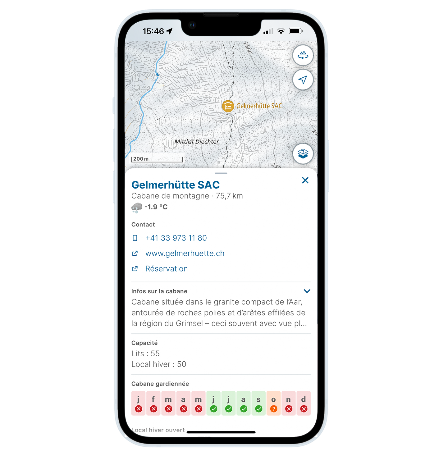
- Additional information on individual POIs (e.g. contact details, opening hours, maintenance times, current information, further links)
- Departures of public transport with real-time information (when tapping on stop)
- Display all stands and platforms at public transport stops (when tapping on stop)
- Highlight the corresponding stand for the selected connection
- Nearest stop for individual POIs
- Display of the current open cable cars and ski lifts, including additional information on the individual facilities (by clicking on the corresponding facility or adjacent station)
- Sunrise and sunset times at individual POIs
- Current weather at selected POIs (e.g. Alpine peaks, mountain huts, road passes, towns)
- Current warnings about forest fire danger and existing measures for firepits
- Display of SharedMobility offers incl. current availabilities
- Display of charging points incl. current availabilities
- Download for offline use
Examples

Rethinking the Base Map – Together
Data from partner organisations
The data of the partner organisations is neither collected nor managed by swisstopo.
The interaction with map elements and functionalities of the app are limited to the perimeter of Switzerland and Liechtenstein. The data for other countries comes from MapTiler/OpenStreetMap.
Federal Office of Topography swisstopo
Seftigenstrasse 264
3084 Wabern