
Digital Aeronautical Chart ICAO
The official 1:500'000 aeronautical map of Switzerland depicts the locations of airports and airfields, air space, restricted and danger zones, plus air traffic control information for Switzerland and its neighbouring countries.
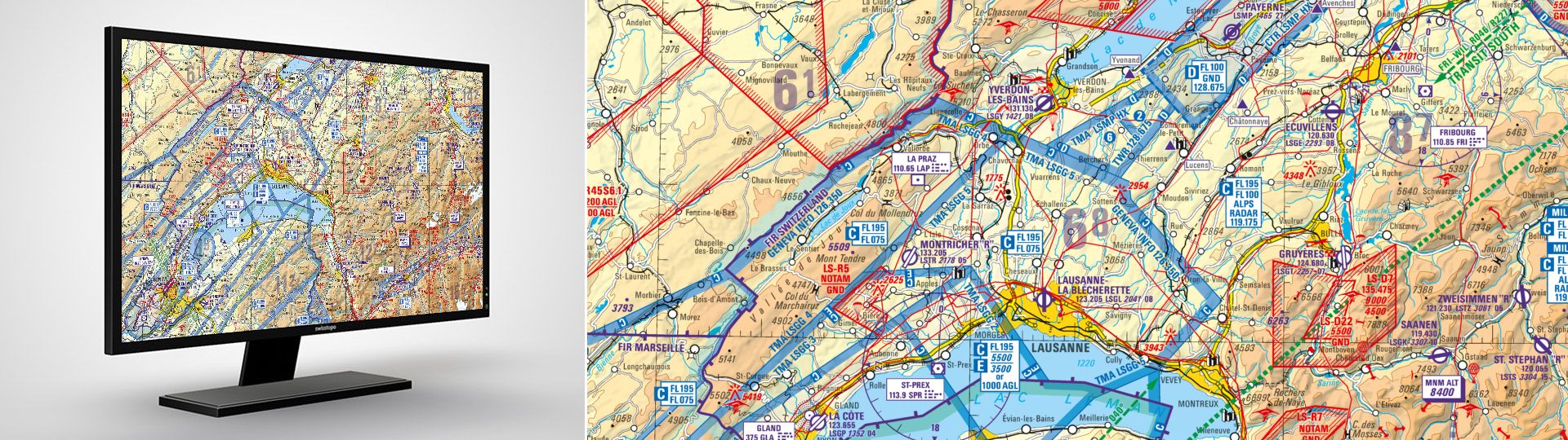
ICAO 1:500'000
Official Aeronautical Chart ICAO of Switzerland 1:500'000, published by skyguide, Data Management, CH-8058 Zürich, with additional air traffic control information.
Please note that only the printed version is legally binding.
Edition 2026: valid from 19 March 2026
Additional information
Aeronautical Chart ICAO - Download
Index
Federal Office of Topography swisstopo
Division Cartography
Seftigenstrasse 264
3084 Wabern
Seftigenstrasse 264
3084 Wabern