
Digital aid for hikers
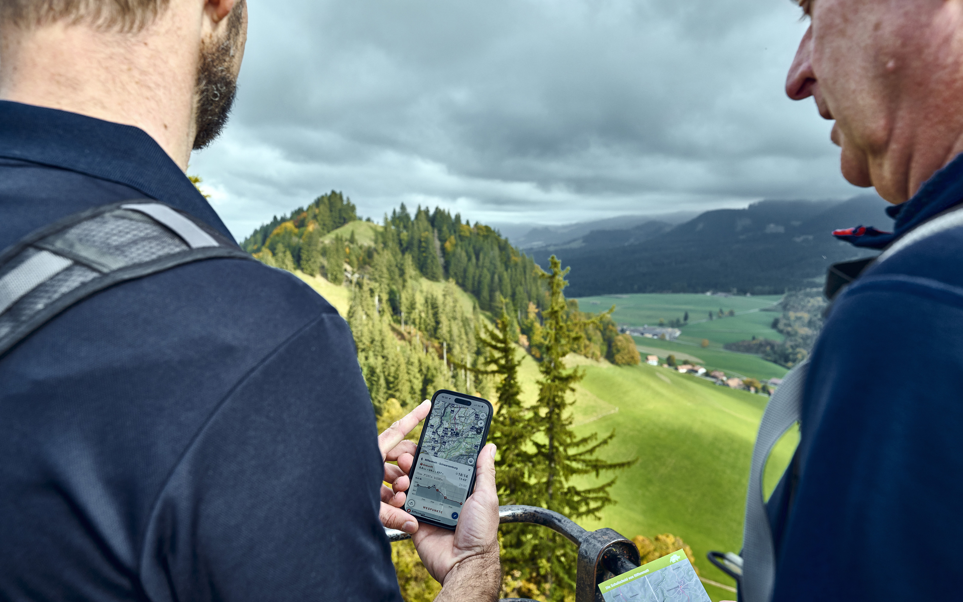
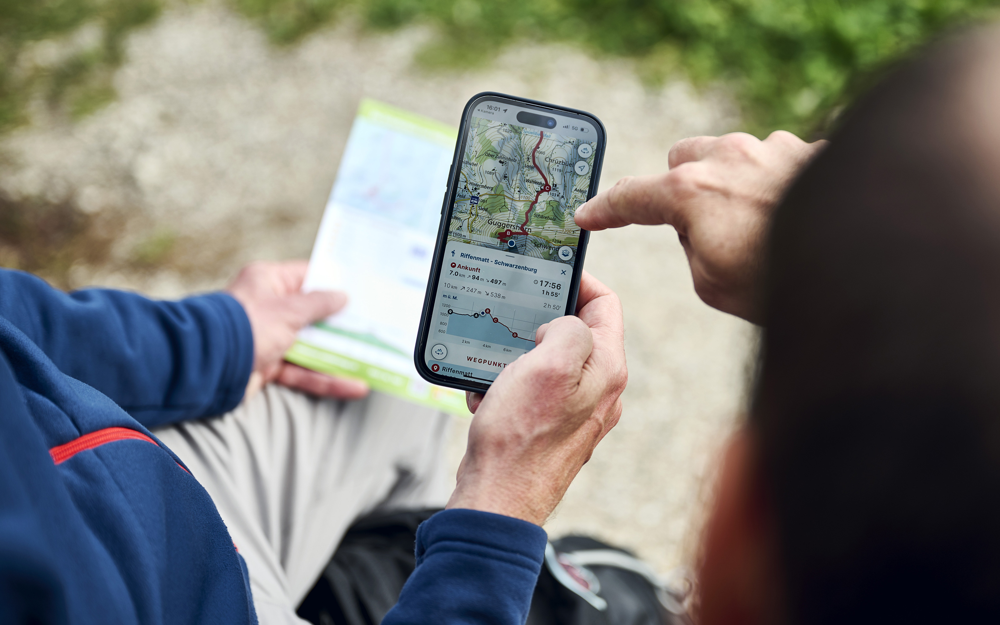
Great news for outdoor enthusiasts: hiking suggestions from the Swiss Hiking Federation now include a QR code that takes you directly to the swisstopo app, which then becomes your smart guide.
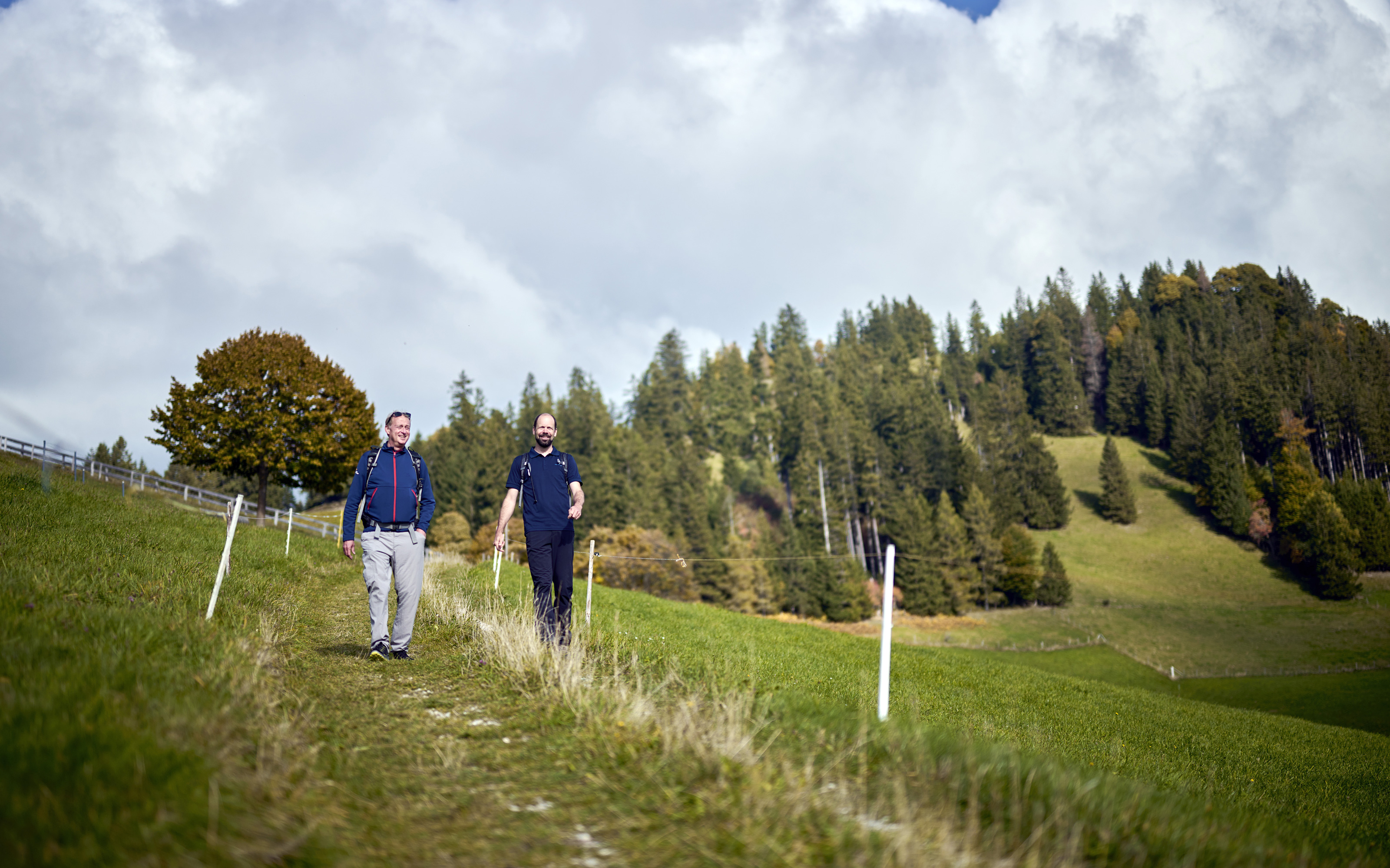
Hiking is Switzerland’s most popular outdoor activity. Around 60 percent of the population regularly put on their hiking boots. Those who pack their rucksack and set out on a hike have an enormous variety of routes to choose from: Switzerland’s network comprises around 65,000 kilometres of marked trails. The Swiss Hiking Federation is a reliable partner for hikers who want to find a suitable route. “Our suggested hiking trails are always thoroughly researched,” explains division and publishing director Thomas Gloor. Each issue of the federation’s magazine, “WANDERN.CH”, which is published six times a year, contains eight seasonal hiking suggestions. And this service is now even more attractive: since autumn 2022, each hiking tip has included a QR code that takes users directly to the swisstopo app so that they can view the route on their smartphone. But that’s not all: “The app also assumes the role of reliable guide,” says Christoph Streit, head of Cartography Product Management at swisstopo.
Virtual guide
Thanks to the swisstopo app, hiking enthusiasts can set out knowing they are in safe hands. As a virtual guide, the app delivers precise information about the route, including distance to destination, height differences and remaining time to destination. The latter is based on the user’s own walking speed, which can be configured with a personalised speed parameter. The app also provides information about route closures, for example, and the location of livestock guardian dogs, plus a panorama mode that accurately depicts the mountain peaks in the region, together with their names. And users who wish to explore their chosen destination before setting out on their hike can take a virtual tour thanks to the integrated 3-D function. Users can conveniently switch directly to other apps such as those of SwissMeteo and Swiss Federal Railways (SBB), so that they can also quickly view weather reports and train timetables. All these services are based on comprehensive geodata provided by swisstopo. “The app also demonstrates the impressive extent of the datasets the Federal Office of Topography has at its disposal, and how these can be used for the benefit of everyone,” says Christoph Streit.
A godsend
As Thomas Gloor points out, for hikers in Switzerland the fact that they can establish a connection to the swisstopo app using the QR code is a godsend. After all, “People who want to go on a hike need no more and no less than reliable cartographic material, a network of hiking routes and information about public transport facilities.” Because the suggested hiking routes are highly popular among the general public, it was decided to add a QR code to all already published routes that are available in the online archive. The Swiss Hiking Federation and swisstopo have been working closely together for many years. When the first official hiking maps were published by the Federation back in the 1980s, the Federal Office of Topography began to provide the necessary basic data, and the Federation has been able to count on this reliable partnership ever since. “In the age of digital transformation, extending our partnership to mobile applications is clearly a logical move,” explains Christoph Streit.
Hiking boom
The app is successful in that it is easy to use, regardless of the age of the user. Special attention has been paid to generation Z: it is a fact that younger people are less familiar with the use of conventional maps than earlier generations. At the same time, hiking is enjoying a notable boom among people between the ages of 15 and 29. According to a current study, this age group has increased by 17 percent. All users of the swisstopo app can now also share their hikes as stories on social media. swisstopo is now planning to introduce additional functions so that the app will remain worthy of the, “Master of Swiss Apps” title, which it was awarded in 2021.
QR code for all interested providers
In the future, swisstopo will place its new service at the disposal of tourism regions, the hotels and other interested providers, free of charge. By following simple instructions, they will be able to create a QR code for a hiking route, which links directly to the swisstopo app. The Swiss Hiking Federation is also sharing the new service: All 26 cantonal sections have the possibility of adding a QR code to their hiking suggestions.
Further information
Federal Office of Topography swisstopo
Seftigenstrasse 264
3084 Wabern