
Media collection: Visualising drought
This media collection provides a comprehensive overview of how remote sensing can be used to detect drought and other stressful situations for vegetation. From high-resolution true-colour satellite images documenting visible changes in the landscape to specialised indices and thematic maps, you will find a wide range of image material to help you understand drought phenomena.
Hydrological drought in Lake Sihl - True-colour images (2025)
Sentinel-2 satellite images show the hydrological drought in Lake Sihl, where falling water levels in the reservoir in April 2025 compared to the previous year have left the lake shores dried up.
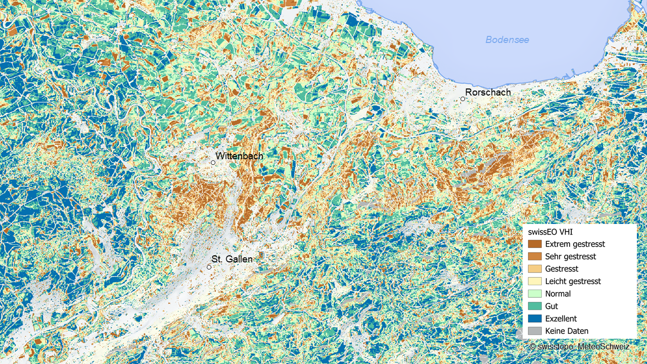
Health status of vegetation in the St. Gallen region - VHI map (2025)
Health status of vegetation in the St. Gallen region («swissEO VHI» from 15 April 2025). This map combines satellite data from Sentinel-2 and Meteosat and shows stressed vegetation due to factors such as drought, disease, windthrow or human intervention compared to the climate reference period 1991-2020.

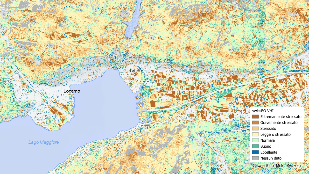
Health status of vegetation in the Magadino plain - VHI map (2023)
Health status of vegetation in the Magadino plain («swissEO VHI» from 15 July 2023). This map combines satellite data from Sentinel-2 and Meteosat and shows stressed vegetation due to factors such as drought, disease, windthrow or human intervention compared to the climate reference period 1991-2020.

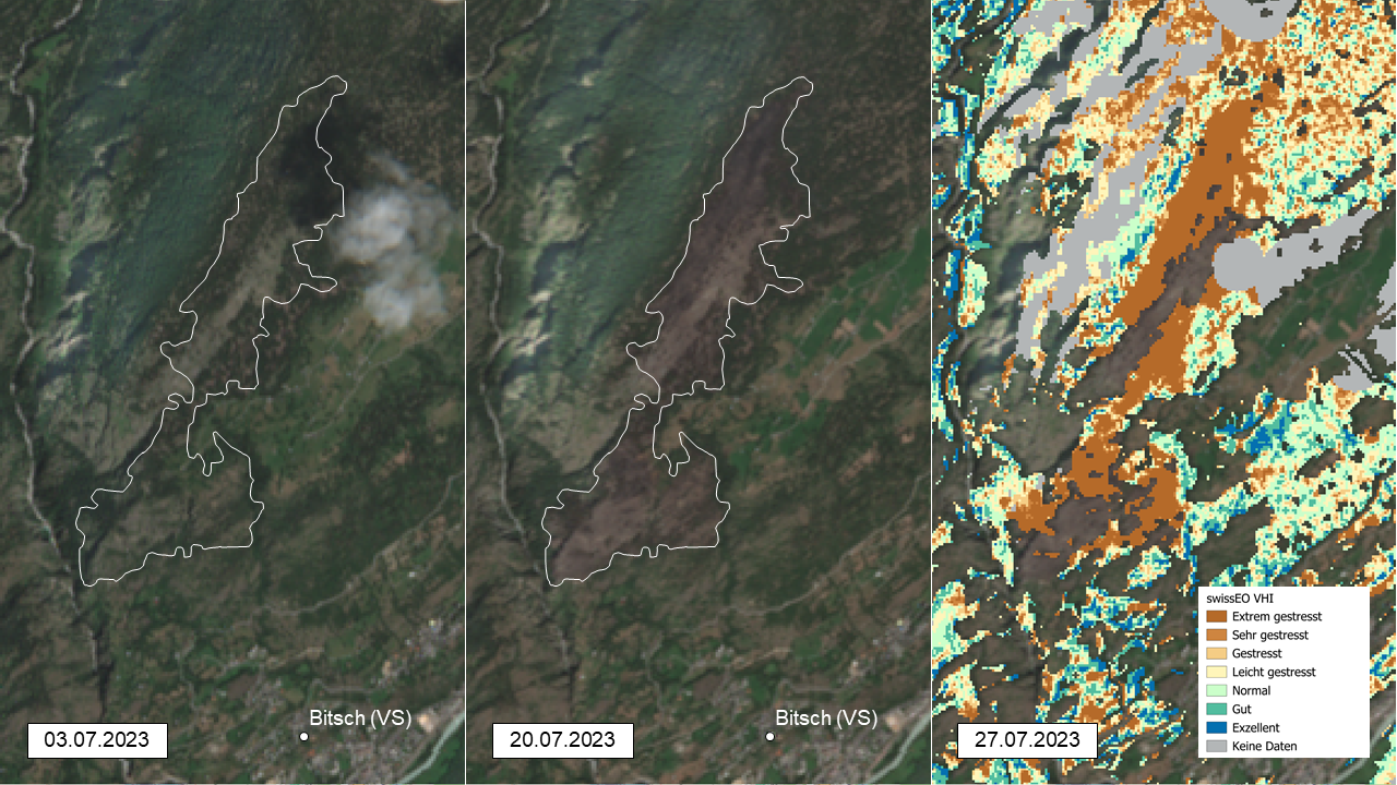
Forest fire above Bitsch - True-colour images and VHI map (2023)
Forest fire above Bitsch (Valais, 17 July 2023) - Left: Sentinel-2 true colour image before the fire (early July). Centre: Condition after the fire (end of July) with outline of the burned area. Right: Vegetation Health Index (VHI) after the fire, with a clearly visible signal indicating extreme stress in the forest stand in the burned area.

Diminshed snow cover in the Aletsch region - True-colour images (2022)
Sentinel-2 satellite images show the diminished snow cover in 2022 in the Aletsch region due to a lack of precipitation in winter followed by warm temperatures.
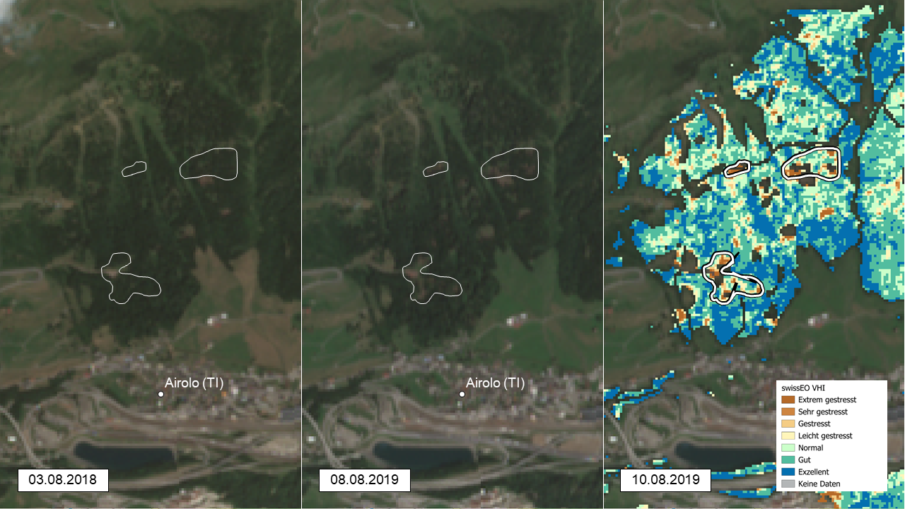
Storm Vaia above Airolo -True-colour images and VHI map (2018)
Storm Vaia above Airolo (Ticino, 29/30 October 2018) - Left: Sentinel-2 true colour image before the storm (August 2018). Centre: Image taken after the storm (August 2019) with outlines of the damaged areas. Right: Vegetation Health Index (VHI) after the storm (August 2019), with a stressed signal for the storm-damaged areas in the forest stand.

Health status of vegetation in the Bernese Plateau - VHI animation (2018)
Health status of vegetation in the Bernese Plateau («swissEO VHI» from 5 august 2018). This overlaid map combines satellite data from Sentinel-2 and Meteosat and shows stressed vegetation due to factors such as drought, disease, windthrow or human intervention compared to the climate reference period 1991-2020.
Agricultural drought in western Switzerland - True-colour images (2018)
Sentinel-2 satellite images show the change in agricultural land from green (June 2017) to brown and dry fields during the drought (August 2018).
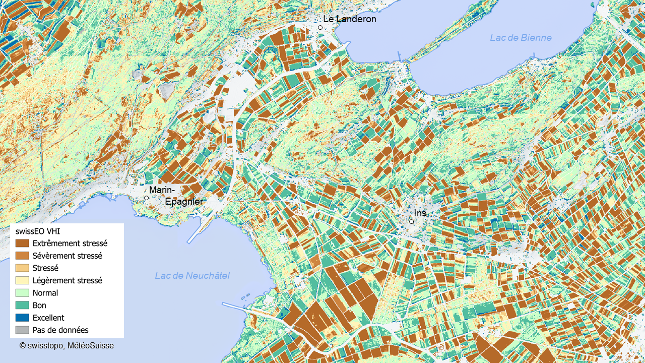
Health status of vegetation in the Seeland region - VHI map (2018)
Health status of vegetation in the Seeland region («swissEO VHI» from 24 July 2018). This map combines satellite data from Sentinel-2 and Meteosat and shows stressed vegetation due to factors such as drought, disease, windthrow or human intervention compared to the climate reference period 1991-2020.
Index
Seftigenstrasse 264
3084 Wabern