
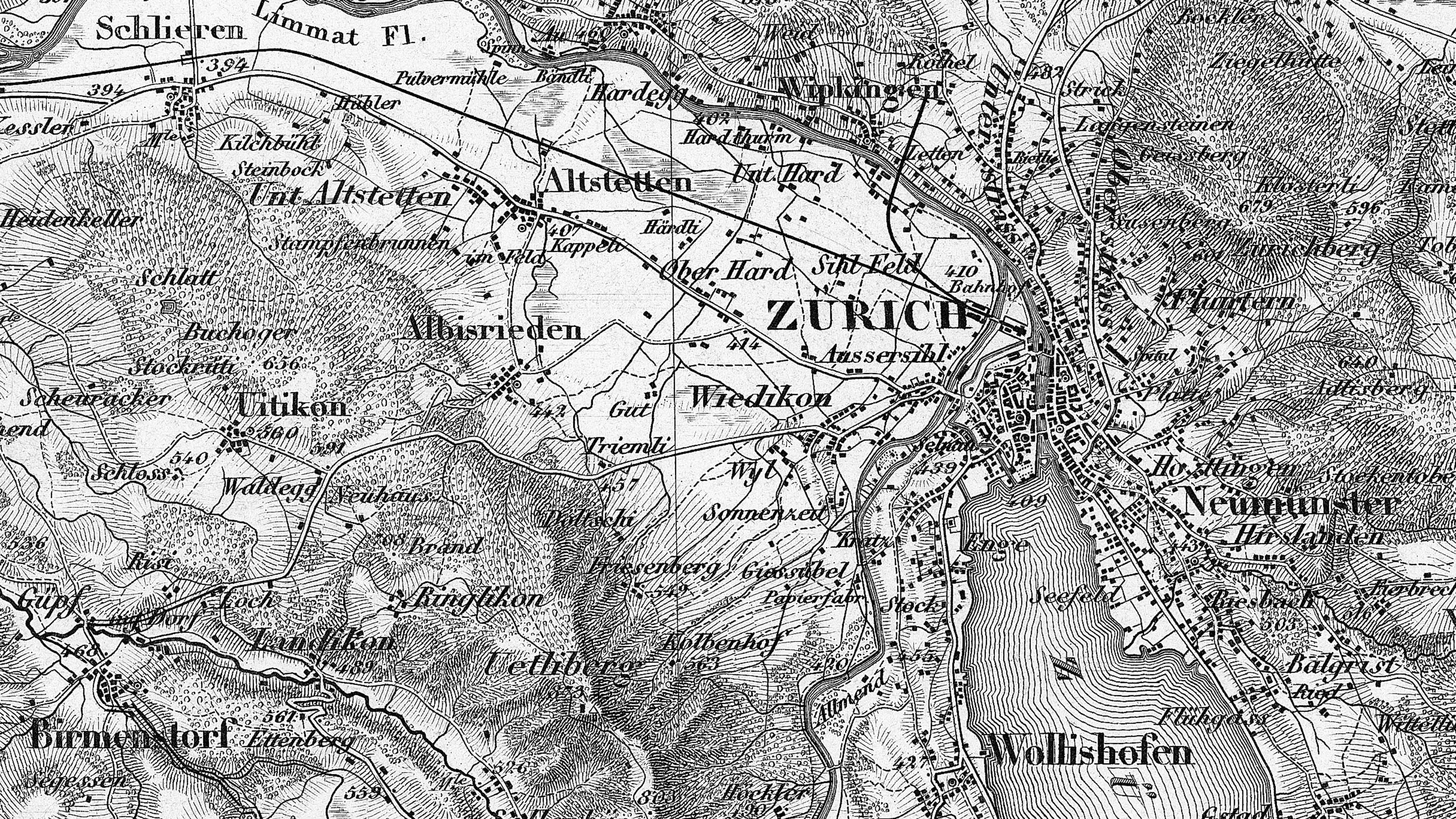
Dufour Map
The 1:100,000 topographic map of Switzerland (Dufour Map) was the first official series of maps that encompassed the whole of the country. It was published in the period from 1845 to 1865 and thus coincides with the creation of the modern Swiss Confederation.
Beginnings
Following initial efforts in the time of the Helvetic Republic (1798 to 1803), the earliest surveys of Switzerland were carried out by officers of the General Staff from 1809 onwards. However, it was not until Guillaume Henri Dufour (1787–1875) was appointed Chief of General Staff of the Swiss Confederation in 1832 that map production really began to make progress. His duties included the creation of the 1:100,000 topographic map of Switzerland.
Geodetic basis
Dufour worked closely together with numerous scientists, topographers and copperplate engravers. To begin with, between 1834 and 1837 astronomer and geodesist Johannes Eschmann (1808–1852) joined together several already existing cantonal networks to form a triangulation (“Triangulation primordiale”). This presented the first nationwide triangulation that joined the areas to the north of the Alps with the regions of the south. In 1840, Eschmann published the results of the trigonometric surveys of Switzerland, which were used as geodetic reference system for the Dufour Map.
Topographic basis
At the same time, topographic surveys were initiated, and for this purpose Dufour had to form a network of colleagues who supplied him with topographic data. In order to bring together a small team of specialists for the purposes of examining the incoming data, converting them to the scale of the future map and subsequently engraving the images in copper, Dufour founded the Federal Topographical Bureau in Geneva in 1838.
In the Central Plateau, Jura and Southern Ticino areas, the fundamentals for the Dufour Map were cartographed using the scale of 1:25,000, while 1:50,000 was used for the Alpine regions. Based on a small number of triangulation points, the coordination and height of which already had to be determined before work on the triangular surveys could commence, the topographers first had to integrate the framework of fixed points directly into the scale with the aid of graphic triangulation. They were then able to survey the terrain in accordance with precise instructions, based on the assumption that their data would “only” be reduced by a factor of four or two for publication. swisstopo refers to the material produced at this stage as “original surveys”.
Some cantons published cantonal maps that were funded partly by private investors and partly by the canton itself. The basic data for these maps was put at the disposal of the Federal Topographical Bureau for conversion into the map of the confederation. The cantons included Basel-Stadt (1836), Neuchâtel (1838–1845), Thurgau (1839), Geneva (1842), Aargau (1845-1848), Zug (1850), St Gall and Appenzell (1851–1956), Fribourg (1955), Zurich (1852–1865), Neuchâtel (1858), Vaud (1862–1885), and Lucerne (1864-1867). As a consequence, large quantities of the topographic data for the Dufour Map are preserved in cantonal archives and are therefore not included in the swisstopo map collection. It should also be noted here that, in some cantons, the Dufour Map is based on the same data as the 1:25,000 / 1:50,000 Topographic Atlas of Switzerland (Siegfried Map).
Division into sheets
From the outset, Dufour defined the framework for the set of maps comprising a grid of five times five sheets (division into sheets). Each sheet covers 70 kilometres (west to east) by 48 kilometres (north to south). Thus the entire work encompassed an area of 350 by 240 kilometres. The corner pages were reserved for the title and other additional items, and contained only limited topographic information. For the 1:50,000 originals, a sheet was divided into 16 sections (each covering an area of 17.5 by 12 kilometres), while for the 1:25,000 originals each section was divided again into four sections (each covering an area of 8.75 by 6 kilometres).
Reproduction
Dufour himself carefully examined the original surveys after they had been delivered to the Federal Topographical Bureau. These were then reduced to the scale of 1:100,000 as copy, and subsequently transferred in reverse form to a copper plate. The map was then engraved into copper and printed. The various forms of the terrain were illustrated with the aid of shading, which resulted in a distinct three-dimensional impression. The individual sheets were released for sale only after they had been carefully checked for accuracy and corrected as necessary. The Dufour Map was published between 1845 and 1865.
Accuracy
Dufour’s instructions specified that the terrain must be surveyed “as accurately as possible”. Thus a contemporary quantification of accuracy did not exist. A distortion analysis of a section of the Dufour Map based on more than 2,560 control points distributed over 3,360 square kilometres revealed a mean deviation of 153 metres in natura, or 1.5 millimetres on the map. The greatest deviation detected was 780 metres.
Praise for Dufour and his team
Throughout the production process the work of Dufour and his colleagues received some criticism but also a great deal of praise. The Dufour Map established the good reputation enjoyed by Swiss cartography throughout the world, and it was honoured with a number of international awards. In recent times, historians have examined and confirmed the importance of the Dufour Map in terms of political and cultural history. This work was the first geometrically accurate and aesthetic depiction of the recently formed confederation – an image of a national unity that banished cantonal differences into the background.
Federal Office of Topography swisstopo
Seftigenstrasse 264
3084 Wabern