
Published on 9 April 2024
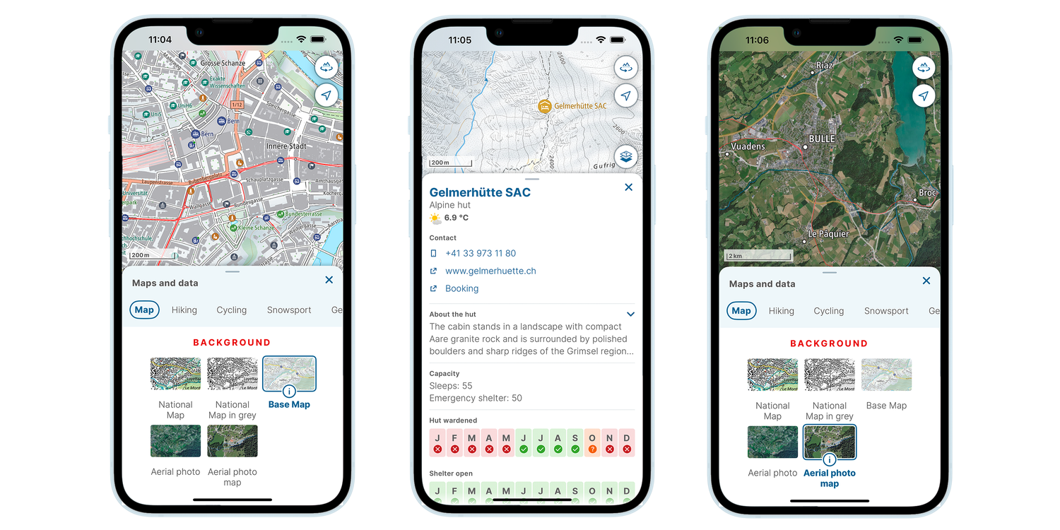
Base Map
The Base Map has been optimised for use on smartphones - especially with regard to the memory requirements for offline use. The map adapts dynamically to the zoom levels and is enriched with interactive map elements (points of Interest POI).
Base Map
No, it is currently not possible to filter POIs. The POIs are displayed dynamically depending on the zoom level.
Like the national map, the Base Map can be selected as a background map in the app and can be combined with layers as usual. However, certain topics such as public transport may already be integrated into the Base Map and will thus be duplicated if an additional layer is inserted.
Foreign data cannot currently be downloaded and is only available in online mode. Unlike the data from Switzerland and Liechtenstein, which comes from swisstopo, the foreign data is obtained from a third party. Third-party licensing restrictions do not permit offline storage.
The areas outside Switzerland in the Base Map are not based on data from swisstopo but on data from the OpenStreetMap community. Rocks and crags are not included in this data set and therefore cannot be displayed.
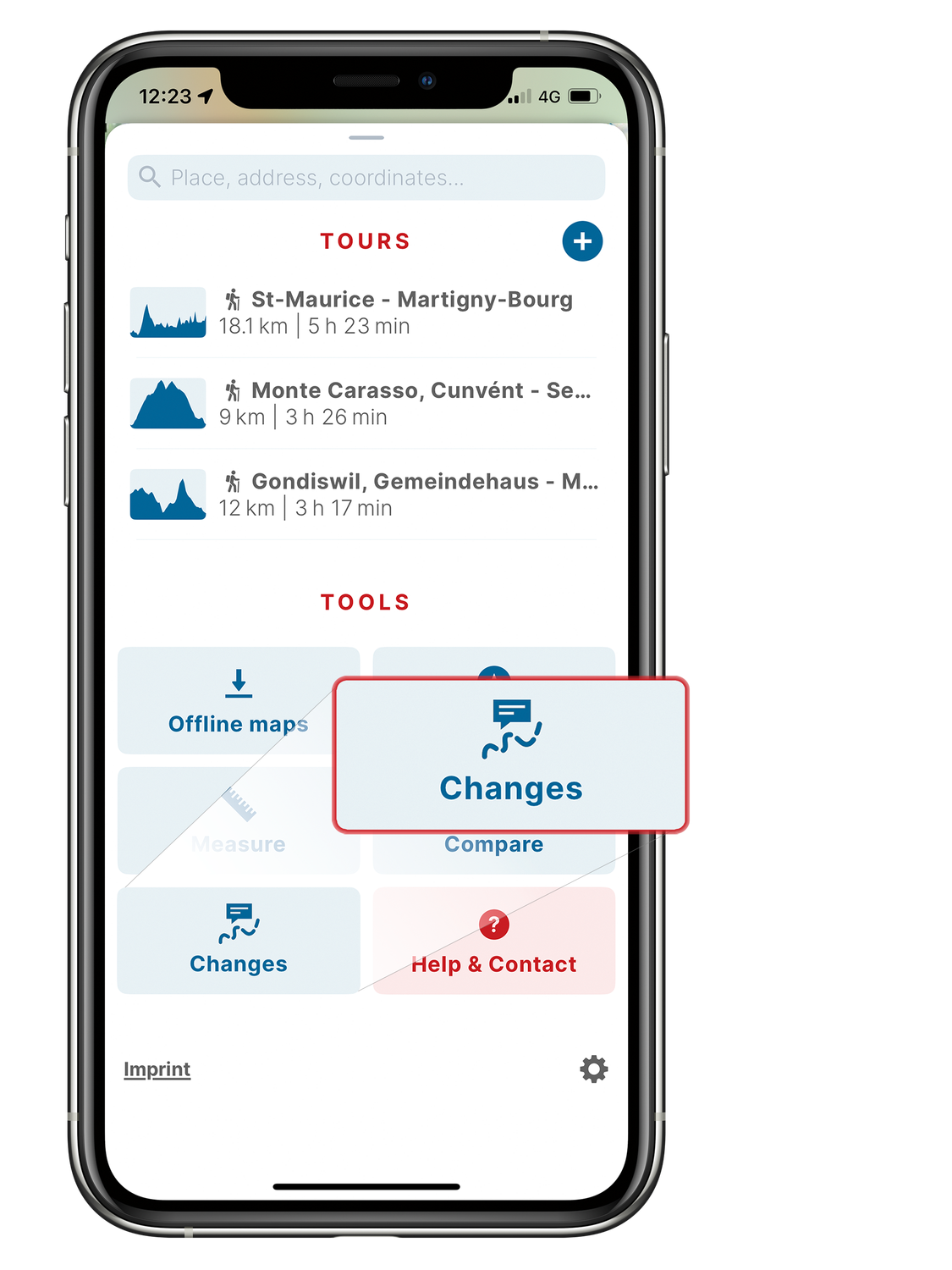 You can report changes and errors in the map material directly in the app using the Changes tool. To do this, drag the menu upwards and tap «Changes». You can now enter your error report.
For errors in points of interest that originate from OpenStreetMap data, you will be redirected to the website https://www.openstreetmap.org/ to submit the error report.Switzerland: Quarterly update (during the course of the year, data content may be updated)
Abroad: The control of the update cycle is carried out by Maptiler
Points of Interest
In addition to swisstopo's own data, some of this data comes from third-party sources and is not collected or managed by swisstopo itself. For data that is not provided by swisstopo, the sources used can be seen in the context menu of the relevant POI.
Further information can be found in the Terms of use of the swisstopo app.
Base Map: Interactive mobile mapThe Base Map is intended for use within Switzerland. In addition to swisstopo data, we also use various other data sources to provide a high level of information. Not all of the data sources are available abroad. It is not possible for swisstopo to evaluate the data sources of foreign countries. We thus restrict our data to a basic offering based on OSM (OpenStreetMap) data from the OSM community.
The POI information is often real-time data which is as up to date as possible. To ensure that you receive the latest available data, the app must be connected to the mobile phone network.
swisstopo has checked the content of the point-of-interest information beforehand to ensure that it is as consistent and complete as possible, and has decided to provide certain kinds of information for each type of POI. swisstopo will continue adding to this information. The completeness of this information depends on the availability of suitable sources and their ability to be linked to the app, since swisstopo does not collect or maintain this data itself.
The information on the current weather originates from MeteoSwiss. MeteoSwiss currently issues local forecasts for places and postcode areas, as well as for certain mountain huts, passes and summits. These are linked to the POIs in the Base Map.
Do you have any further questions? Here is an overview of the most frequently asked questions about the swisstopo app.
Federal Office of Topography swisstopo
Seftigenstrasse 264
3084 Wabern
Monday 10.00 - 19.00 Tuesday 10.00 - 19.00 Wednesday 10.00 - 19.00 Thursday 10.00 - 19.00 Friday 10.00 - 19.00