
Geodata to support digitalisation in the construction sector
The objective of the «building information modelling» method is to digitalise and network the construction sector. Geodata form a fundamental basis for this method. armasuisse Real Estate and swisstopo are implementing the project in an innovative way.
Bunkers, cable railways, barracks: armasuisse’s real estate portfolio is highly diverse, and encompasses around 7,000 buildings and installations. Each year, approximately 1,100 projects are initiated that are associated with the use of real estate. In Payern alone, where there is a military airfield, 80 dossiers are currently in preparation. At armasuisse Real Estate, the real estate competence centre of the Federal Department of Defence, Civil Protection and Sport (DDPS), management is running at full speed: Specialised personnel are engaged in a broad variety of activities, ranging from planning, construction and operation through to renovation, alteration and demolition. “A vast amount of data and documentation is accumulated in the course of the life cycle of a property or installation,” explains Giuseppe Acciardi from armasuisse Real Estate. And this is where "building information modelling" (BIM) comes in.
Policy-driven
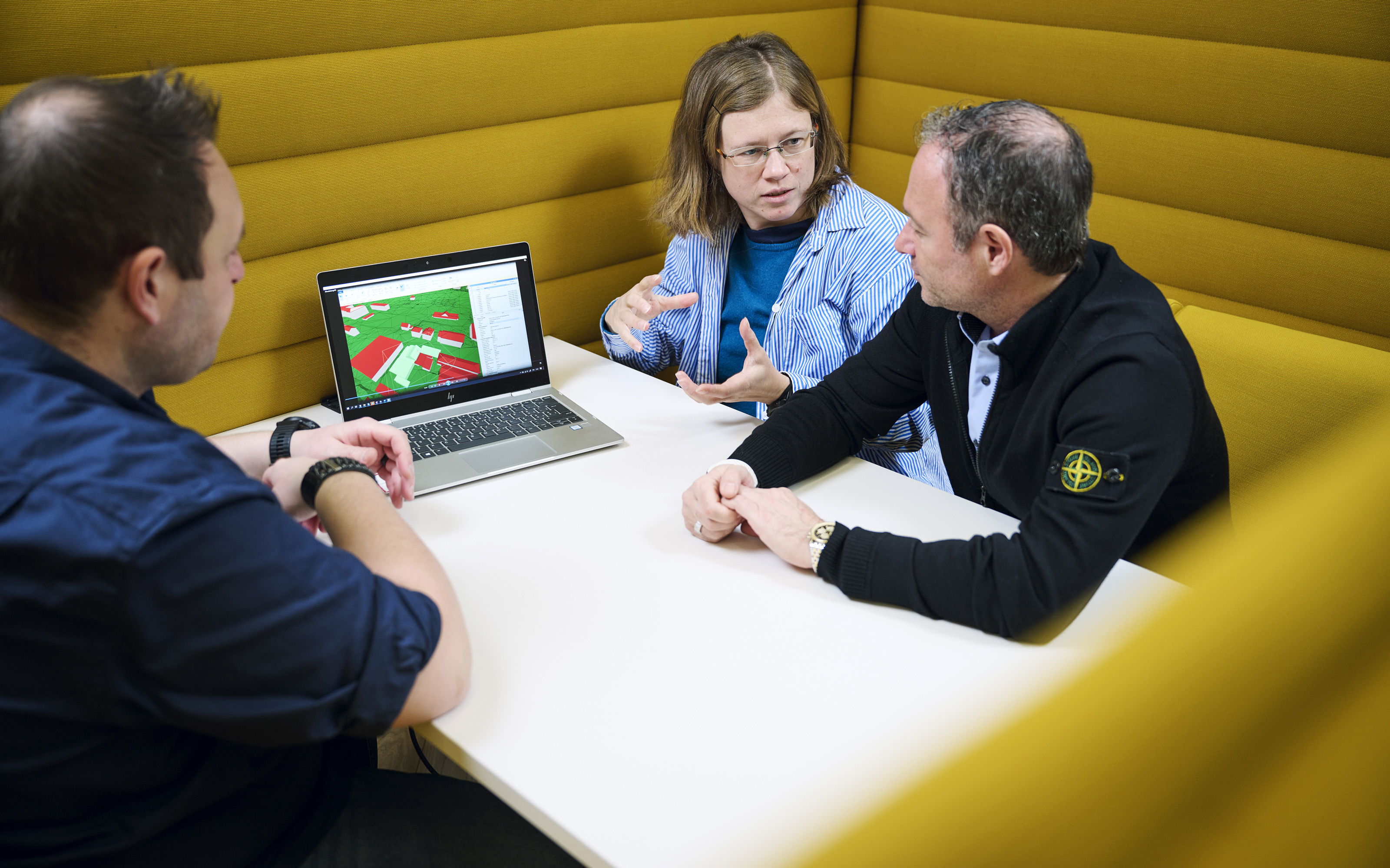
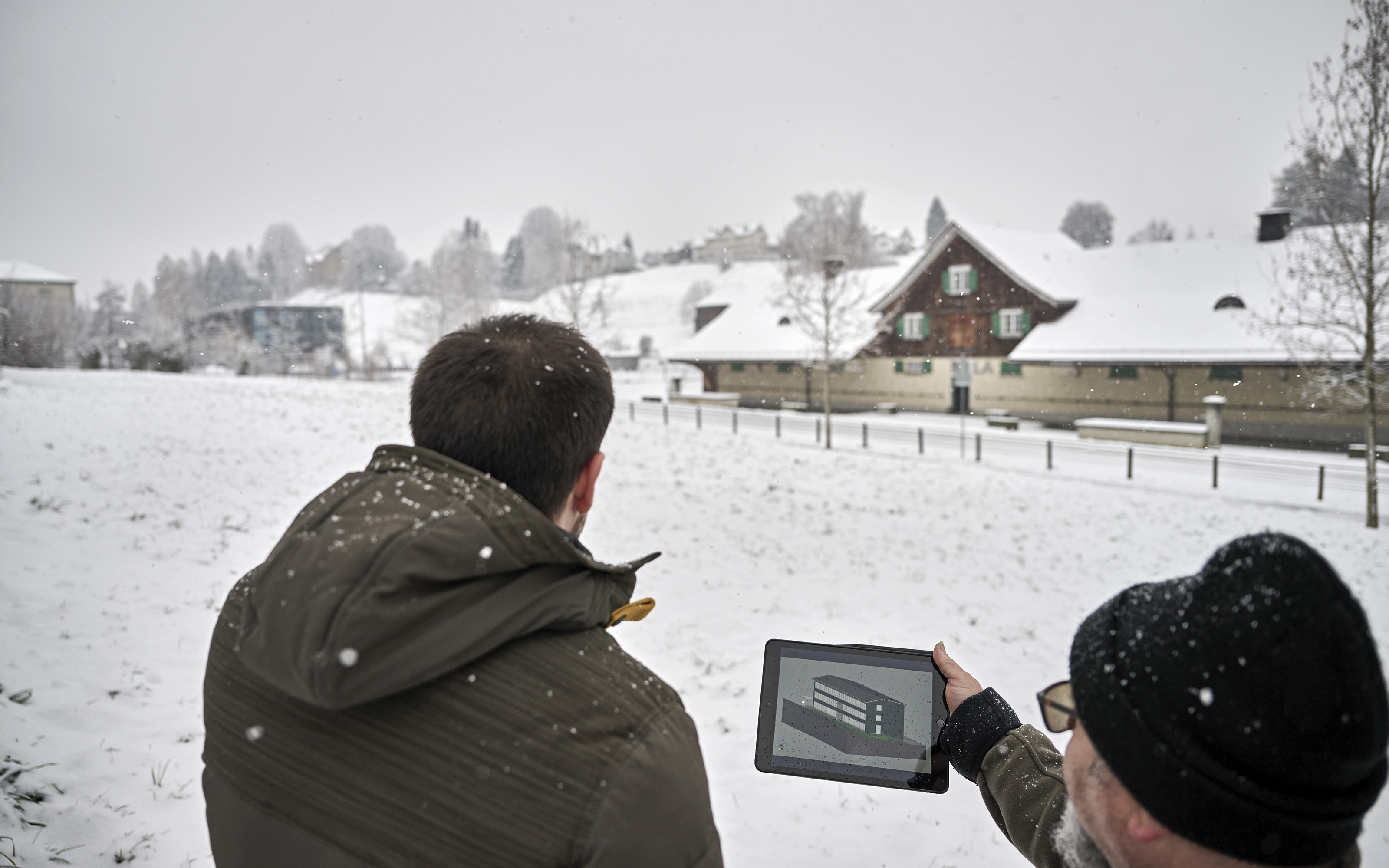
The aim is to transfer all data to a system to which all involved players will have access, ranging from planning and construction specialists and tenants, through to the management and users of the various facilities. This will facilitate networked planning and management, and will ensure that no data will be lost between the various interfaces. Giuseppe Acciardi, responsible for the introduction of BIM at armasuisse Real Estate, has an ambitious goal: he wants to ensure that the digital transformation process within armasuisse Real Estate is affected as rapidly as possible. This task is the result of a federal policy decision. The Federal Council has stipulated that the BIM method must be applied for all new construction projects within the federal administration by 2025. At armasuisse Real Estate the aim is to work closely together with swisstopo, because geodata form the basis for spatial planning and development: buildings are always embedded in a real environment, which is replicated in digital form with the aid of geodata. The interaction of geodata and BIM project data is referred to as geoBIM.
Geodata provide answers
3-D visualisation
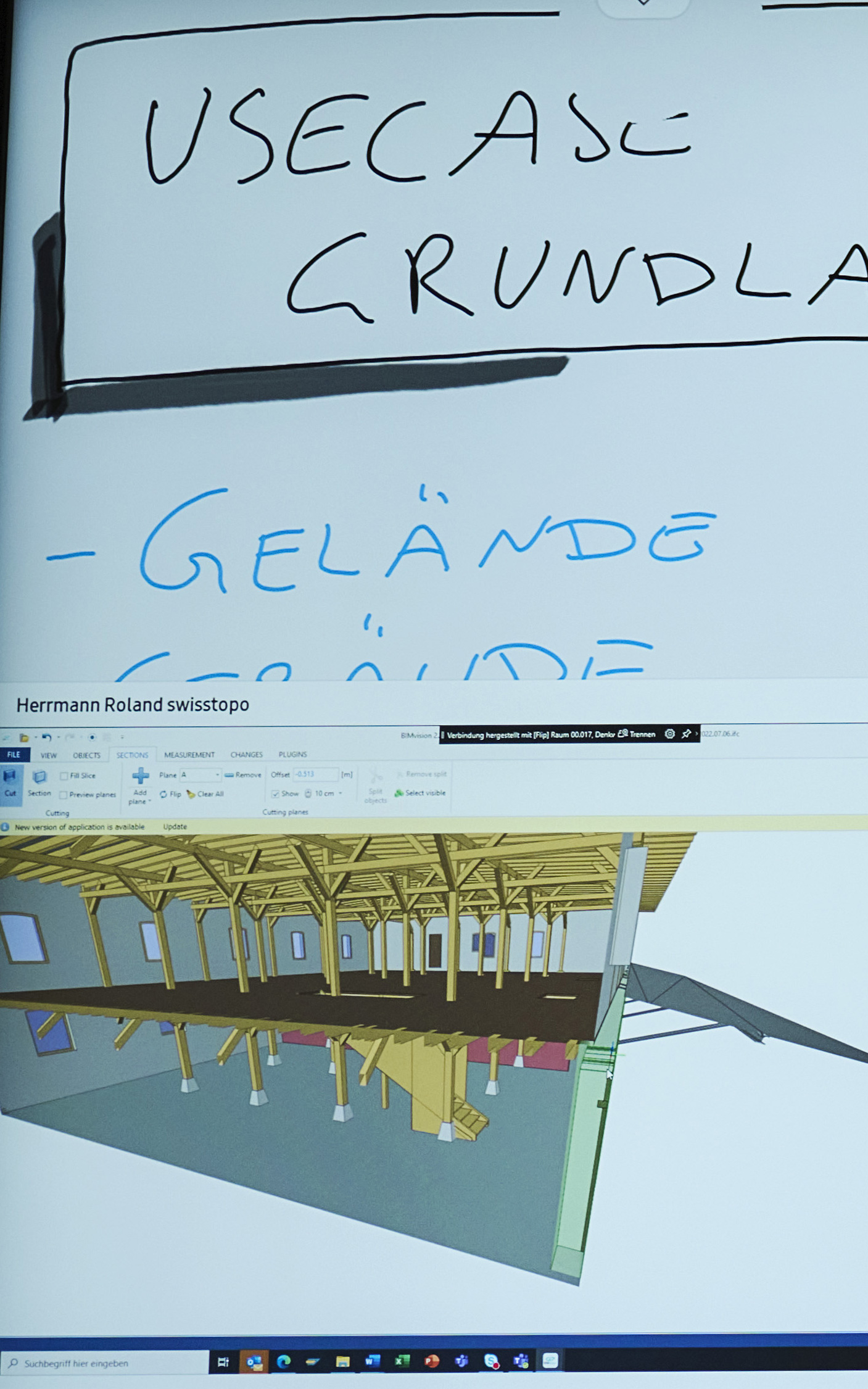
Through the use of BIM, the aim is to be able to model construction projects and visualise them in 3-D before construction work is initiated. In this way it will be possible to identify any problems or errors at an early stage. The digitalised data will remain available on a platform throughout the entire service life of the building or installation, and will be constantly updated. This also yields benefits for the management of buildings and installations: as Giuseppe Acciardi explains, during the life cycle of a building, 80 percent of the costs are attributable to its operation, management and maintenance, whereas planning and realisation only account for 20 percent. Thus, digital renovation could prove to be a financial gain.
geoBIM to support BIM
swisstopo recently adopted a “geoBIM” strategy to support building information modelling. The objective here is to harmonise and standardise geodata throughout the country so that they can be applied for the BIM method. The data concerned are to include high-quality topographic landscape and height models.
Further information
Federal Office of Topography swisstopo
Seftigenstrasse 264
3084 Wabern