
GeoSuite (LTOP/REFRAME/TRANSINT)
GeoSuite is a package of calculation, file editing and data visualising tools, grouped together in a single free modern and efficient application. It has also been optimised for the latest computers and operating systems.
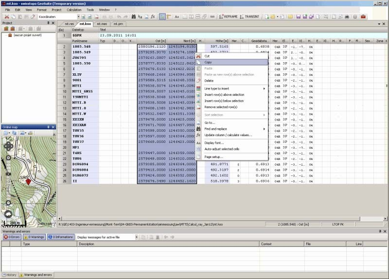
swisstopo’s «geodetic toolbox»
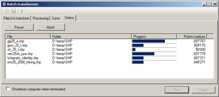
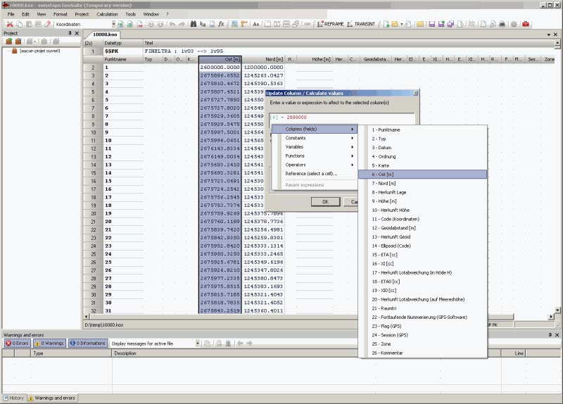
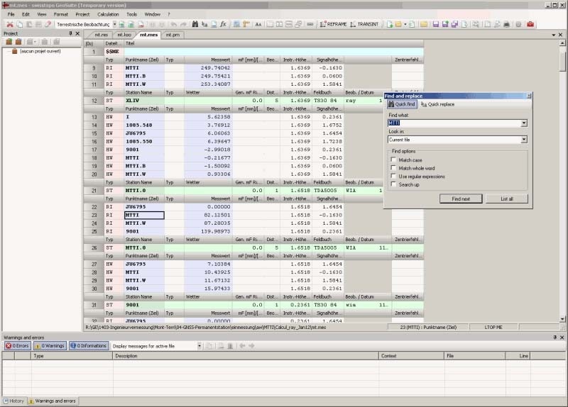
An advanced file editor like a spreadsheet permits intelligent data entry and modification. With the integrated project management tool it is possible to efficiently organise the coordinate and measurement files and the calculation parameters, results and protocols. For making calculations there are numerous productivity-oriented features: contextual and detailed messages and warnings, multitasking, background and batch processing, detailed log files, HTML protocols, coordination of differences or residuals, and integrated graphic visualisation.
It is possible to perform all operations in a unified environment, without the need for any external tools. The package also contains export functions, including graphics, and ensures optimal connectivity with CAD and GIS solutions.
The GeoSuite editor is downloadable free of charge from our website.
The LTOP module
GeoSuite calculation module for the pre-analysis and compensation of geodetic networks, networks combining GNSS observations and terrestrial measurements and, where necessary, levelling networks.
It is possible to initiate an LTOP calculation directly from DAT, KOO and MES files and use the GeoSuite graphic user interface. This can be done either by importing an existing DAT file into a GeoSuite project, then changing the various parameters as required before initiating the calculation, or by starting with a blank project. In the latter case, only the KOO and MES files are required. The parameters in the DAT file can now be directly entered via the graphic user interface.
The REFRAME module
GeoSuite calculation module for planimetric and/or height transformation for application in the Swiss national survey and the cadastral survey.
REFRAME for GeoSuite permits the transformation of all coordinates and heights that are relevant in Switzerland.
It is possible to carry out the interactive processing of data (manual input), or quickly process coordinate files, CAD drawings and GIS (geographic information system) datasets (e.g. INTERLIS).
The TRANSINT module
GeoSuite calculation module for planimetric transformation and interpolation of points, allowing the comparison of geodetic networks or adjustments with existing fixed points.
TRANSINT for GeoSuite offers several methods of transformation and also enables robust adjustment. The transformation of coordinates with different models can be carried out with manually defined or automatically calculated parameters. This variety of methods, together with the file comparison option (calculation of difference/deformation vectors), makes TRANSINT ideal for local adaptations in cadastral surveying or for special surveys (network comparison or adjustment).
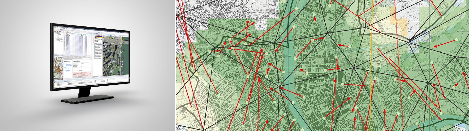
Integrated graphic visualisation provides an immediate overview of results, adjustment points or other transformation datasets (triangles or grids), as well as calculated transformation vectors, on a cartographic background map (national map, orthophoto or topographic landscape model).
Additional information
Application Geosuite - Download
Version 1.6.5410 (21.05.2026) for Windows 32-bit or 64-bit - Full installation package
Index
Federal Office of Topography swisstopo
Seftigenstrasse 264
3084 Wabern