
swissALTI3D
swissALTI3D is an extremely precise digital elevation model which describes the surface of Switzerland without vegetation and development. It is updated every six years.
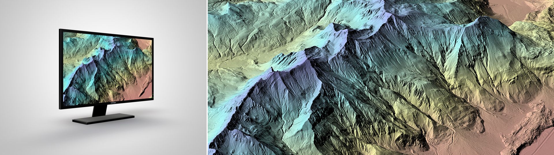
The high precision digital elevation model of Switzerland
Applications
swissALTI3D can be used for a number of different applications and offers an ideal basis for a wide variety of tasks. For example, it can be used:
- as a basic height data-set in a geographic information system
- as a basis for 3D visualisations, simulations and visibility analyses
- as a basis for mapping small structures and forest paths
- as a planning tool in the fields of spatial planning, telecommunications, natural hazards and forestry
- as a basis for ortho-rectification of aerial and satellite images
Additional information
swissALTI3D - Download
Index
Federal Office of Topography swisstopo
Topography - Geodata Distribution
Seftigenstrasse 264
3084 Wabern
Seftigenstrasse 264
3084 Wabern