Open print view

swissSURFACE3D Raster

swissSURFACE3D Raster is a digital surface model (DSM) which represents the earth’s surface including visible and permanent landscape elements such as soil, natural cover, and all sorts of constructive work with the exception of power lines and masts.

surface3d_raster

The digital surface model of Switzerland

swissSURFACE3D Raster is derived from airborne LiDAR data of swissSURFACE3D. To model the surface, the following elements (classified LiDAR points) are used:

  • soil (class 2)
  • vegetation (class 3)
  • buildings (class 6)
  • bridges / footbridges / viaducts (class 17)
  • water (class 9)


To improve the surface representation of large rivers and lakes, watercourse vectors of the topographic landscape model TLM are implemented.

Applications

  • Runoff and mass movement models under consideration of vegetation and buildings
  • Production of (True)-Orthophotos
  • Modelling of the solar energy potential for roofs
  • Rendering of 3D-visualisations
  • Line-of-sight calculations
  • Biomass modelling for forestry
  • Canopy height models with swissALTI3D as terrain model
  • Disaster analysis (e.g. rock fall or debris flow events)

Terms of use

Additional information

Technical details

Structure: The data is structured as a grid with a mesh size of 0.5m and delivered in tiles (tile size = 1 km2).

Format and file sizes

  • Cloud Optimized Geotiff (COG),  LZW compression
    • ~ 16 MB / tile, 335 GB / half of Switzerland
  • ASCII X,Y,Z single spaced
    • ~ 60 MB / tile, 2.6 TB / half of Switzerland
  • ESRI ASCII GRID (on request)

Coordinate system: LV95 - LN02

Planimetric accuracy: +/- 20cm (1 Sigma)
 
Altimetric accuracy: +/- 10cm (1 Sigma)
 
Update: After completion of the acquisition, no update is planned.
 
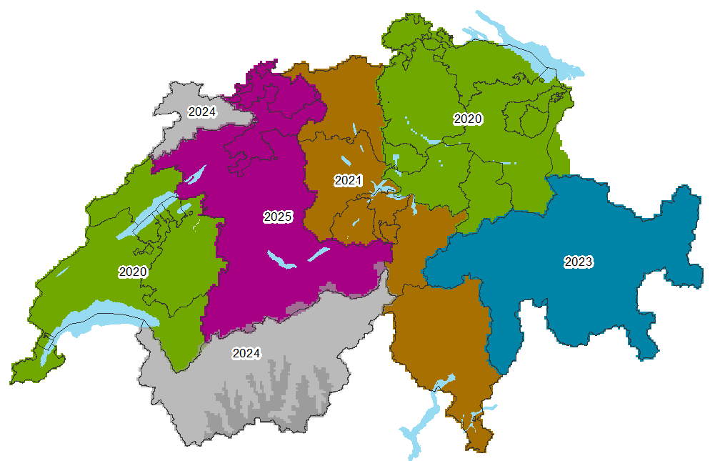
Availability: swissSURFACE3D Raster will be available for the whole of Switzerland and the Principality of Liechtenstein as of 2025. It will replace the current DSM product. For regions not yet covered by swissSURFACE3D Raster, the DSM can still be ordered. We gladly accept orders via geodata@swisstopo.ch.

surface3d-raster-availability-EN

Documents

Almost every publication concerning swissSURFACE3D Raster is available only in German and French. Please select your preferred language in the navigation bar, to view the desired document

Sample data

The sample data show their type and format. They are free of charge and may be used for test purposes only. It is not permitted to include them in a product.

swissSURFACE3D Raster - Access to geodata


Federal Office of Topography swisstopo Seftigenstrasse 264
P.O. Box
3084 Wabern
Tel.
+41 58 469 01 11

E-mail

Federal Office of Topography swisstopo

Seftigenstrasse 264
P.O. Box
3084 Wabern

Show map