Open print view

swissTLM3D

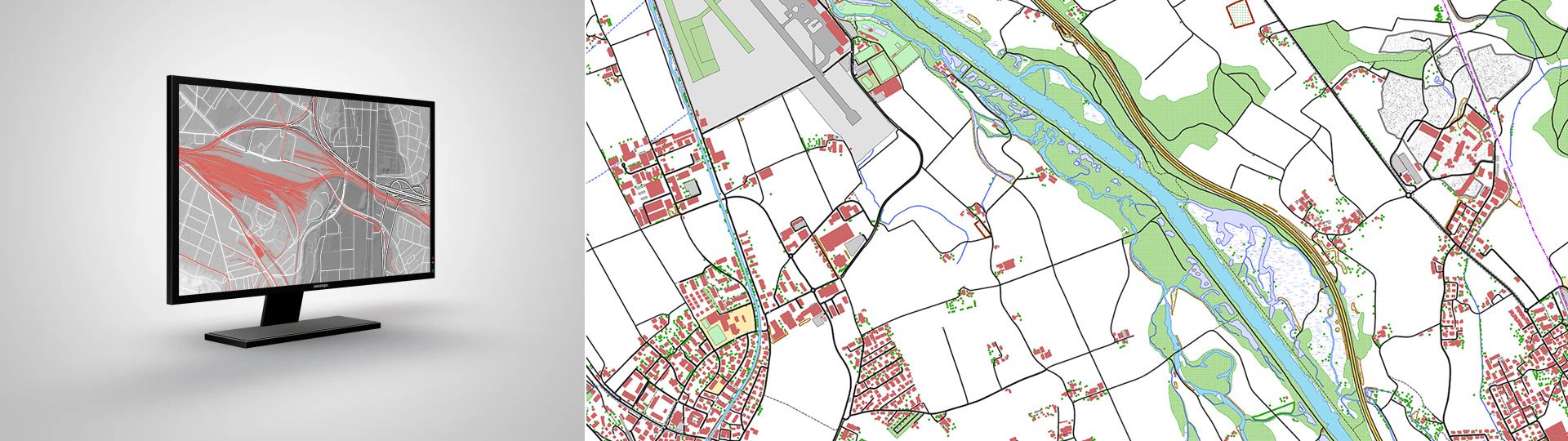
swissTLM3D is the large-scale topographic landscape model of Switzerland. It includes both natural and artificial landscape features, as well as name data in vector form. With a high degree of accuracy and the incorporation of a third dimension, swissTLM3D is the most extensive and accurate 3D vector dataset of Switzerland.

tlm3D

The large-scale topographic landscape model of Switzerland

Version 2.1

swissTLM3D is available for all of Switzerland and the Principality of Liechtenstein. The current release has the version name swissTLM3D 2.1. A PDF document containing a full overview of the swissTLM3D 2.1 data catalogue, including a list of modifications made in comparison to swissTLM3D 2.0, is available in German or French.

News from swissTLM3D

The 2023 edition of swissTLM3D is now also available in GeoPackage format and contains all validated street names from the official index of streets.

Applications

swissTLM3D can be used for a wide range of applications thanks to its simple and clearly defined landscape feature structure:

  • as a reference data set for establishing information systems (e.g. dynamic segmentation based on the road network of swissTLM3D)
  • as a basis for 3D visualisations and analyses (depending on the application, in conjunction with swissALTI3D)
  • as a database for simulations, plans and statistics
  • as a starting point for publications (maps, plans, Internet) and finished products (e.g. multimedia, navigation or geomarketing)

Terms of use

Additional information

Technical details

Structure

swissTLM3D describes more than 20 million landscape features, together with their position and shape, the corresponding landscape feature type and many other attributes. swissTLM3D comprises of 8 topics, each of which contains one or more feature classes.

Roads and tracks

Road and path networks

Public transport

Railway lines and other rail systems, shipping routes and public transport stops

Buildings

Buildings, walls, dams, constructions relating to transport, communication, energy, sport and leisure

Areas

Plots with special land usage (transport, nature, habitat, leisure, etc.)

Land cover

Ground coverage independent from land usage

Hydrography

Watercourses and lake contours

Single point objects

Selection of prominent landscape features which aid orientation (crossings, sources, caves)

Names

Various names (mountains, areas, towns, etc.)

File formats

swissTLM3D is available in the following file formats:

  • ESRI File Geodatabase
  • ESRI Shapefile
  • GeoPackage
  • DXF (please order data by email at geodata@swisstopo.ch)
  • Interlis 2 

Coordinate system

  • LV95 LN02  

Quality

Geometric accuracy:

  •  For well-defined landscape features such as roads or buildings: 0.2 to 1.5 m in all three dimensions
  • for landscape features which are not clearly defined (e.g. forests): 1 to 3 m in all three dimensions

Documents

Almost every publication concerning the swissTLM3D is available only in German and French. Please select your preferred language in the navigation bar, to view the desired document.

Sample data

swissTLM3D - Access to geodata


Federal Office of Topography swisstopo Seftigenstrasse 264
P.O. Box
3084 Wabern
Tel.
+41 58 469 01 11

E-mail

Federal Office of Topography swisstopo

Seftigenstrasse 264
P.O. Box
3084 Wabern

Show map