
Swiss Map Vector 10
Swiss Map Vector 10 is the Swiss national 1:10'000 scale map in vector format. swisstopo’s largest scale topographic map stands out for its detailed representation of traffic, settlements, terrain and vegetation as well as its thorough labelling. Raster data for relief and rock features complete the vector data.
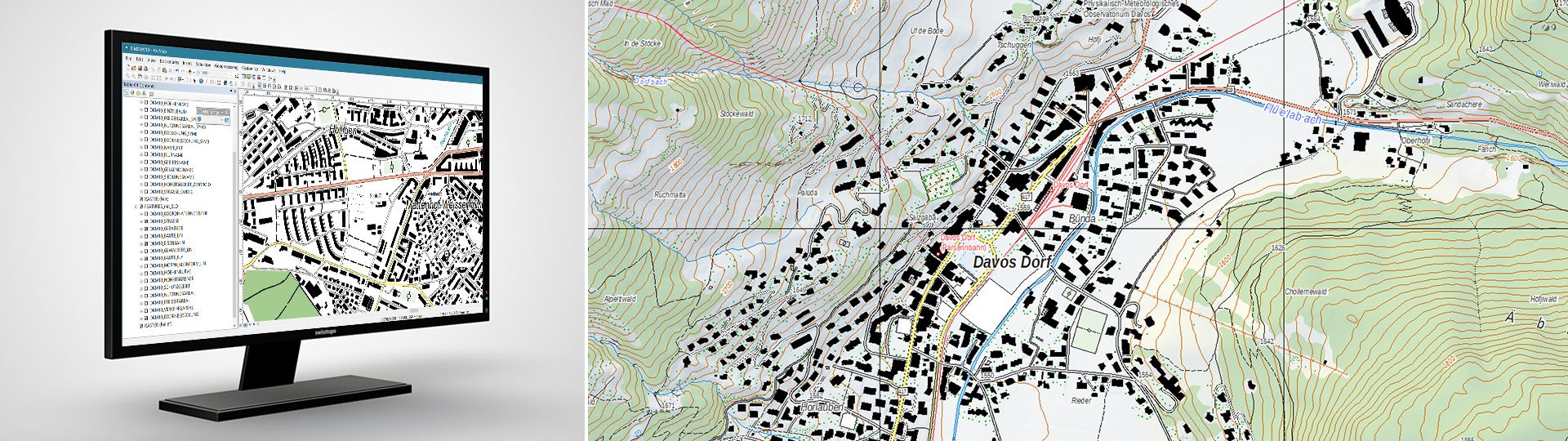
Swiss national vector map 1:10'000
The perimeter of the map covers the national territory of both Switzerland and the Principality of Liechtenstein. Updates are made every year based on the latest version of swisstopo’s topographic landscape model (TLM). Contents are structured according to subject matter and can be edited by class or by object. This product, which features a very high standard of cartography, forms the ideal basis for a variety of uses in the public administration and the private economy, as well as in scientific circles and by the general public.
Your feedback matters to us!
With this short survey, we aim to better understand how you use our Swiss Map Vector products and which requirements are most important to you. Your feedback helps us improve and further develop our products to better meet your needs.
Thank you for taking part!
Uses
- For the development of information systems and use in GIS applications with major demands on cartographic representation and possible personalisation
- As a basis for personalised publications and illustrations in the media
- As a basis for subsequent cartographic developments
Data formats
“Swiss Map Vector 10” is available in “File Geodatabase” (Version GDB) and “GeoPackage” (Version GPKG) formats. Ideally, it is recommended that the “GDB” version be used in “ArcMap”. For the “GeoPackage” version, there are support files for depiction similar to national maps in “QGIS”.
Vector PDF
As an alternative to the GIS formats, the SMV data are also available in a vector PDF (max. size: 52.5km2). The map elements are separated according to layers and can be individualised in a graphics programme if required.
Access to data
The data are offered as predefined spatial units for free download. For a deviating unit or access to vector PDFs, please send your orders to geodata@swisstopo.ch who will make an offer for the costs of the provision of the data. To facilitate the order, please specify the area of interest (rectangle in Swiss coordinates, municipality, etc.), the format and, if necessary, the resolution or variant.
Note regarding the 2026 update:
Due transition to a new GIS system for cartographic production (ArcGIS Pro), no comprehensive update of the 1:10,000 national map will be published in 2026. This affects around one-sixth of Switzerland. From 2027 onwards, updates will be available as usual.
Additional information

Swiss Map Vector 10 - Download
Reduce your download time and take part in our survey. Your opinion matters to us!
With this short survey, we aim to better understand how you use our Swiss Map Vector products and which requirements are most important to you. Your feedback helps us improve and further develop our products to better meet your needs.
Thank you for taking part!
Index
Federal Office of Topography swisstopo
Seftigenstrasse 264
3084 Wabern