
Geoid
The geoid is a selected equipotential surface of the earth's gravity field and serves as the reference surface for height determination. It can be considered as an idealised continuation of the mean surface of the oceans beneath the continents.

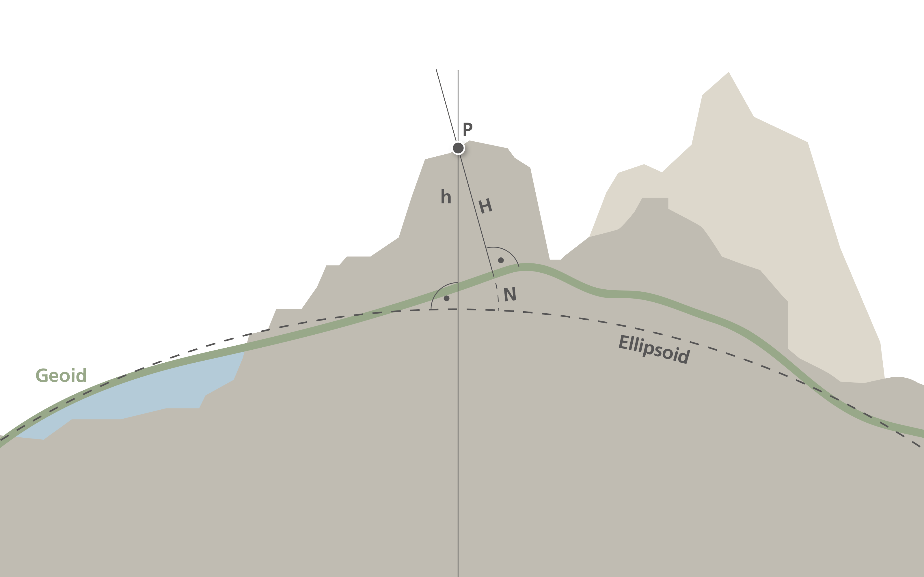
The geoid deviates globally from a mathematical reference surface (the rotation ellipsoid) by ±100 metres. The deviation from the local reference ellipsoid in Switzerland is ±5 metres.
The geoid can be determined with astro-geodetic and gravimetric methods. In the past few years it has become possible to determine the geoid «directly» through levelling and GNSS observations (GNSS-levelling).
Today the geoid model is indispensable, in particular for GNSS applications because it allows the easy transformation of ellipsoidal heights (h) determined by GNSS to the normally used orthometric heights (H), using the following simple formula: H = h - N
The Geoid in Switzerland
The geoid model in Switzerland (CHGeo2004) was determined through a combination of all methods and has an accuracy range of 1 to 3 centimetres.
The Swiss geoid model is available in the form of a 1-kilometre grid and can be integrated into practically all commercially available GNSS receivers.

Links
- Height reference
- Geodetic Reference systems
- Geodetic Referece frames
- Local Swiss Reference frames
- Video tutorial: «Einführung in Höhensysteme» (Introduction to height systems), in German
- Video tutorial: «Einführung in Höhensysteme» (Introduction to height systems), in French
Download
Geoid, format ESRIASCIIGRID, variants LV95/LHN95, LV95/LN02, ETRS89/LHN95, ETRS89/LN02
(under open data licence Creative Commons CC0)
Federal Office of Topography swisstopo
Seftigenstrasse 264
3084 Wabern