
GeoMaps 500 Vector
The GeoMaps 500 are a series of geological, tectonic, hydrogeological, geophysical and palaeoglaciological overview maps of Switzerland at a scale of 1:500'000.
Vector datasets
- The Geological Map of Switzerland 1:500'000 provides an overview of the distribution of the uppermost rock strata occurring in Switzerland. Additionally, age and simplified tectonic assignment of the different types of rocks are given.
- The Tectonic Map of Switzerland 1:500'000 displays the large-scale structural and tectonic units, which contribute to a better understanding of the geological buildup of the Alps.
- The Hydrogeological Maps of Switzerland – Groundwater resources 1:500'000 shows the various groundwater resources in Switzerland and provides productivity information.
- The Hydrogeological Maps of Switzerland – Vulnerability of Groundwater Resources 1:500'000 indicates the vulnerability of groundwater resources to possible contamination.
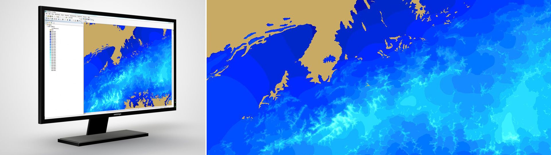
- The Gravimetric Map of Switzerland – Bouguer Anomalies 1:500'000 shows on the one hand the regional negative anomalies associated with the Alps and on the other hand the positive anomaly of the Sesia–Finero zone, which signifies an excess of mass at depth.
- The map of “Switzerland during the Last Glacial Maximum (LGM)” 1:500'000 shows the maximum extent of glaciation in Switzerland at the height of the last Ice Age about 24,000 years ago.
Additional information
GeoMaps 500 Vector - Download
Index
Federal Office of Topography swisstopo
Division Swiss Geological Survey
Seftigenstrasse 264
3084 Wabern
Seftigenstrasse 264
3084 Wabern