
Giubiasco - 1881 baseline
The "fantastic 1860s" were an important time for the surveying of Switzerland: in 1861 the Swiss Geodetic Commission (SGC) was established.
After 1863 the surveyors' concordat on the harmonisation of cadastral surveys was prepared and was implemented by the Federal Council in 1868. The Swiss Alpine Club was founded in the same year. At the end of 1864 Dufour submitted the final report on the production of the 1:100,000 topographic map of Switzerland (the "Dufour map") to the Federal Council. Its last sheet was published in 1865.
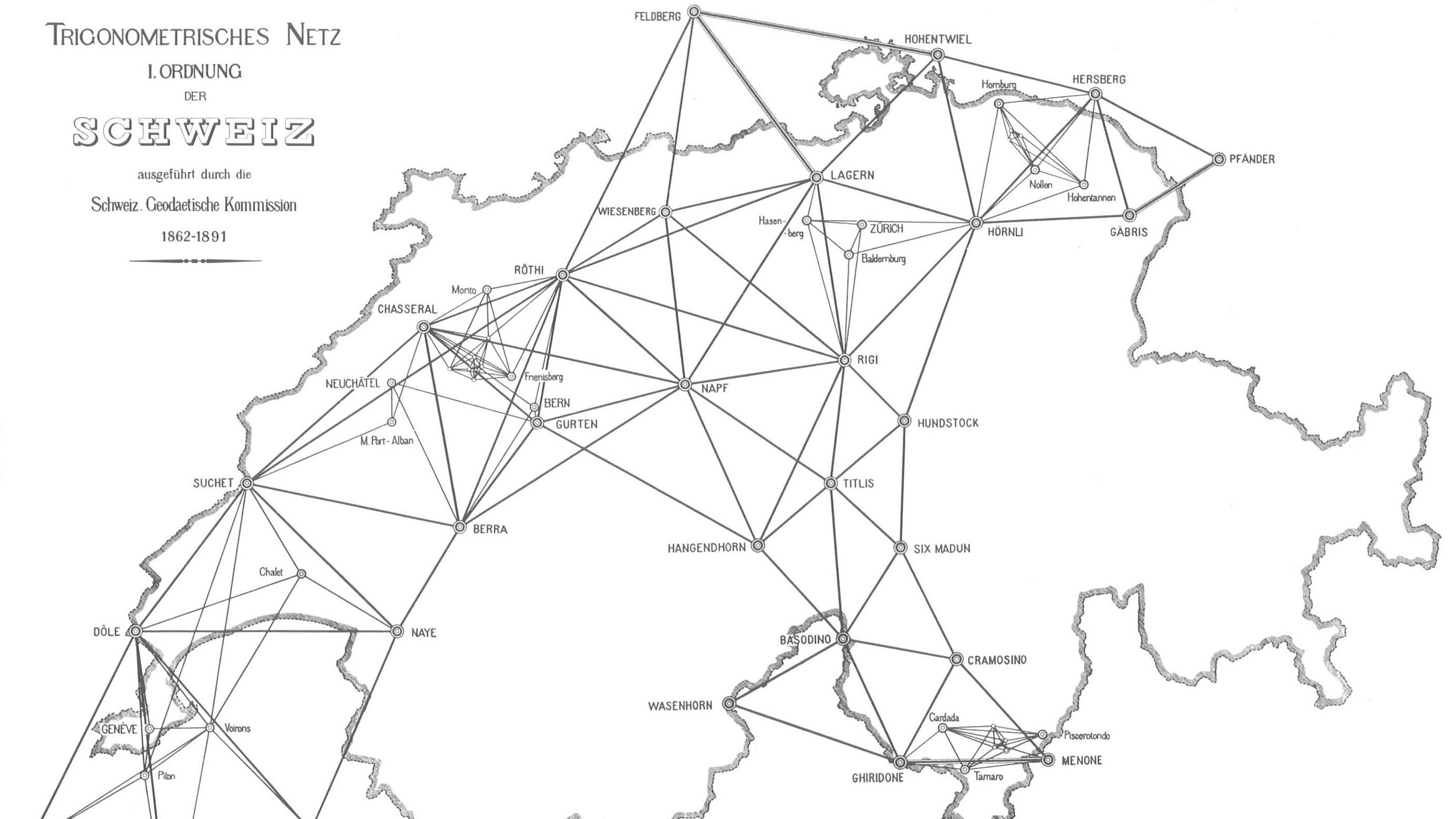
However, the "first-order triangulation", whose results had already been published in 1840, could no longer be regarded as an adequate basis for central European arc measurement. Consequently, between 1862 and 1879, the angles for a new grid were measured. Its "benchmark" would then be defined by three baselines, of which two would be north of the Alps (at Aarberg in 1880 and at Weinfelden in 1881) and one to the south, at Bellinzona, which, today, is designated as the "Giubiasco baseline".
The same measuring equipment, known as the "Ibañez baseline apparatus", was used for all three baselines. It bears the name of the general who demonstrated, in 1858, that it was sufficient to measure a segment of around 3 km with a high level of accuracy and then transfer it trigonometrically to the whole baseline. The Giubiasco baseline came as the last in the series of three SGC baselines. After completion of the measurement at Weinfelden the equipment was carefully cleaned, packed up and, accompanied by the "brigade d'opérations" (operating team), transported by rail to Chur where it was loaded onto waggons and taken over the San Bernardino Pass to Bellinzona. It arrived there in good condition on the evening of 12 July 1881.
The baseline end points were secured underground by two identical constructions. The measuring points were each established as a cross on a metal cylinder. The work was directed by the two SGC members Emile Plantamour (1815–1882) and Colonel Jules Dumur (1840–1920). The baseline was measured on two occasions, one immediately after the other, between 15 and 23 July. The team consisted of 78 men. The guard detail alone comprised 40 men. In addition, the Canton of Ticino provided a group of 10 gendarmes to protect the traffic police.
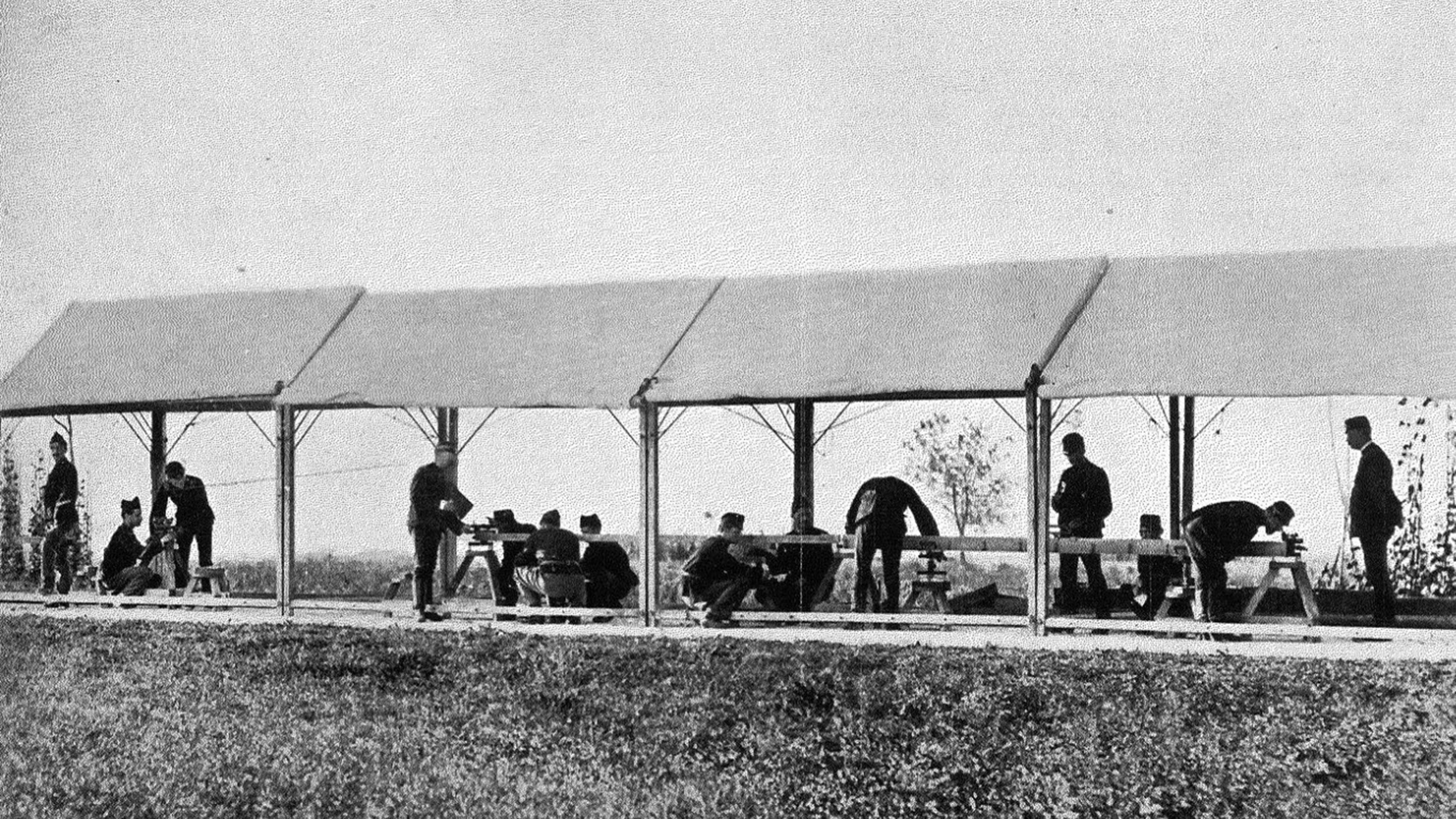
The road, which was around 8.5 metres wide, could not be closed to traffic during the measurement because there was a lack of passable roads between the Ticino and the steep valley sides. Although the road was in good condition, it was covered with a thick layer of dust which was whirled up by the wind and passing coaches, making the work rather tedious.
At temperatures of over 31°C in the shade, the heat was oppressive and impeded progress of the work. At times, operators were indisposed and had to be replaced by colleagues, but at least work could forge ahead in fine weather. As had already happened in Weinfelden, the eight sections of the baseline were measured once early in the morning and once in the evening.
Carl Koppe describes the actual measuring procedure as follows: "A 4-metre-long iron measuring rod is marked off into half-metre sections. Two microscopes which are isolated from the rod supports are focused on these divisions, usually on the zero and 4-metre lines. Once this has been set up, the rod is moved forward by its own length in such a way that its back end is located under the forward microscope and the microscope that is now free is moved forwards and set up over the front end of the rod. Then the rod is moved forward again and the procedure repeated, and so on.
On each occasion, one measures the distance between the two microscopes similar to one rod length and, by moving the staff, its zero line is always under the cross-hairs of the microscope when the microscope is moved to the end mark of the staff."
According to Lang, the outward and return measurements gave the following readings:
Measurement 1 3200.4093 m
Measurement 2 3200.4076 m
Average 3200.4084 m
From the differences in the repeated measurements of the sections, a measurement accuracy (1σ) of ± 1.1 mm was derived.
Immediately after the end of the measurement, the apparatus was carefully cleaned and transported by waggons over the San Bernardino Pass to Chur from where it was transported by rail via Basel-Porrentruy-Belfort to Paris. On 6 August, it could be handed over to the Brunner brothers, who were commissioned by General Ibañez to undertake the return and storage of the equipment until it was next required.
Federal Office of Topography swisstopo
Seftigenstrasse 264
3084 Wabern