
swissALTIRegio
swissALTIRegio is a small scale digital height model that describes the surface without vegetation nor construction of Switzerland and regions of its neighbouring countries.
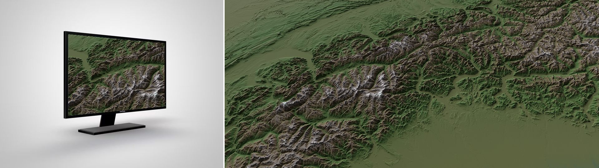
The small-scale height model of Switzerland
Applications
swissALTIRegio can be used in a large variety of applications:
- as a basic height data-set in a geographic information system
- as a basis for 3D visualisations over large areas
- as a basis for simulations and calculations over large areas
- in applications that go beyond the Swiss border
- As a basis for publications - e.g. as a background layer in maps, plans and web applications
Terms of use
swissALTIRegio may be used, distributed and made accessible. Furthermore,it may be enriched and processed and also used commercially. A reference to the source is mandatory. In the case of digital or analogue representations and publications, as well as in the case of dissemination, the following source references must be attached in any case:
For the 2025 and all subsequent versions:
Bundesamt für Landestopografie swisstopo; Tarquini S., I. Isola, M. Favalli, A. Battistini, G. Dotta (2023). TINITALY, a digital elevation model of Italy with a 10 meters cell size (Version 1.1). Istituto Nazionale di Geofisica e Vulcanologia (INGV). https://doi.org/10.13127/tinitaly/1.1; DGM Österreich, geoland.at; DGM1, Bayerische Vermessungsverwaltung – www.geodaten.bayern.de; DGM1, Baden-Württemberg: LGL, www.lgl-bw.de, dl-de/by-2-0”; RGEAlti, Institut National de l’information géographique et forestière, données originales tétéchargées sur https://geoservices.ign.fr/rgealti#telechargement5m, mise à jour du juillet 2023
For the first version 2024:
Bundesamt für Landestopografie swisstopo; Tarquini S., I. Isola, M. Favalli, A. Battistini, G. Dotta (2023). TINITALY, a digital elevation model of Italy with a 10 meters cell size (Version 1.1). Istituto Nazionale di Geofisica e Vulcanologia (INGV). https://doi.org/10.13127/tinitaly/1.1; DGM Österreich, geoland.at; DGM1, Bayerische Vermessungsverwaltung – www.geodaten.bayern.de; EU-DEM, provided under COPERNICUS by the European Union and ESA, all rights reserved; RGEAlti, Institut National de l’information géographique et forestière, données originales tétéchargées sur https://geoservices.ign.fr/rgealti#telechargement5m, mise à jour du juillet 2023
Additional information
swissALTIRegio - Download
Index
Federal Office of Topography swisstopo
Seftigenstrasse 264
3084 Wabern