
swissALTIRegio - the elevation model for wide-area applications
The latest addition to swisstopo's range of elevation models has recently become available. swissALTIRegio is a small-scale terrain model. It replaces the outdated DHM25 and covers Switzerland and neighbouring countries with the latest elevation data.
Resolution and coverage
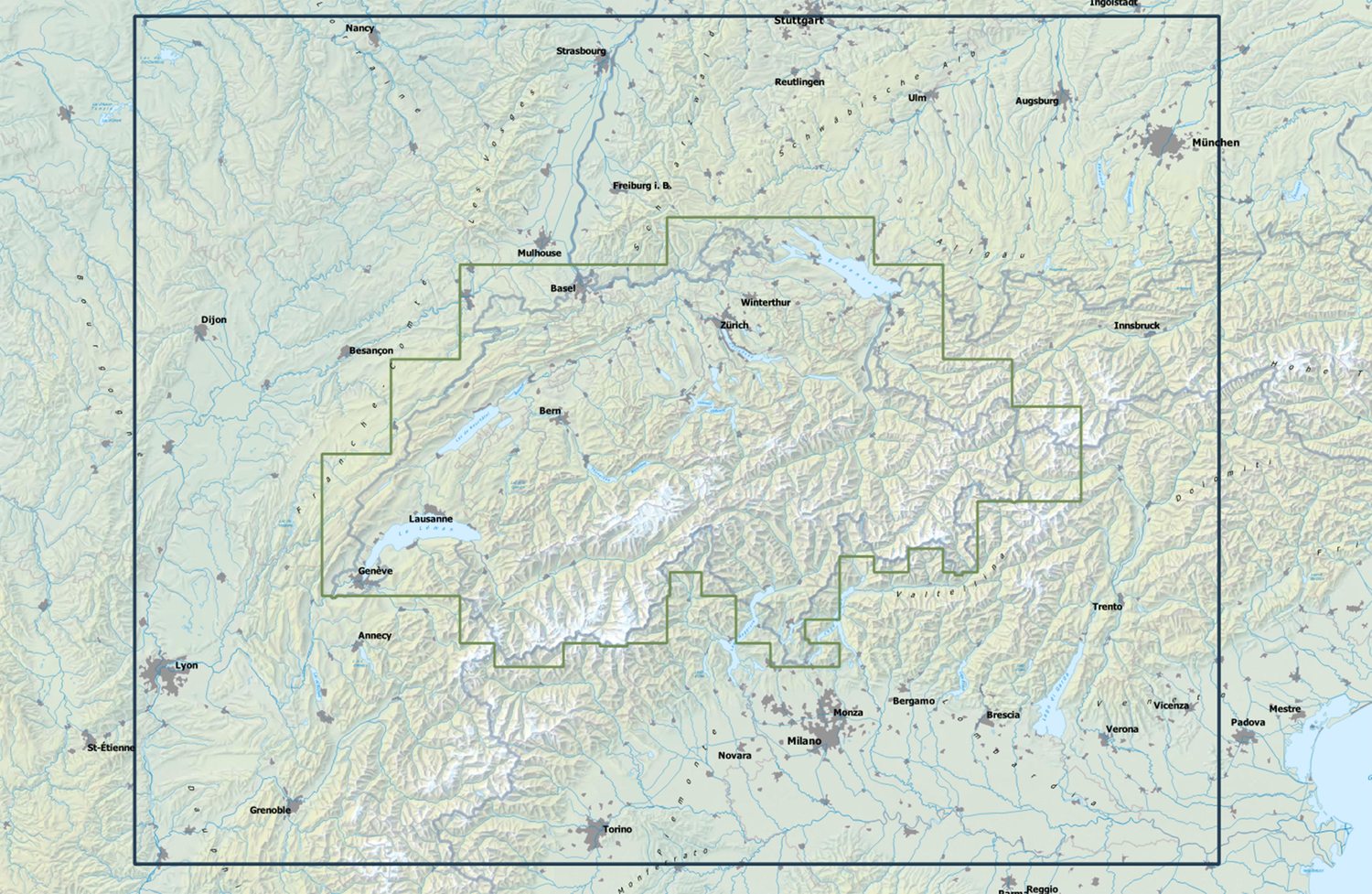
With an elevation grid mesh size of 10 metres swissALTIRegio is suitable for wide-area applications - even beyond Switzerland's national borders! In terms of resolution, this puts it between the DHM25 (25 metres) and the most accurate elevation models from swisstopo (resolution 50 cm). The 10 m resolution has the great advantage that much larger areas can be covered and analysed with the same or lower storage requirements. The coverage of swissALTIRegio extends to at least 100 km beyond the national border - significantly further than is the case with swissALTI3D or DHM25.
Access and formats
swissALTIRegio can be downloaded and used free of charge. We offer it in two formats:
- Cloud optimized Geotiff (COG) for usage in GIS systems
- ASCII XYZ, for usage in CAD software or if point data is required as input.
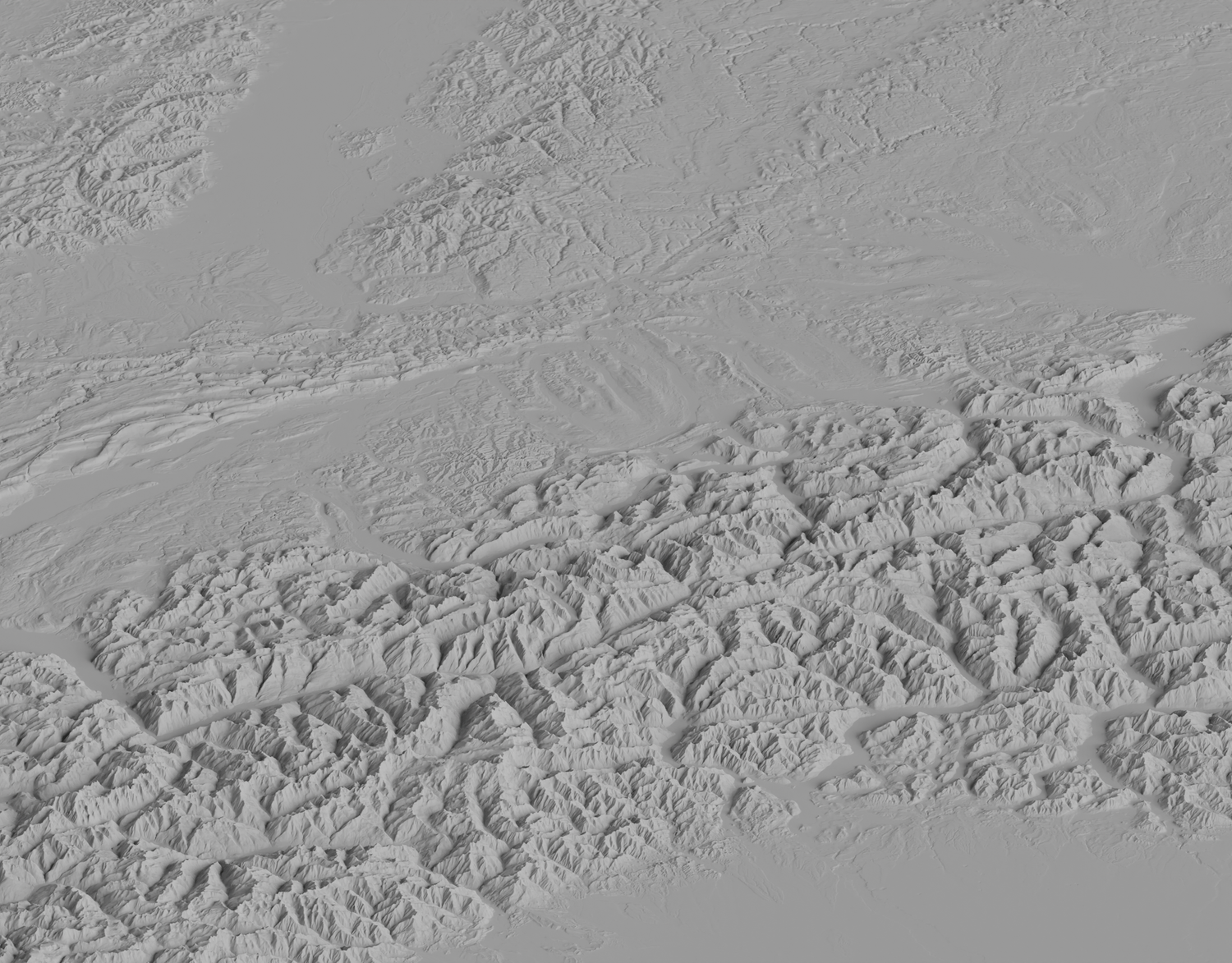
The two shaded reliefs of swissALTIRegio on map.geo.admin.ch enable a visual inspection of the terrain and thus provide a first impression before the data is downloaded.
Application examples
What can such a height model be used for?
Imagine, for example, that you are planning a mountain bike tour from Lucerne to Innsbruck: What is the total difference in altitude you have to surmount? Where are the steepest climbs? Or would you like to know whether you can see Mont Blanc from Dijon on a clear day? Perhaps you need a 3D print of all the four-thousand metre peaks in the Alps? These are possible questions that can be answered quickly and efficiently thanks to swissALTIRegio 's larger scale and comparatively low storage requirements. A specific inhouse use case: Since the beginning of this year, swisstopo has been calculating the slope inclinations and slope inclination classes for the central Alpine arc based on swissALTIRegio.
Composition
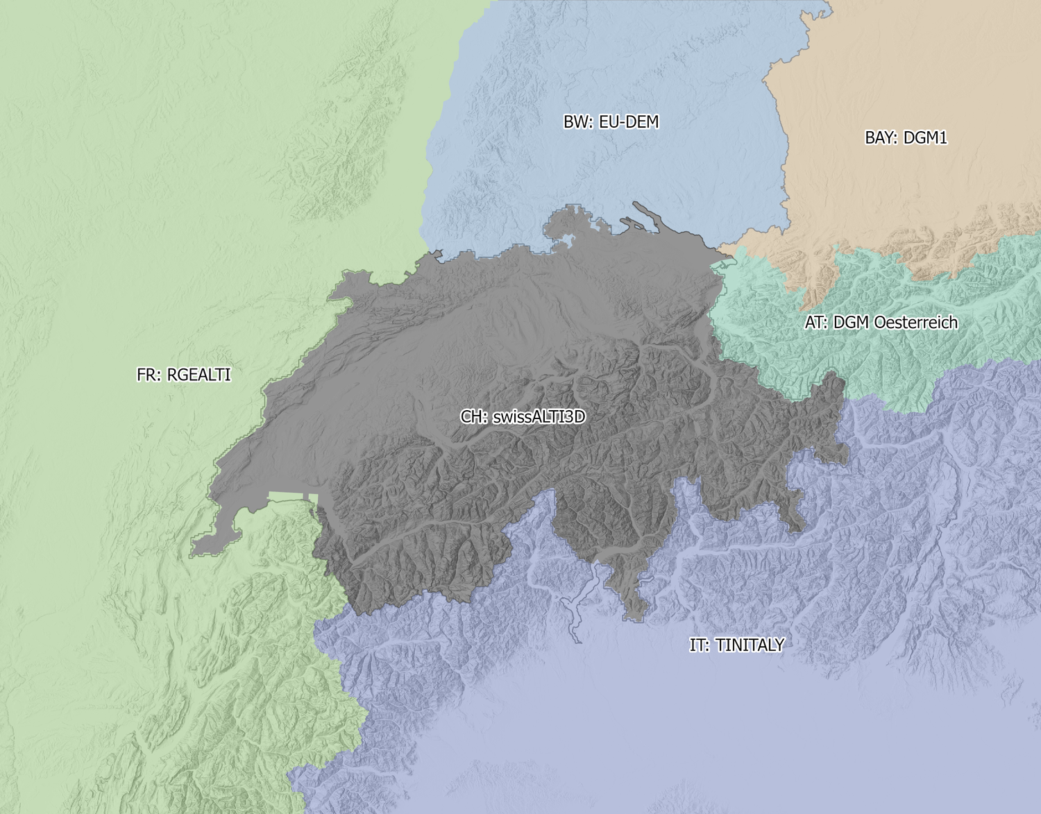
The centrepiece of swissALTIRegio is the most recent version of swissALTI3D, which covers Switzerland and the Principality of Liechtenstein. France, Italy and Austria are covered by the respective national terrain models. Only the German part currently consists of two data sets: The Free State of Bavaria provides its high-quality DTM1 free of charge. Baden-Württemberg has not yet completed the transition towards open geodata, so that its terrain model cannot yet be used and passed on licence-free. Therefore, elevation data from the Copernicus EU-DEM dataset was used for Baden-Württemberg. The transitions between the respective data and state boundaries were smoothed by linear interpolation. This avoids large jumps in altitude.
Update and further development
swissALTIRegio is updated annually. Within Switzerland, this is done by integrating the updated version of swissALTI3D. Outside Switzerland, the areas are also updated where possible. In the short to medium term, the data on French territory could be updated. IGN France is carrying out a nationwide LiDAR survey with the LiDAR HD programme. This data will be systematically integrated. If Baden-Württemberg offers its elevation data as open geodata, we will also incorporate it. By doing so, the EU-DEM would be replaced.
Federal Office of Topography swisstopo
Seftigenstrasse 264
3084 Wabern