
swissSURFACE3D
swissSURFACE3D models all natural and man-made objects of the surface of Switzerland in the form of a classified point cloud. These high-accuracy and high spatial density data are collected by airborne LiDAR.
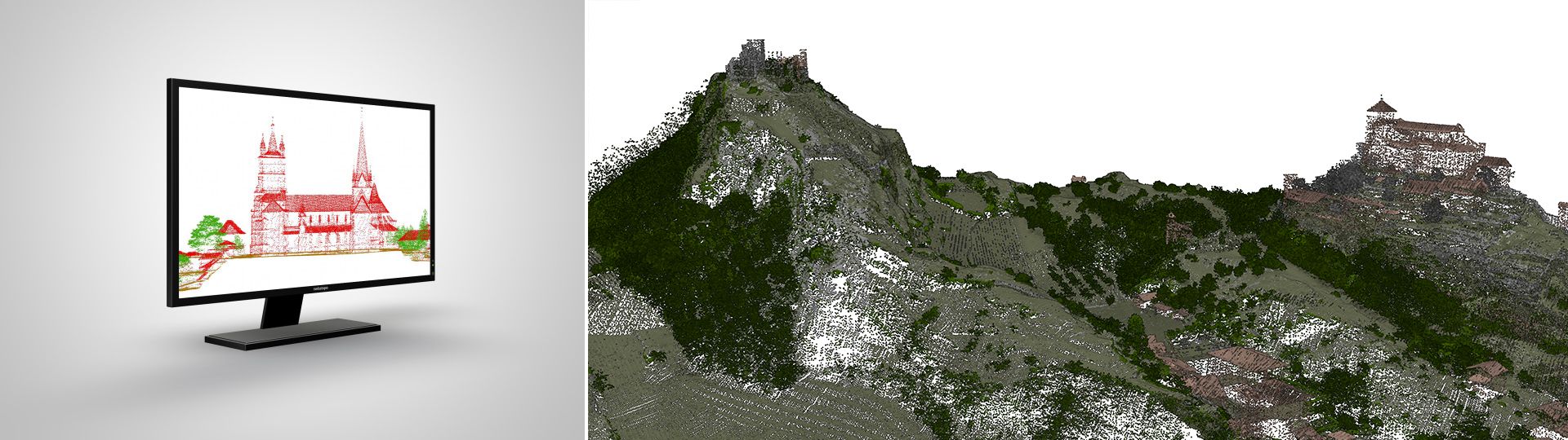
The classified point cloud of Switzerland
Based on airborne LiDAR, swissSURFACE3D contains several millions of points per km2. These points are irregularly spaced between them and model the landscape in 3D with a high spatial density. Each measurement has very accurate X, Y, Z coordinates and is classified according to a predefined classification that defines the type of measured objects.
Applications
- Automatic 3D modelling of buildings and other landscape objects
- Volumes calculation
- Study of the forest: map of cuts, calculation of biomass, planning of cuts, digital canopy models
- 3D modelling of ground-based elements under vegetation cover such as forest roads or watercourses
- Creation of digital terrain models
- Creation of digital surface models
swissSURFACE3D is available on the entire Switzerland and Liechtenstein since 2024 (see planning).
Additional information
swissSURFACE3D - Download
By default, the latest data is displayed in the download window. In the case of swissSURFACE3D, the latest data is available in a new data format: Cloud optimised point cloud (.copc). If this format and the time status ‘current’ are selected in the download window, the older data, which is available in zipped .las format, will not be displayed. If you select the LIDAR (zip) format and uncheck ‘current’, the older data available for the whole of Switzerland will be displayed.
Index
Federal Office of Topography swisstopo
Seftigenstrasse 264
3084 Wabern