
The Topographic Landscape Model
The topographic landscape model is the central instrument for the production of national geodata. It contains objects that shape the landscape, e.g. buildings, roads and bodies of water. These data are recorded, processed, managed and kept up to date by swisstopo, with a high degree of accuracy and in three-dimensional form, and are subsequently placed at the disposal of the various users. The topographic landscape model forms the basis not only for the production of the national maps, but also for a broad range of spatially-related applications.
What is the topographic landscape model?
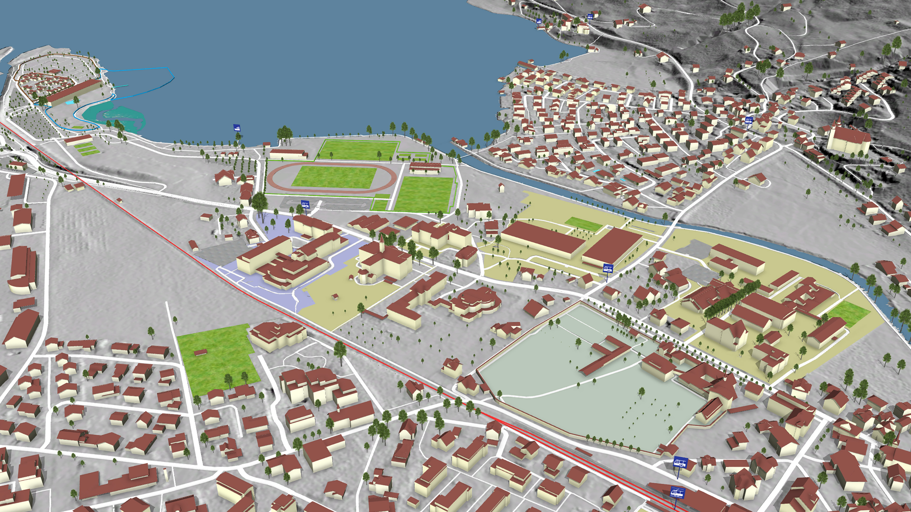
The topographic landscape model is a huge database for three-dimensional geodata. The natural and man-made objects it contains that shape the landscape can be used for depicting our entire landscape in a large-scale format. The currently available data encompass Switzerland and the Principality of Liechtenstein.
Unlike previous landscape models developed by swisstopo, the topographic landscape model is produced directly on the basis of aerial images instead of the national map. Because swisstopo’s specialists now no longer use generalised basic data, they can depict the various objects and their respective locations more accurately and in greater detail. Well-defined objects such as buildings and roads are depicted with a high degree of accuracy (in the decimetre range), while less clearly definable objects such as forest perimeters can be depicted with an accuracy of between one and three metres.
This unique and complete 3D dataset encompasses the entire country with a high degree of quality and in homogeneous form. By periodically updating the database and conducting frequent updating campaigns we are able to record changes timely and thus keep the topographic landscape model up to date.
A database with more than 25 million objects
The topographic landscape model contains digitally recorded objects that shape the landscape of Switzerland and the Principality of Liechtenstein. The database contains more than 25 million objects in three-dimensional form depicting their location and shape. For each object, supplementary details are included, e.g. object type, usage and relation to other objects. The objects are recorded in the form of point, linear or surface based 3D vectors and subsequently geo-referenced in the topographic landscape model, i.e. stored with the relevant spatial reference.
The objects contained in the topographic landscape model are divided into the following categories:
What is the purpose of the topographic landscape model?
The topographic landscape model may be regarded as a comprehensive 3D database from which a variety of products can be developed. It functions as the basic dataset for the national maps, as well as for a broad variety of other spatially-related applications. For example, it forms the basis for a wide range of spatial models, calculations, analyses, depictions, visualisations and simulations, as well as for documentation and planning purposes.
Examples:
- Basis for national map production
- Use as a spatial and urban planning tool
- Basis for calculations for the application «sonnendach.ch»
- Basis for landscape monitoring
- Basis for a broad variety of visualisations and simulations
Production of the topographic landscape model
The production and updating of the topographic landscape model are based on current aerial images. The various objects are digitally recorded and stored with the aid of photogrammetric 3D evaluation. Thanks to the creation of a special working environment for this method, swisstopo’s specialists are able to directly measure and register the objects in 3D. In addition to entering its own data, swisstopo also procures supplementary datasets or information from external sources on a case-by-case basis. After they have been geometrically adjusted to meet the quality requirements of the topographic landscape model, the data are integrated into the topographic landscape model. Topographers clarify any remaining questions arising from the evaluation of the aerial images by visiting the location concerned.
A video produced by swisstopo describes the various steps in the geodata production process, including the development of the topographic landscape model. Click on the link below to find out more about the production of this model.
History
swisstopo has been working on the buildup of the topographic landscape model since spring 2008. Before production could be initiated, however, the various production processes as well as the necessary infrastructure had to be adapted. To form the basis for the new landscape model, the first step was to transfer the existing data. Employees of swisstopo then updated the data between 2008 and 2010 in that they improved geometries and incorporated additional attributes. Then in autumn 2010, swisstopo was able to derive the initial products from the topographic landscape model database and deliver them to clients. The systematic buildup of the model has been taking place since 2011. Specialists are now entering or processing geodata on an area by area basis in accordance with specified guidelines in order to ensure that the data meet the defined quality requirements.
Perspectives
Technological developments and higher levels of resolution of source data (aerial images and LIDAR) are opening up new opportunities for future products and their applications. We place high demands on the quality of our products and their updating, and are therefore constantly endeavouring to ensure that the topographic landscape model can fulfil its function as Switzerland’s basic dataset, both today and in the future, for a broad variety of applications. swisstopo is constantly expanding the model and working on the derivation of new products from it. In this way, we will be able to add new application options and more effectively meet the needs of users.
Federal Office of Topography swisstopo
Seftigenstrasse 264
3084 Wabern