
Photogrammetry and National Maps
The Swiss National Maps were published from 1938 onwards, a new map collection. This modernised and standardised the representation of Switzerland in map images. But the processes on which the national maps were based were also changing significantly: photogrammetric surveying methods and negative scribing on glass revolutionised work processes between 1926 and 1958.
Photogrammetry
The 1920s had a lasting influence on swisstopo. Photographic processes for topographical surveying became the norm at the time.
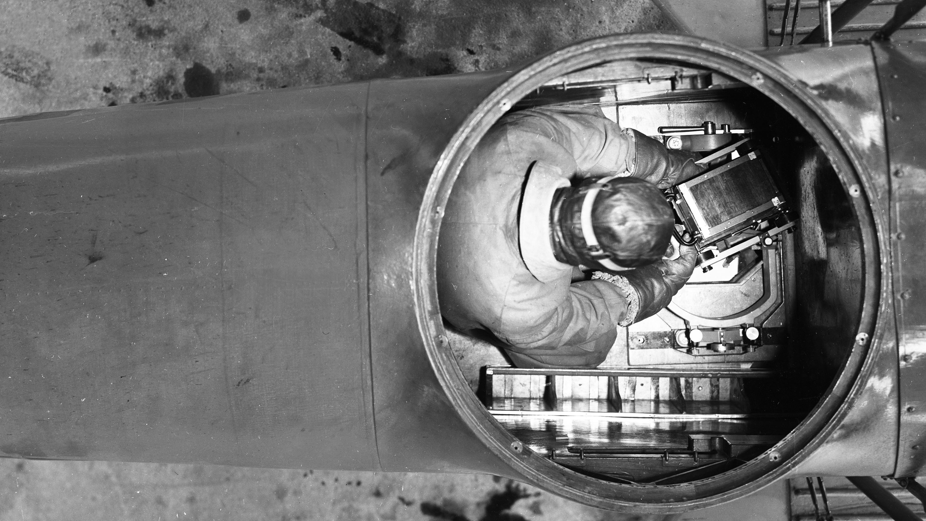
In 1926, the Swiss Office of Topography introduced terrestrial images (from the ground), as practised for many years, as an official working method. In the same year, the Federal Office hired its first pilots. They took the first aerial photographs for photogrammetric use – “aerophotogrammetric images” are the most important source for creating geodata still today.
National Maps
The collection of terrestrial and aerial images was a treasure trove, which served the Siegfried Map. It had to be constantly updated. In 1935, Parliament pointed the way to a new era in Swiss cartography. It adopted the Federal Act on the Creation of new National Maps. The National Maps were to replace the Siegfried Maps and appear in a complete set of scales from 1:25,000 to 1:1,000,000.
The Federal Office of Topography’s work on this new map series made a key contribution to Switzerland’s ability to defend itself in dangerous times. Between 1938 and 1963, the first editions of the map sheets were published, first to a scale of 1:50,000, the Army’s priority.
Negative Scribing on Glass
A technical change was also closely associated with the map series, particularly in the fields of cartography and reproduction.
In 1953, the Swiss Federal Office of Topography switched completely from copperplate engraving to negative scribing on glass. This process guaranteed faster work processes and a clear reduction in the price of producing maps.
1927: Debate on new national maps
Intensive public debate on new national maps. Professor Eduard Imhof calls for production of maps in the entire range of scales (1:25,000 to 1:1 million).
1928: Introduction of aerial photogrammetry
Definitive introduction of aerial photogrammetry in the central plain and Jura.
1930: Use of aerial images
Productive use of aerial images for map production.
1931: Introduction of photo-engraving process
Definitive introduction of etching process (photo-engraving) on copper (e.g. for reproduction of map lettering).
1934: Memorandum calling for the production of new national maps
Memorandum signed by numerous scientific bodies and the Swiss Alpine Club calling for the production of new national maps and bearing the stamp of cartography professor Eduard Imhof.
1935: Federal legislation on production of new national maps
Parliament adopts federal legislation dated 21 June 1935 governing the production of new national maps. Complete range of scales to be produced, but due to the political situation only the 1:50,000 map to be processed initially.
1938: Publication of first sheet of new 1:50,000 national map
Publication of first sheet of the 1:50,000 national map (no. 263, Wildstrubel).
1952: New negative scribing process
Initiation of development of new negative scribing (engraving on glass) process. Method subsequently licensed worldwide.
1952: Publication of first sheet of 1:25,000 national map
Publication of first sheet of 1:25,000 national map (no. 1125, Chasseral).
1952: Printing of "Siegfried Map" discontinued
Discontinuation of printing of Siegfried Map.
1953: Copperplate engraving replaced by negative scribing
Negative scribing replaces copperplate engraving as method for original production.
1954: Col du Pillon - first sheet of national map
Publication of first sheet of 1:100,000 national map (no. 41, Col du Pillon).
Federal Office of Topography swisstopo
Seftigenstrasse 264
3084 Wabern