
Integrating the map viewer into a website
geo.admin.ch offers a simple and free way of integrating the map.geo.admin.ch map viewer into any web page using an iFrame.
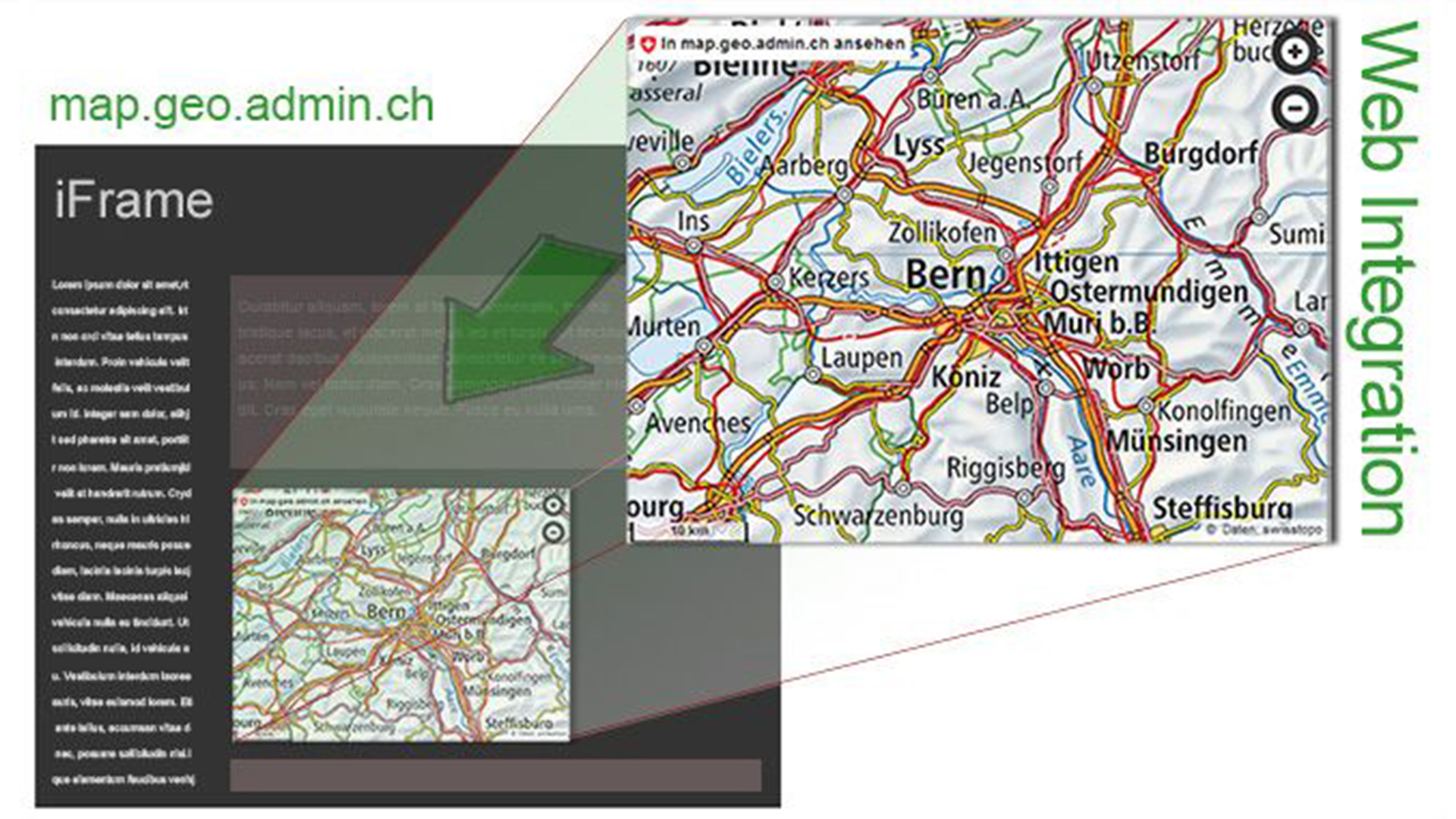
A description of a place, a map for an event or an illustration to support a presentation can now be easily viewed. What's more, the map content can be expanded and, if required, the full application can be integrated using iFrame.
Flyer (in German)
Map integration options
Some examples of integration:
Terms and conditions of use
- The map.geo.admin.ch map viewer can be integrated into any web page as a small dynamic map (iFrame). The layout (CSS) and functions must not be modified.
- When displaying user or third-party data using the available interfaces (e.g. KML/WMS), the conditions of use of the respective data owner must be observed.
- Liability claims against federal authorities - to the extent permitted by law - are excluded. This functionality is available at https://www.admin.ch/gov/en/start/terms-and-conditions.html.
Further information
Federal Office of Topography swisstopo
Coordination, Geo-Information and Services (COGIS)
Seftigenstrasse 264
3084 Wabern
Seftigenstrasse 264
3084 Wabern