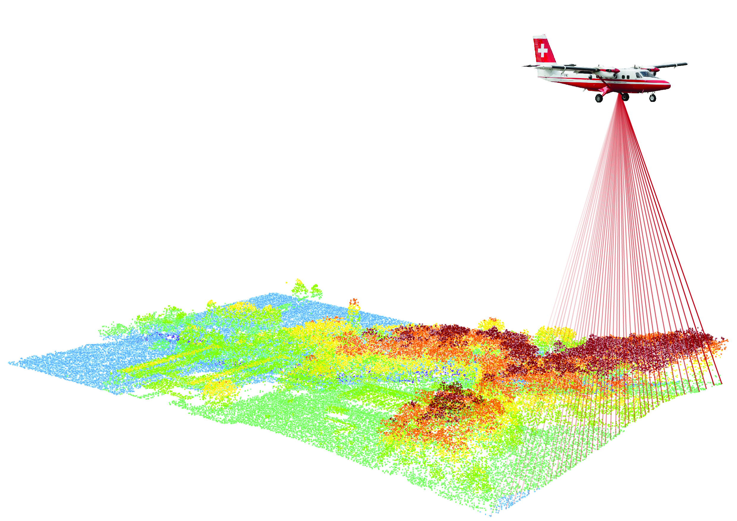
LiDAR data acquisition
In 2024 swisstopo has launched another LiDAR survey of Switzerland and the Principality of Liechtenstein. Airborne laser scanning is one of the most effective methods for measuring territory in 3D. It provides valuable, high-quality data in terms of both detail and accuracy. As the basis for digital terrain models, these data also contribute to other products and are used by many applications.
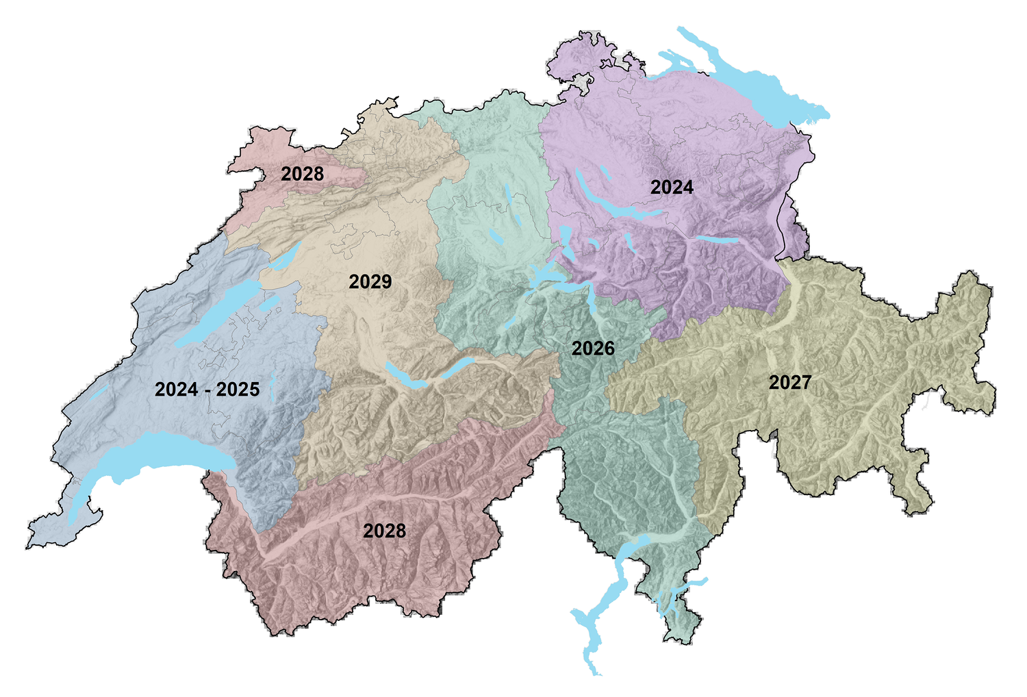
Acquisition campaign to be repeated
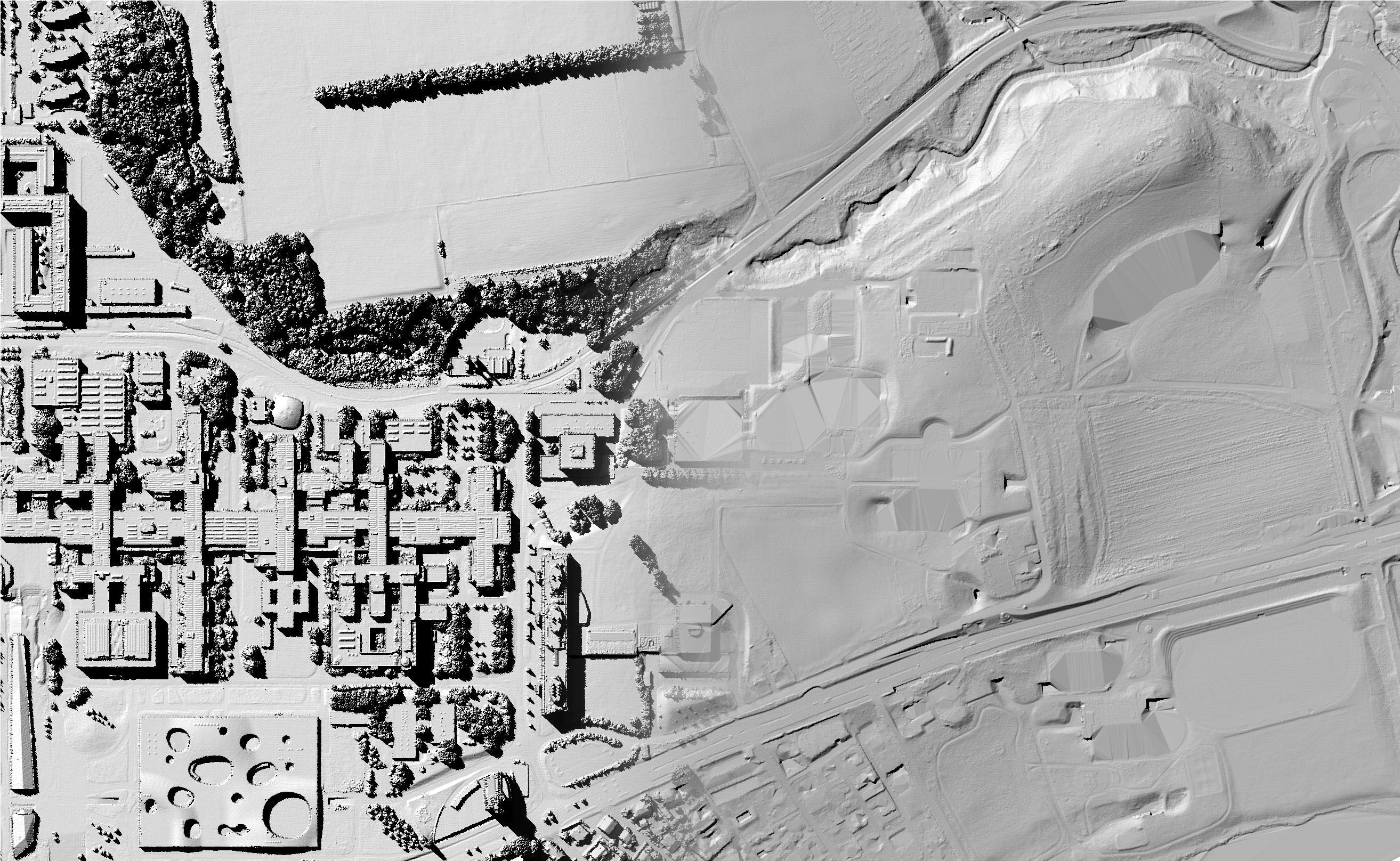
swisstopo has been using LiDAR technology since the 2000s with the production of the cadastral survey digital terrain model(DTM-AV) – the predecessor to swissALTI3D. Since the laser penetrates into the forest, it is possible to produce a homogeneous and high-quality digital terrain model for the entire territory. In 2024, swisstopo launched a new acquisition campaign to obtain LiDAR data for the whole of Switzerland and Liechtenstein, spread over a six-year period (see below). The annual figures correspond to the year of the aerial survey. On average, the data are available about 12 months after acquisition.This campaign will be concluded with the publication of the data by the end of 2030.
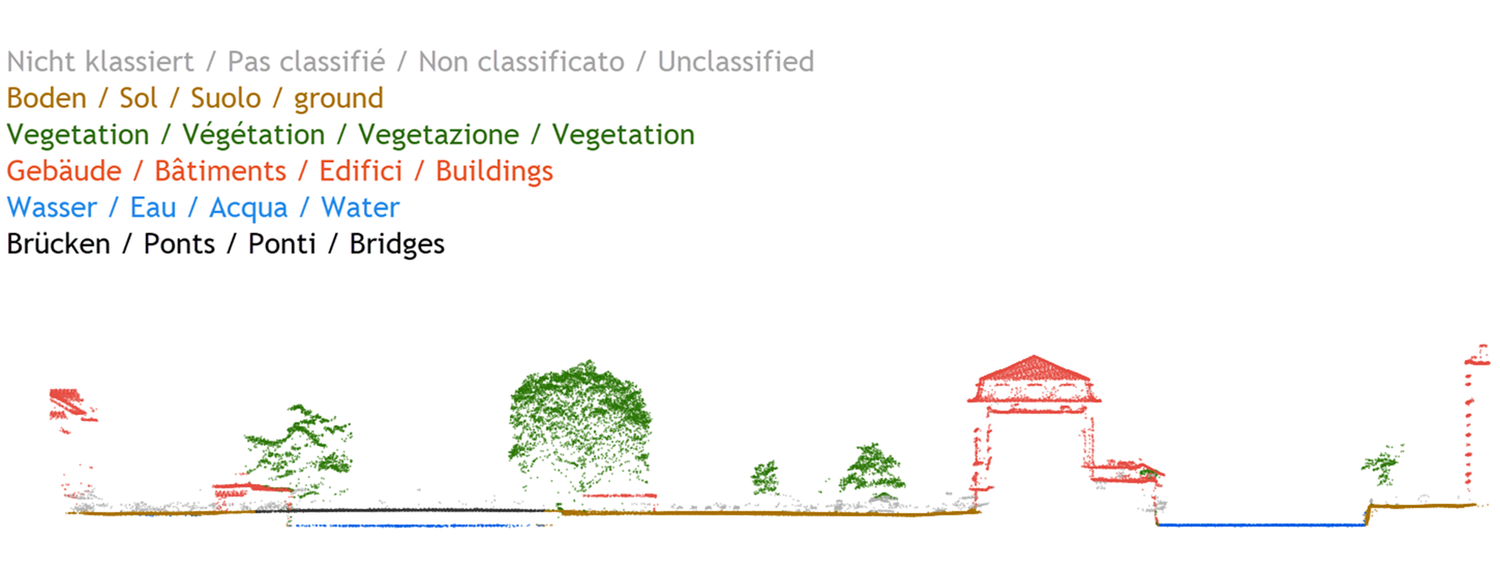
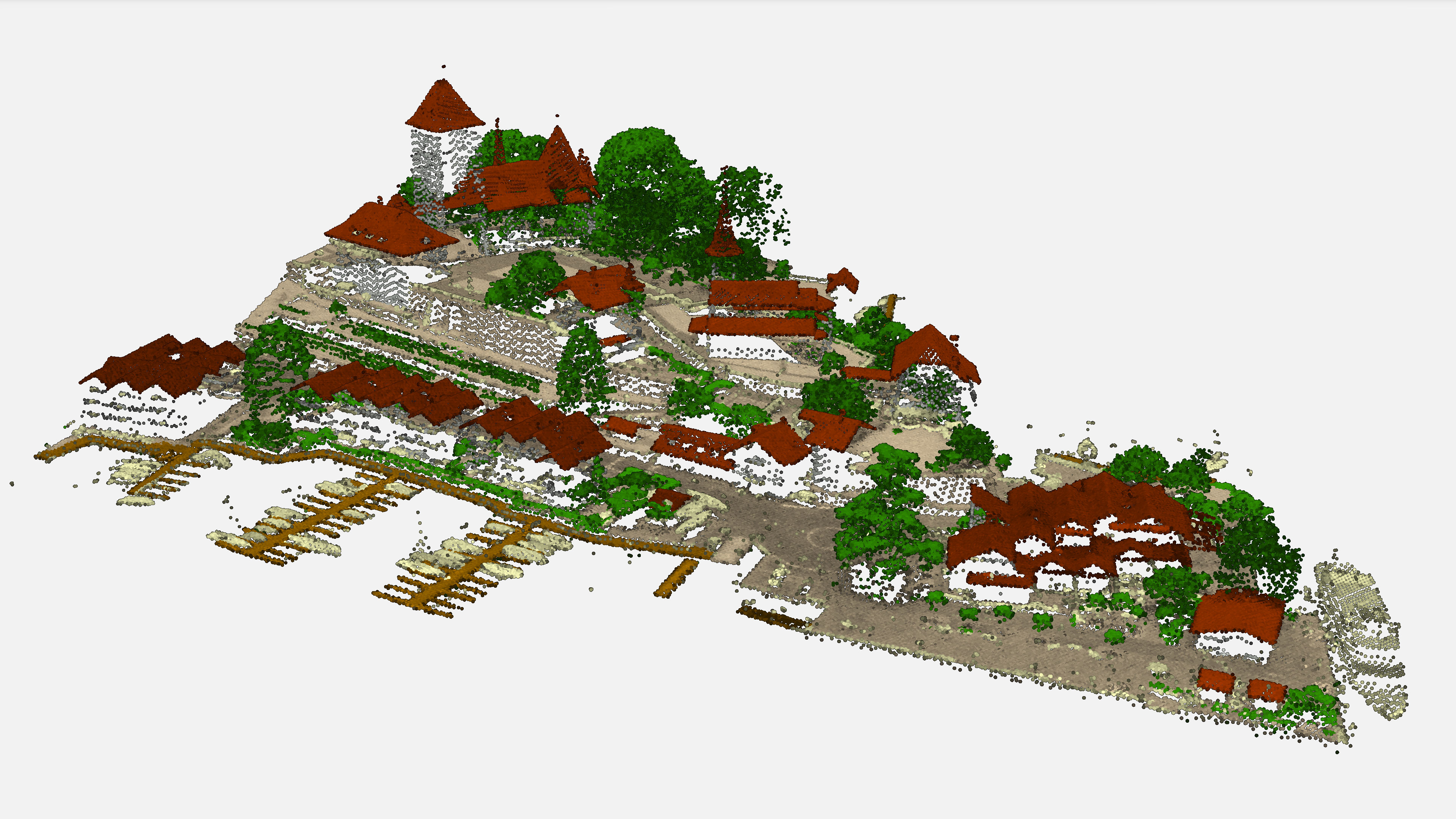
LiDAR data form a classified point cloud. It is used in-house to update terrain and landscape models and is also available in our online shop with the product swissSURFACE3D.
The current availability of LiDAR data is given by the layer “Division swissSURFACE3D” in the federal geoportal map.geo.admin.ch.
Characteristics of LiDAR data
- No foliage or snow during acquisition to facilitate ground information and production of a digital terrain model
- Density of points: minimum 10 pulses per m2
- Classification: unclassified, ground, vegetation, building roofs, water, high-voltage and traffic lines, structural pylons/towers, bridge deck, docks and viaducts, building facades, bridge piers and viaduct stay cables
- Synthetic points on water bodies and under bridges (class water and ground, flagged as synthetic)
- Normalised intensity values
- Planimetric accuracy: 20 cm (1 sigma)
- Altimetric accuracy: 10 cm (1 sigma)
Cantonal LiDAR data
In addition to its own planned acquisitions, swisstopo sometimes purchases cantonal LiDAR data if they meet its criteria in terms of quality and acquisition period. These data are then also incorporated into the products distributed by swisstopo.