
Long live the copper plates!
Swiss cartography has an excellent reputation around the world. It all began with 25 unique copper plates that were engraved by hand in the 19th century. They were used to record data for the first national map, and still impress as a cartographic medium today.
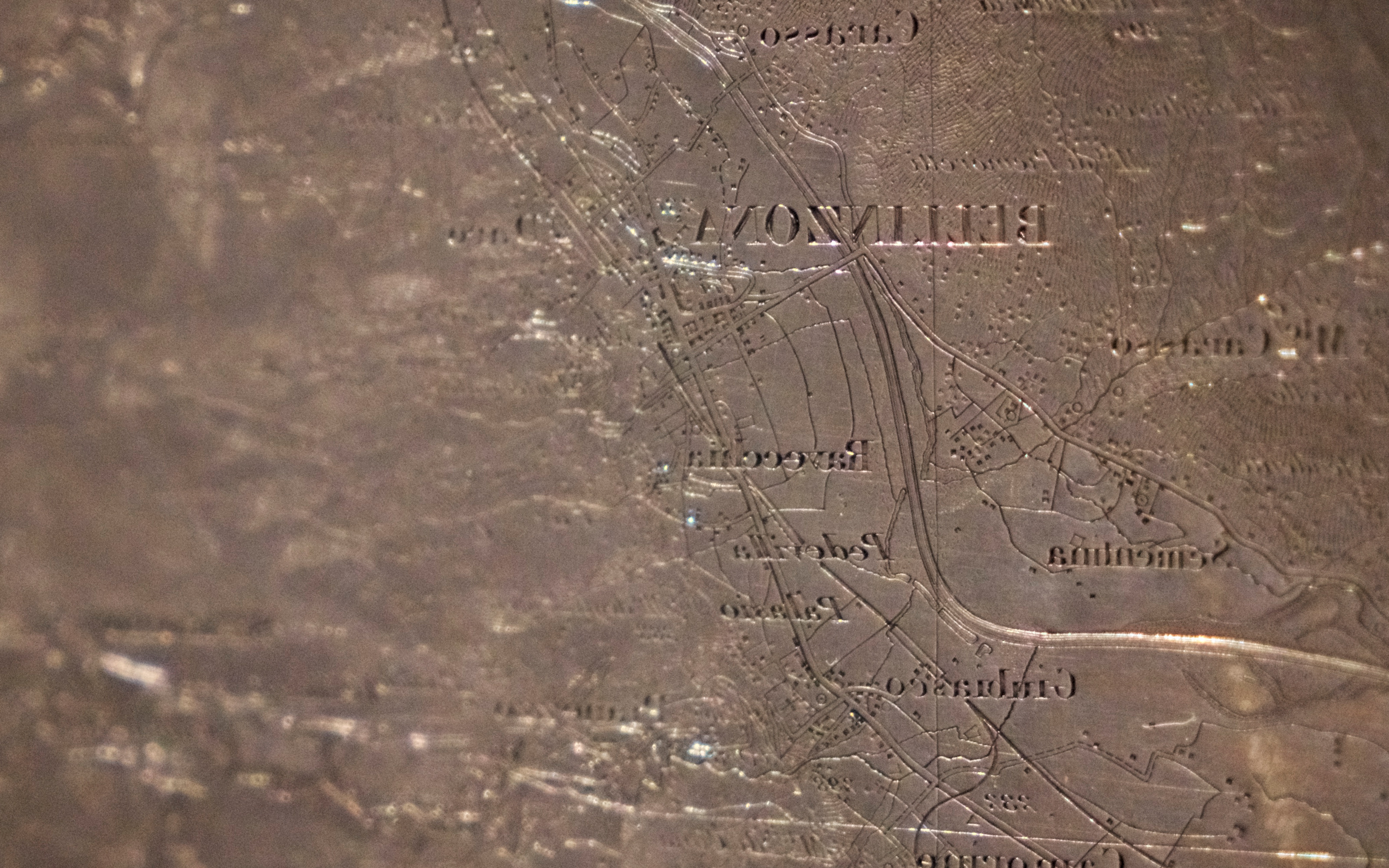
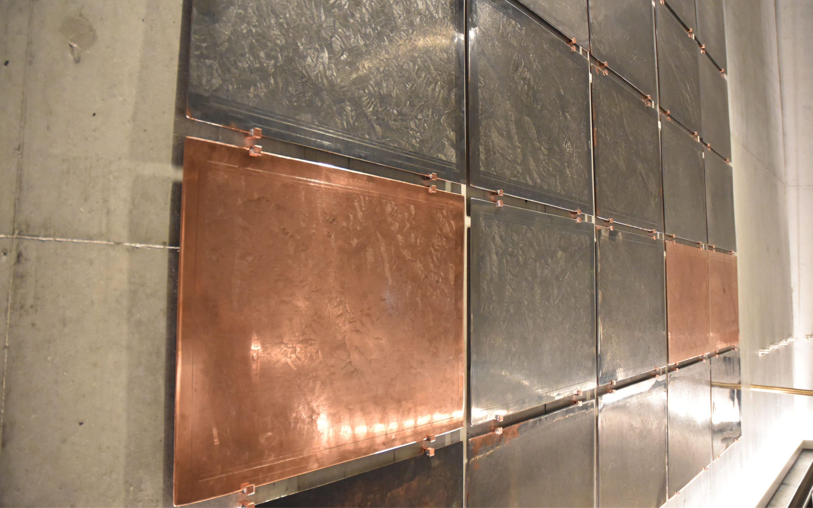
What turns 25 copper plates into a topographical masterpiece? The Dufour Map. The first national map of Switzerland started as the brainchild of General Guillaume Henri Dufour and was first printed in 1865. It was the first to depict the whole country as a single geographic entity. The foundation of this complete work, which brought international fame to Swiss topography, is a series of 25 one-of-a-kind copper plates that were engraved by hand between 1845 and 1865. To complete the engraving, Guillaume Henri Dufour brought the best copperworkers – including experts from abroad – to Geneva. They were tasked with transferring his meticulously rendered relief onto the plates with absolutely no margin for error.
A national treasure
The Dufour Map, which uses a scale of 1:100,000, is now on display at the Federal Palace in Bern and in the Swiss National Museum in Zurich, which also currently houses the 25 original printing plates. swisstopo lent these very special data recording devices to the National Museum for display as part of the “Ideen Schweiz” (Ideas Switzerland) exhibition. These artefacts are part of Switzerland’s cultural heritage, and can be described as true national treasures in that they are a form of collective national memory of the Swiss landscape. When studied in detail, the plates truly take your breath away: the terrain, valleys, rivers and lakes are depicted with stunning accuracy, and were transferred onto the copper plates to within a millimetre of the exact corresponding locations on the original master copy.
With burin and magnifying glass
Copper printing was ubiquitous at the time of the map’s production; practically no other techniques were used, particularly given the impressive accuracy and longevity that copperplate engraving provided. Engravers used specialist tools such as burins (also known as gravers), etching needles, hallmarking tools and scrapers. They also had drills, whetstones and cleaning brushes in their workshops, and always worked while holding a magnifying glass that enlarged their engravings by a factor of four. It must have been an extremely taxing process, as the engravers were limited to working no more than six hours – in a time when the average working day in factories was around twice as long as that.
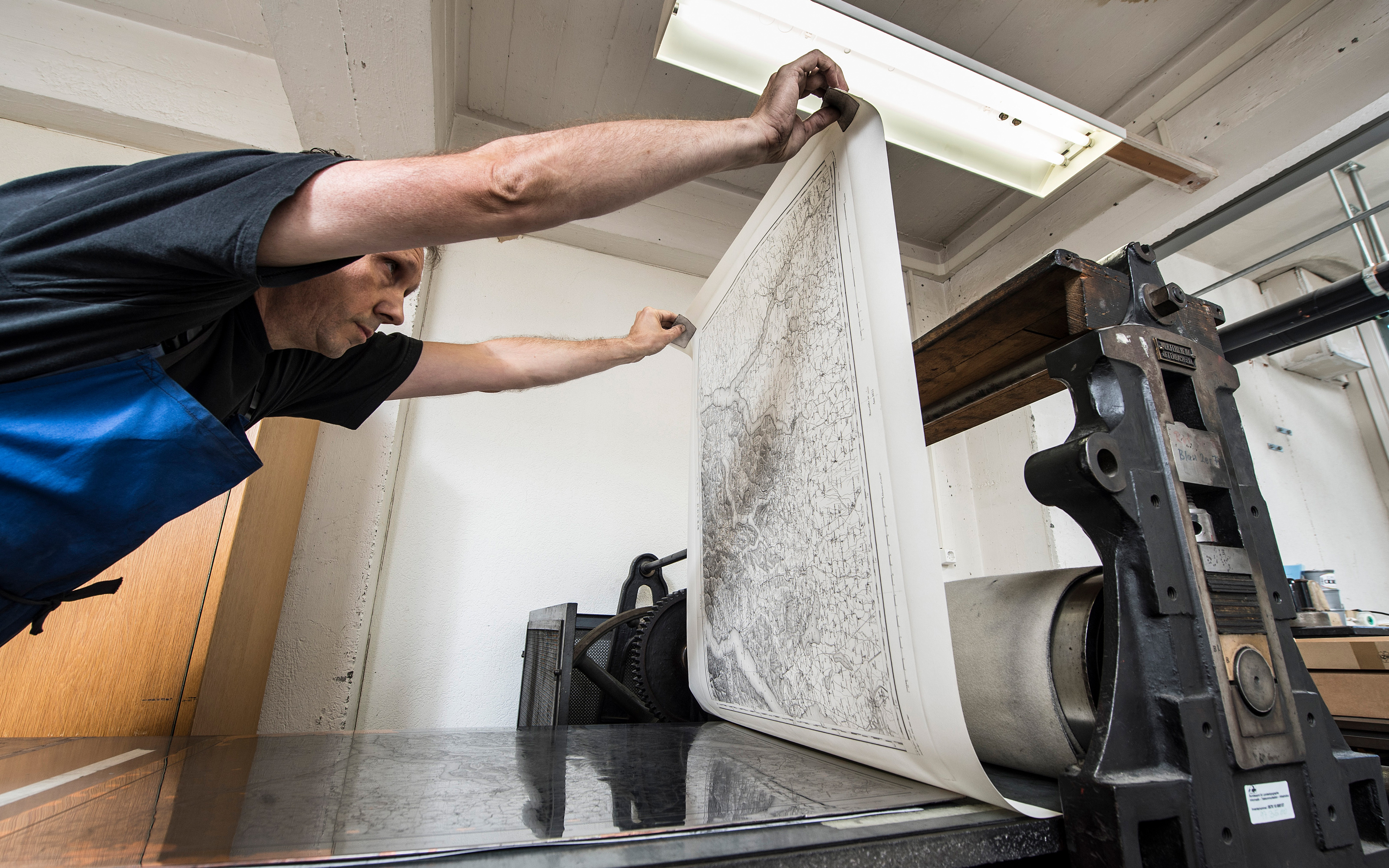
Four sheets an hour
Copperplate engraving, or chalcography, is known as intaglio printing. At the beginning of this elaborate process, the printer carefully rubs ink onto the plates, which is then absorbed by the engraved lines. The printing itself is done using a rolling press that forces the ink out of the indentations and onto the paper. This technique can produce a maximum of four sheets per hour. At the time when the Dufour map was produced, these copper plates could withstand between around two and three thousand impressions. The objects were reproduced multiple times until 1908.
New prints, old techniques
The Dufour Maps displayed in the Federal Palace and Swiss National Museums are replicas of the originals. In 2015, swisstopo employees reprinted these maps as part of a one-off project, using the same method as Dufour’s team did almost two centuries ago. As the Federal Office of Topography, swisstopo considers itself to be a guardian of Switzerland's historical legacy. There is no doubt that the 25 original 19th century copper plates come under this category. They are considered to be the oldest information recording devices associated with the national topographical map and boast an unrivalled longevity in that role. What’s more, they still fulfil their purpose even after 175 years: The Dufour Map is a significant tool in aiding scientists to understand spatial and settlement development in Switzerland.
More about the copper plates
Seftigenstrasse 264
3084 Wabern