
What does a national map show?
National maps are scaled down and simplified representations of a section of the earth’s surface. They provide an overview as complete as possible of any residential zones, paths, roads, bodies of water, terrain, vegetation, and individual objects.
Content of the Swiss National Maps
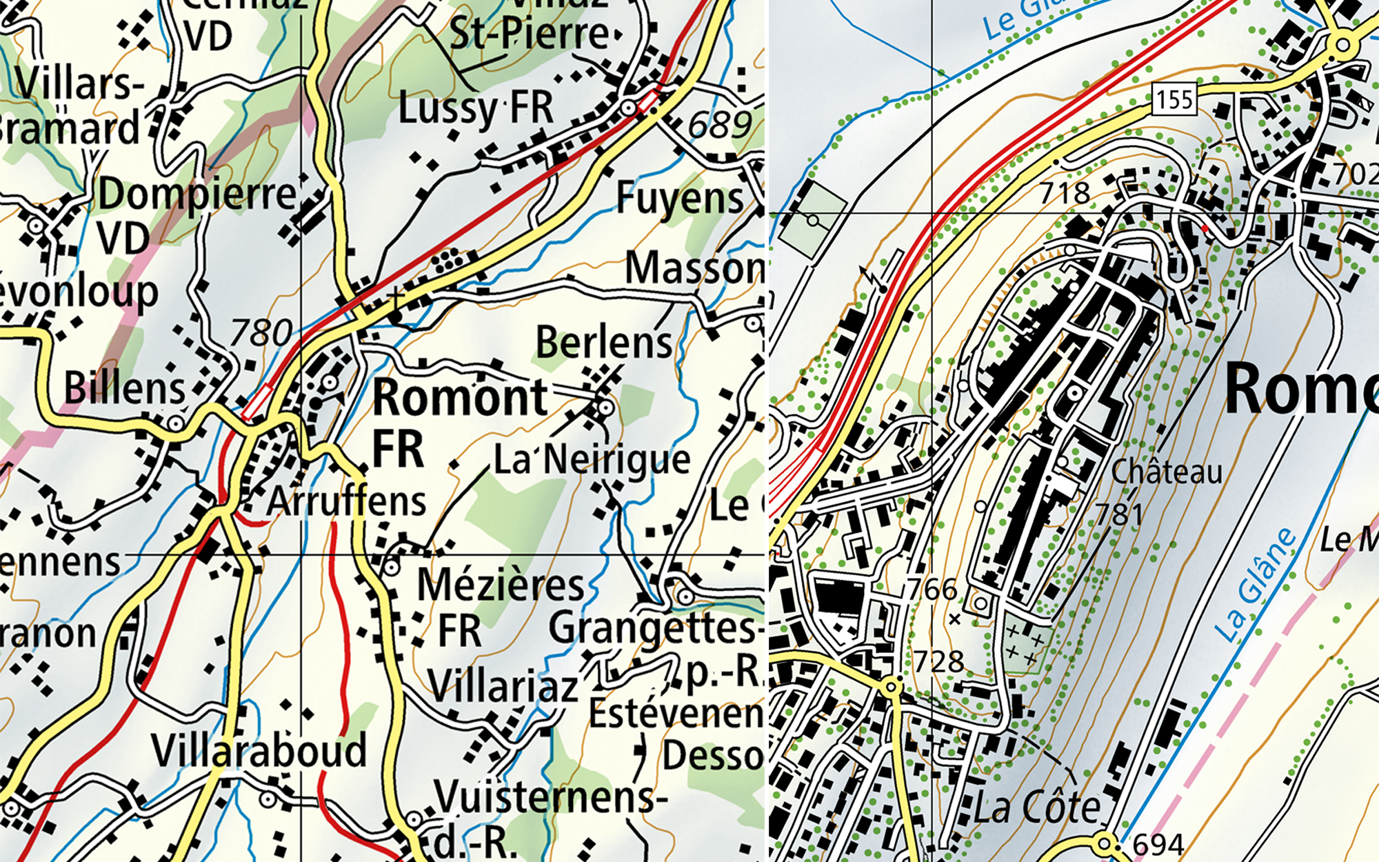
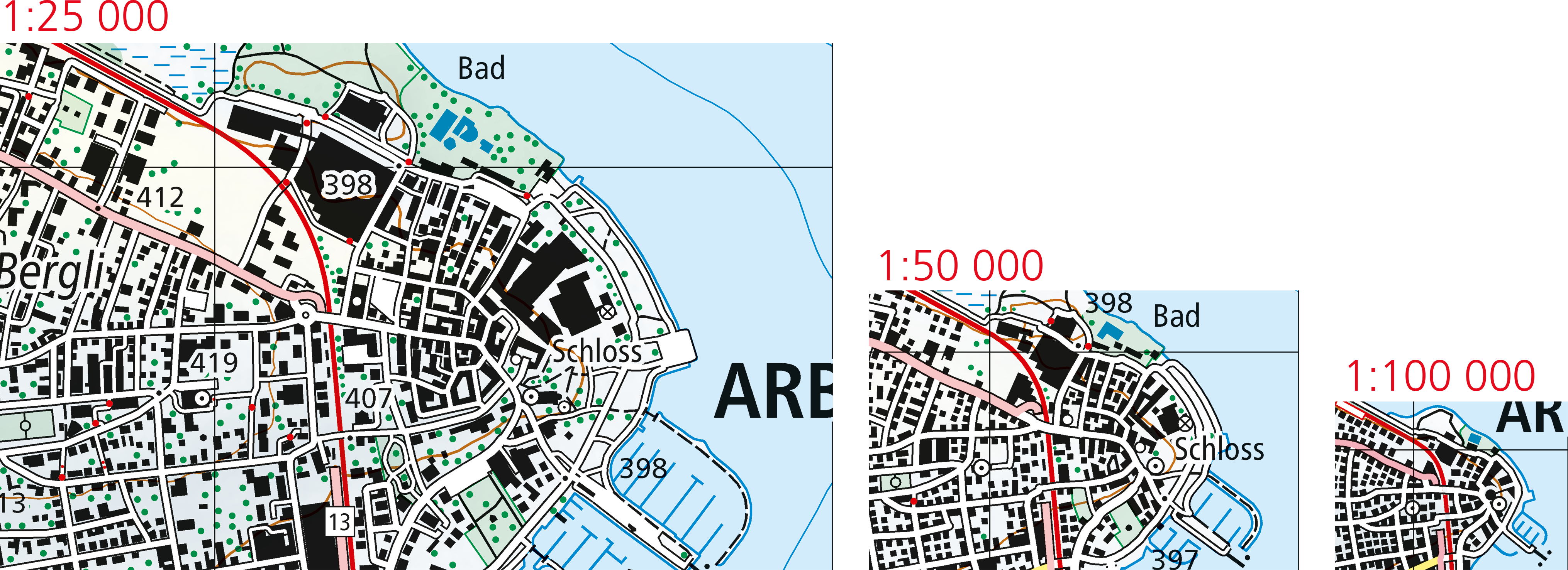
The swisstopo National Maps are topographic maps of Switzerland and adjoining foreign territory. In a simple and legible form, they provide as much information as possible on settlements, paths, roads, bodies of water, terrain, vegetation as well as individual objects (e.g. observation towers, antennae, monuments, etc.). This content is supplemented with annotations and boundaries. The degree of detail mainly depends on the scale – the reduction ratio. The smaller the scale, the less space is available on the map and the content must be reduced accordingly. The reduction of the map’s contents is called cartographic generalisation. Generalisation ensures that the map is easy to read without losing the essential content.
The National Map does not show any legal information

Map design
The readability of a map depends directly on its cartographic design. The depiction of each object is clearly defined in the form of symbols und and is described in the legend.
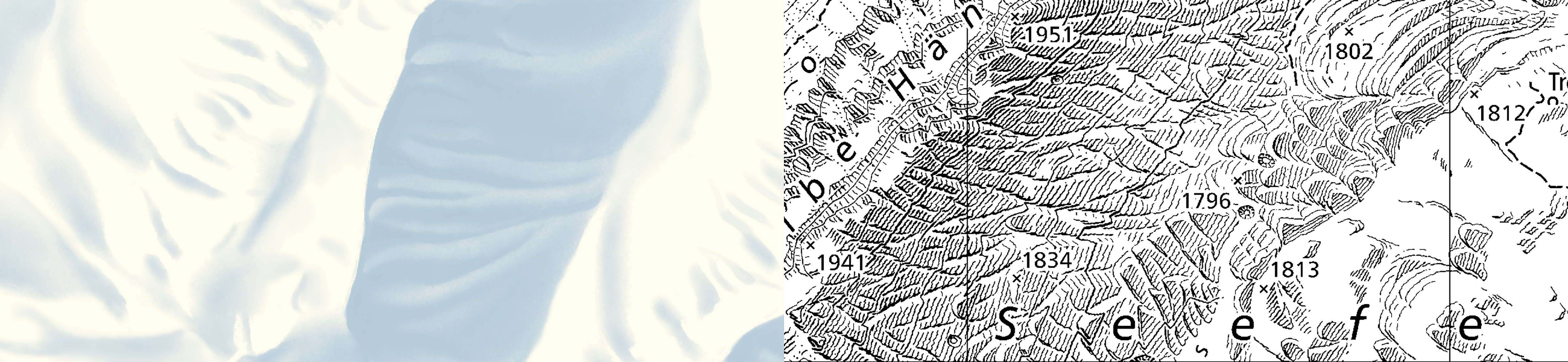
The unique depiction of terrain is a distinguishing feature of the Swiss national maps and is one of the main reasons why they enjoy such a good reputation throughout the world. The three-dimensional effect of the Swiss national maps is above all based on the depiction of relief, rock, boulders and glaciers.
Equal high quality for all
Based on the Geoinformation Act, swisstopo has the task of providing geographic information and maps in an unbiased and independent manner. swisstopo ensures consistent and comprehensive coverage of Switzerland with high-quality maps, in digital and print format.
Report changes to maps or geodata
Changes to the terrain or errors in the geodata and maps can be reported to swisstopo. An online revision service is available for submitting suggestions for corrections directly in the swisstopo app or at map.revision.admin.ch.
More information
Federal Office of Topography swisstopo
Seftigenstrasse 264
3084 Wabern