
Map production
How is a map created? Numerous experts at swisstopo tackle this major question every day. Many steps are required to create a map. Many different professions are involved, from surveying, taking aerial photos and compiling enormous geodatabases to cartographic processing and the publication of maps using various media. The range of cartographic products is wide and ranges from apps to web portals and from geo-services to classic paper maps.
Map fundamentals
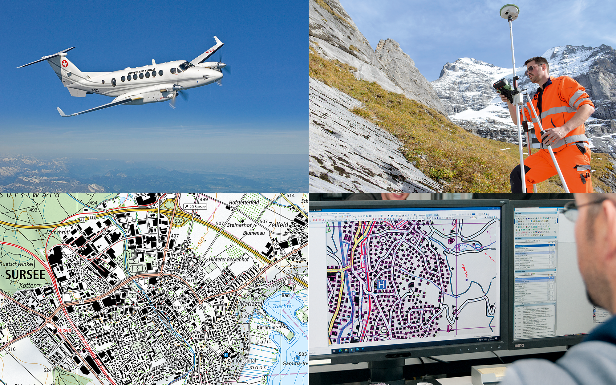
A plane equipped with a high-resolution aerial camera takes pictures of Switzerland from above. These images are geo-referenced and analysed on the basis of the survey. The terrain and heights of objects are also determined from the aircraft using high-precision laser scanning. This data is then processed to create a three-dimensional geodata set and partly supplemented with data from other sources, such as the official municipal register. The resulting topographic landscape model forms the basis for the creation of the maps.
Map production
A cartographic model is calculated using the topographic landscape model. The various digital and printed products are derived from this cartographic database. Production is partially automated using geographic information systems (GIS) along with other software solutions. The content of the maps is simplified to make it easy to read. This is called cartographic generalisation. The display is clearly regulated for each object in the form of map signatures. In addition, further detailed corrections are made manually by geomatics specialists. All of the maps are updated periodically.
Quality
The demands placed on the national map have increased greatly as a result of digital transformation. It is not only used for navigation in the field but also wherever spatial information is needed. Cartographic content has become indispensable, whether as a basis for planning or as a source of background information for factual data in geodata portals, apps or on paper. Everything happens somewhere and maps provide information about where.
The swisstopo maps are unique in their wealth of detail and their graphics. Every summit, every street and every house is shown. This is what the national maps have always represented. As maps are increasingly being used in digital environments, their graphics are also changing. Depending on the use, different distinctive variants are generated in different colours, with different symbols or enhanced with additional data. The quality of the maps is therefore not only based on their beautiful graphics and how up-to-date they are but also the possibility of linking them to additional data and their easy accessibility via electronic applications.
The job description has changed – the profession of cartographer no longer exists. Today, geomaticians take on the work and the training includes classical cartography as well as data processing, web technologies, surveying, etc. Cartography, or the science of maps, as such remains part of the training of professionals so that coordinates, elevation lines, symbols and signs can continue to be assembled into an easy-to-read map, ensuring that map data and applications meet the high standards. In this way, swisstopo will continue to ensure that the Swiss national maps meet the various requirements.
Apprenticeship as geomatician EFZ
National maps
The national maps produced by swisstopo are referred to as “National maps of Switzerland”. The different scales and characteristics make up the official topographical map of Switzerland. Swisstopo is legally required to publish and update the national maps. The layout of the paper maps still in use today dates back to General Henri Dufour. In digital applications, such as the swisstopo app, the maps are now seamlessly joined together.
Video on the creation of the national maps
Insight into the processing, storage and use of topographical data:
Documents
Federal Office of Topography swisstopo
Seftigenstrasse 264
3084 Wabern