
A special collaboration: the map of Mount McKinley from 1960
A unique mapping project links swisstopo with the highest mountain in North America, Denali. In 1960, when the stone giant was still called Mount McKinley, a map of the mountain was published the appearance of which resembled the Swiss national maps. How did this relationship come about?
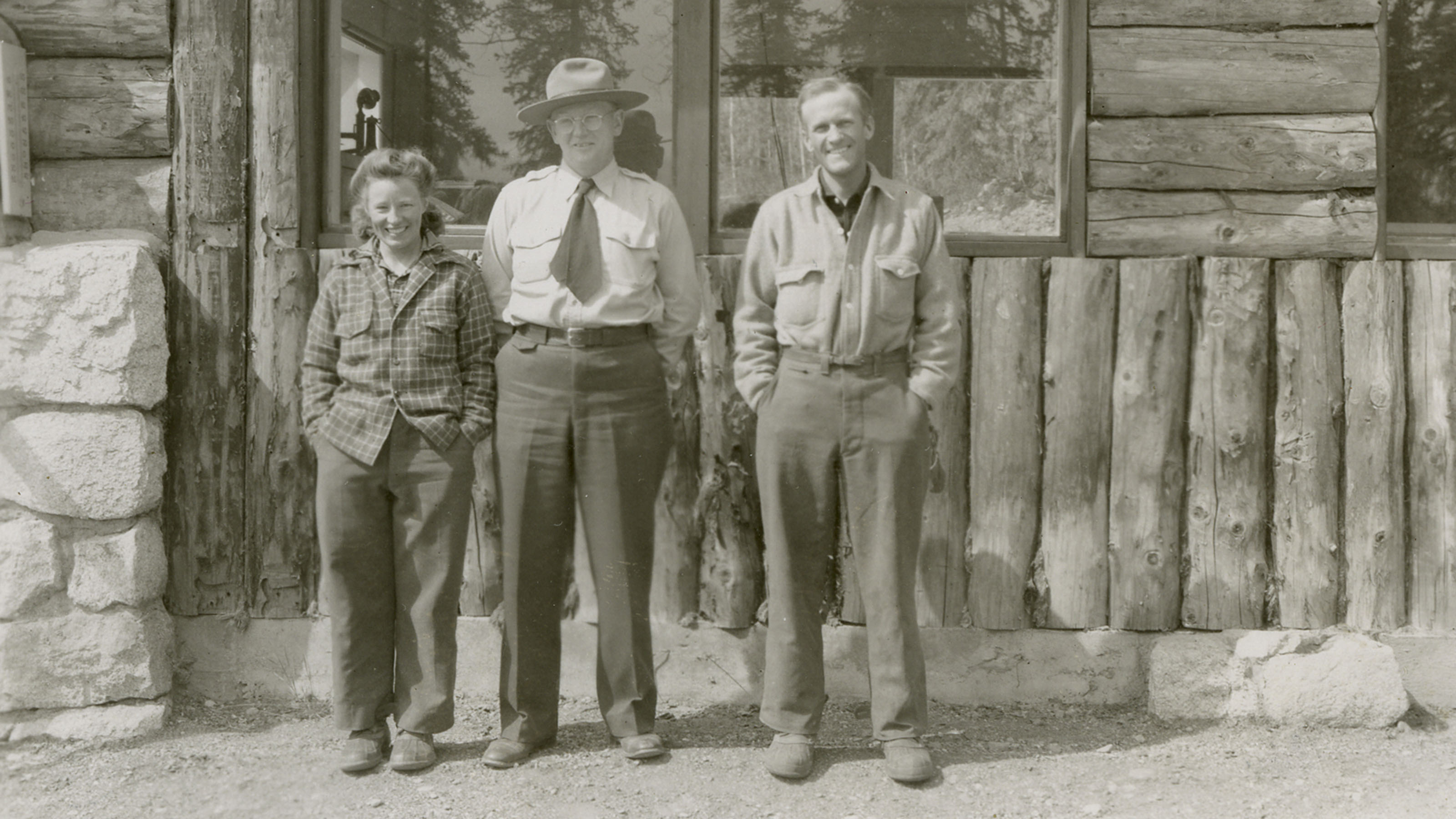
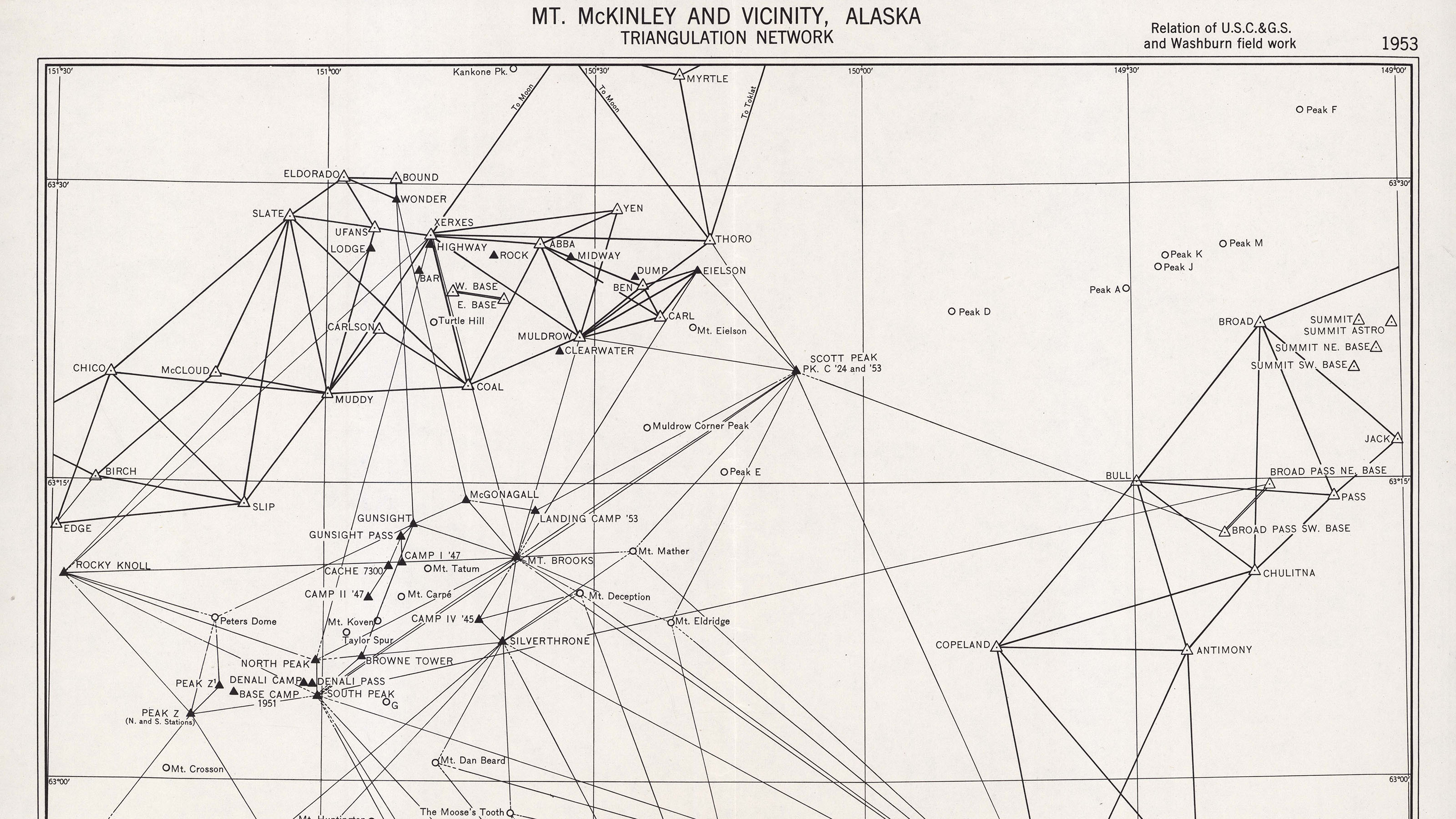
In 1951, US Air Force survey planes flew over Mount McKinley, the highest mountain in North America at 6190 metres above sea level. They took aerial photographs of the entire McKinley massif in inland Alaska. The driving force behind the survey work was Henry Bradford Washburn (1910–2007). This mountaineer, photographer, cartographer and director of the Boston Museum of Science had a passion for the mountain. He repeatedly undertook tours of Mount McKinley, which his wife Barbara was the first woman to climb in 1947.
Washburn wanted to use the aerial photographs, taken in 1951 and 1955 during US Air Force flights, as the basis for a topographic map of Mount McKinley. His demands were high: the work should be accurate, detailed and aesthetically pleasing; most important to him, however, was the skilful rock drawing. For this reason, the American approached the Swiss Foundation for Alpine Research and the Federal Office of Topography (now swisstopo) in the mid-1950s. As he testified in 1957, he wanted to use the skills of the “outstanding Swiss cartographers” for the McKinley map and to base its appearance on that of the Swiss national maps. Looking back at the project in 1961 he wrote:
Over and over again I have been asked, «Why on earth are you having your map published in Switzerland?» [...] It is my conviction that no other country in the world - in fact, no other team of cartographers even in Switzerland - could equal the job done by Wild and the Landestopographie.
Washburn also wanted the photogrammetric evaluation of the aerial photographs on 12 evaluation plates to a scale of 1:20,000 to be implemented in Switzerland. The busy American found an ideal partner within the Wild Heerbrugg company in the form of Othmar Wey, a luminary in photogrammetry.
The Boston Museum of Science along with other American donors and institutions bore 80% of the costs for the elaborate project, which amounted to around 123,000 Swiss francs.
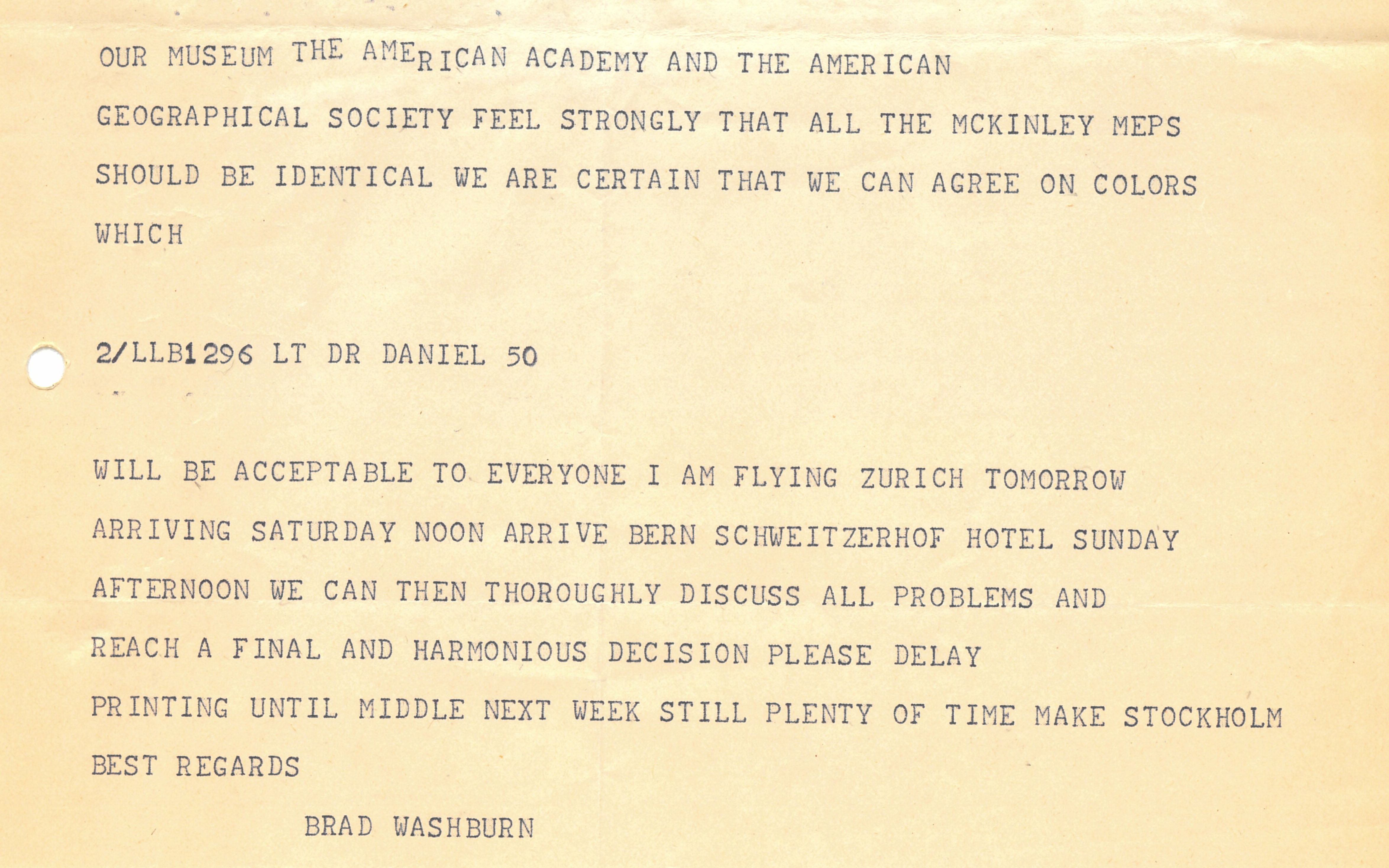
From the beginning of the aerial image interpretation, drawing and engraving work (1957–1960) up until the publication of the McKinley map (1960), Bradford Washburn was in regular contact with the staff of the Federal Office of Topography and the photogrammetry operators of Wild Heerbrugg. At the Federal Office of Topography, the relief expert Paul Witzler, the rock engraver Paul Ulmer and the head of the photographic department, Daniel Chervet, were the key contacts for the American. Mostly, this exchange took place by airmail letter and in urgent cases by telegram. For direct collaboration, Washburn also stayed at the headquarters of the Federal Office of Topography in Wabern near Bern in 1957, 1958 and 1960. In 1959 he travelled with Barbara Washburn to Mount McKinley, where they conducted final reconnaissance work on map details.
Proofs of the latest advances in interpretation, drawing and engraving were regularly sent from Heerbrugg and Wabern to Boston. Washburn analysed them meticulously and compared them with orthophotos and oblique photographs. He then returned the proofs to his Swiss partners with an attentive critique of the details. Washburn always expressed his great admiration for the high quality of the work. Thus, in a letter of 4 June 1959, he expressed to Daniel Chervet his amazement at the extraordinary accuracy of Paul Ulmer's translation of the aerial photographs into a representation of the rock which was as exact as it was beautiful: "I simply don’t see how he has been able to do such an immensely complicated and intricate job of interpretation with only half a dozen of errors."
Knowledge of the terrain
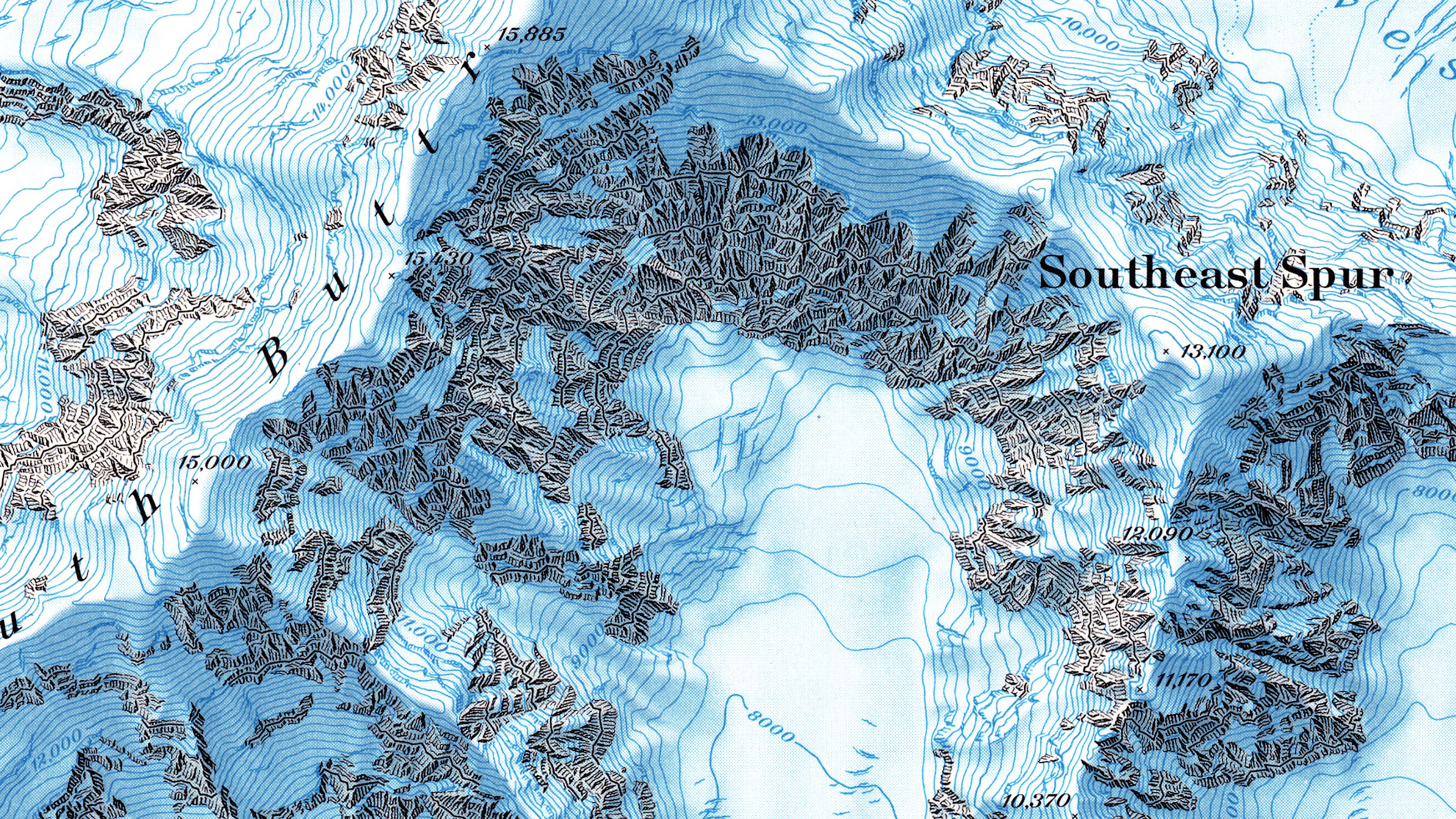
The positive exchange between Boston, Heerbrugg and Wabern was indispensable for the success of the mapping project. This was not least because Bradford Washburn was the only person with direct experience of the terrain in the McKinley area. He functioned as the eyes and ears of the project on the ground. Accordingly, many map elements were shaped by his individual perception of the area. For example, it was important to Washburn that the areas with vegetation on the northern edge of the map appeared in a vivid green. He suggested this in a letter to Paul Ulmer in 1958:
A barren rocky valley is lifeless and miserable to live in. A grassy valley (even when there are no trees) is a heavenly spot, and I feel that we must show this by fine green dotting, a screen or a tint over these areas.
Washburn's experience as a McKinley climber was also incorporated into the map. This was shown, for example, in 1959 in feedback on Paul Ulmer's depiction of the rock:
Also, I feel that the details of the rock spurs coming down from the N. Peak to Harper Glacier should be made to look as nearly as possible exactly like the real spurs […] as this is the main route up the mountain and often in bad weather the accurate identification of the lower tips of these spurs is the only way in which you know where you are!
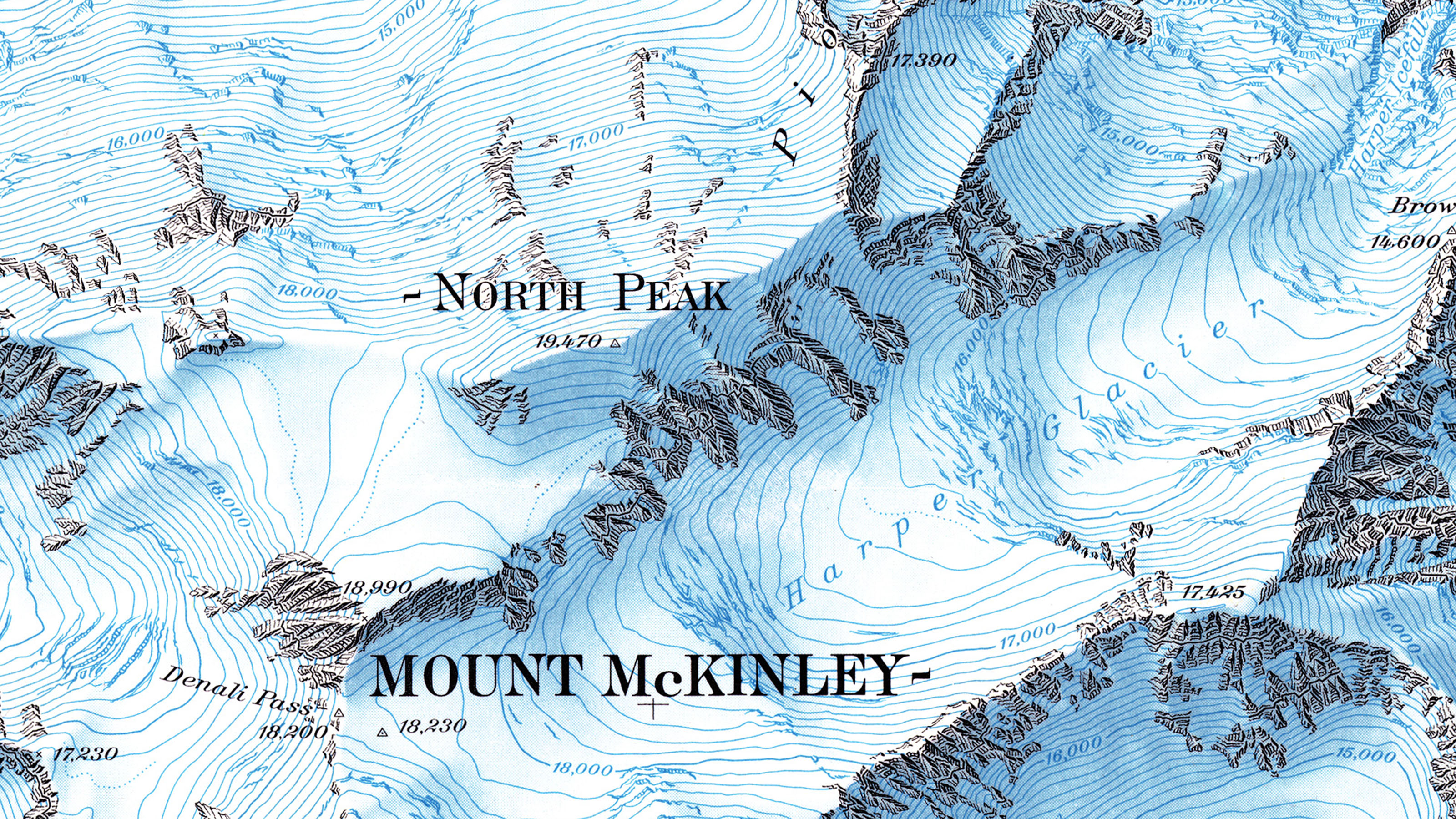
Washburn's personal perception of Mount McKinley also affected the colouring of the map. In order to "convey McKinley’s real grandeur", he advocated "to get a little more really vital blue into our map than is on the recent Swiss topo sheets."
A balancing act between beauty and readability
Another central aspect in the McKinley project was establishing the difficult balancing act between beauty and readability. Bradford Washburn, for example, criticised the fact that, in some places, the contour lines threatened to be lost in the rock depiction. The rock engraver Paul Ulmer corrected the contour lines accordingly, whereupon the Bostonian noted with delight: "The 1000-foot contours are now being handled perfectly – just dark enough to make them evident, just hidden enough so that they don’t spoil the effect of the rock-drawing."
Other lines on the map image where cartographers had to balance between beauty and readability were the longitude and latitude lines. Bradford Washburn advocated that these lines should not be drawn across and along the entire sheet, but that each minute should only be marked at the edge of the map: "In this way it will be easy to locate anything precisely and at the same time the beauty of the map will not be marred."
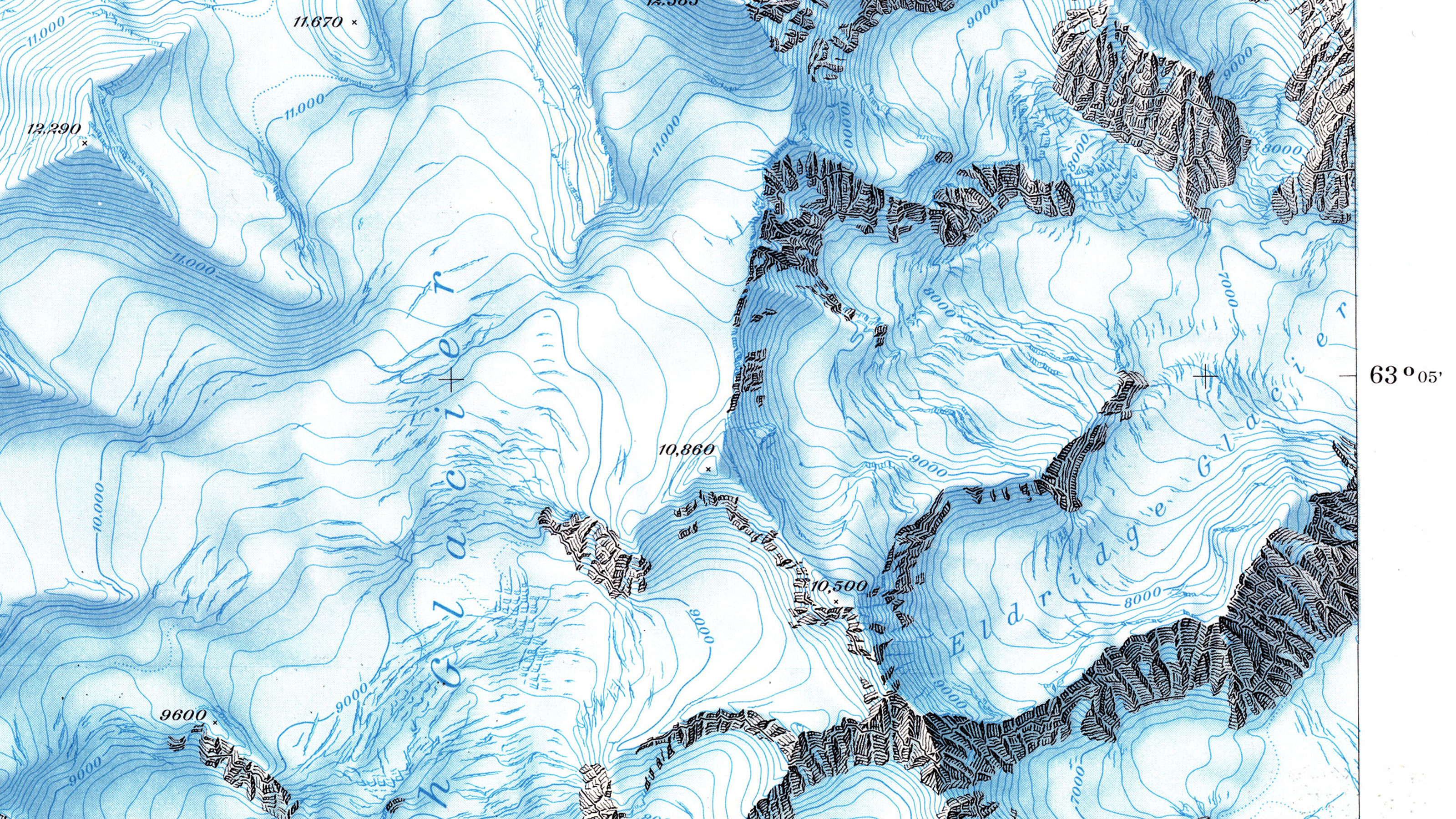
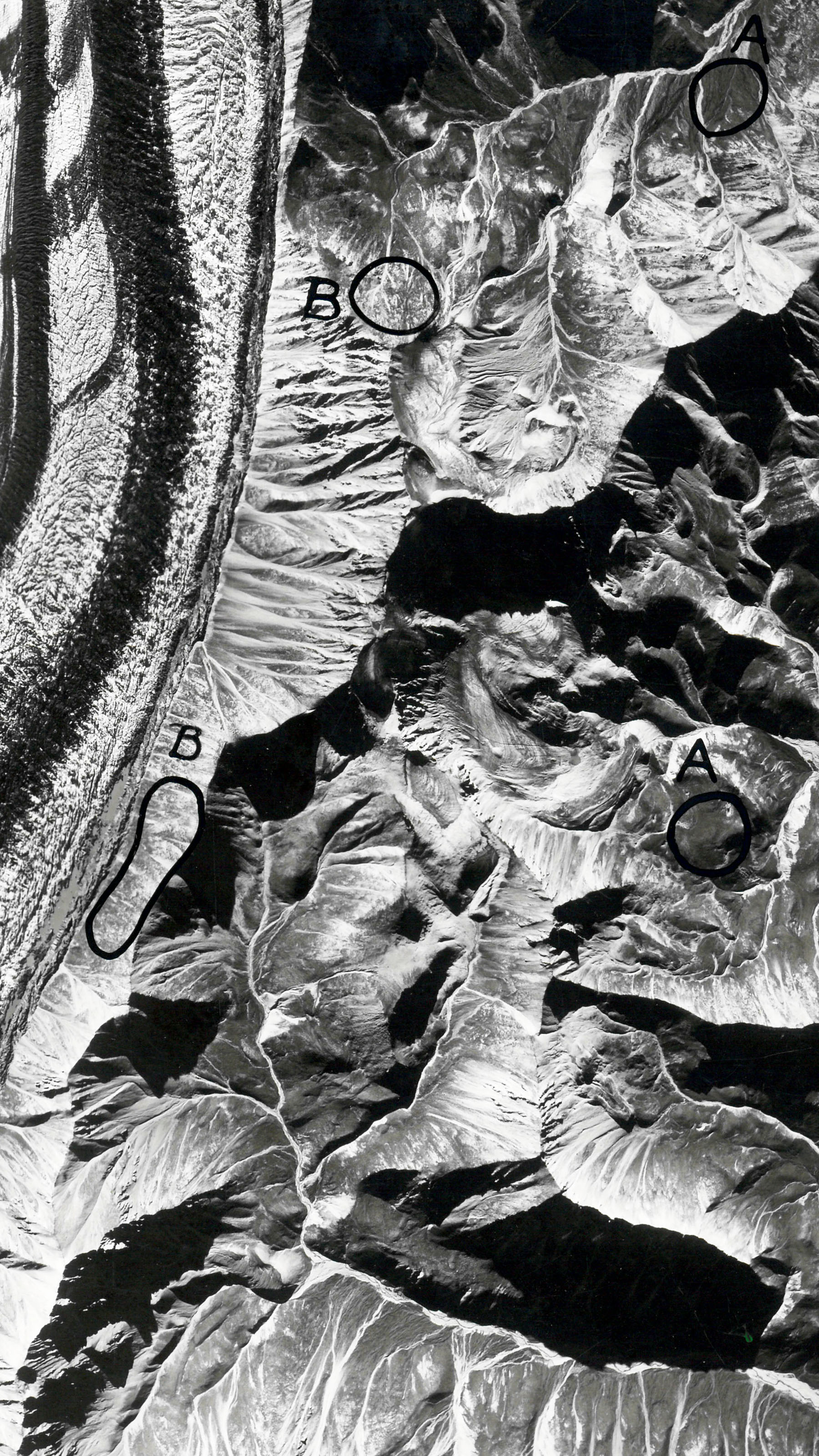
The glacier drama
An important detail can be found at the bottom of the map: "This map depicts 1951 conditions of glaciation." This is significant because the glacier world around Mount McKinley changed dramatically in 1957: the flow rate of the glaciers in that year was exceptionally higher than in the years before and after. This led to countless new crevasses as well as a significantly changed shape of the ice tongues. The sea level of the glacier surface also changed. For example, the Muldrow Glacier near Mount McKinley sank 200 feet (about 61 metres), according to Washburn. The faults meant that a so-called glacial surge had occurred. Such surges occur cyclically in Alaska at decade-long intervals. In 2021, the phenomenon repeated itself for the first time since 1957. In April 1959, Bradford Washburn described the effects of the Surge in a letter to Paul Ulmer:
[L]ower Muldrow Glacier is still virtually impassable on foot, in large areas where seven years ago you could have almost ridden a bicycle on the ice!
For Washburn, it was clear that recording the glaciers shortly before they suddenly changed was of great scientific importance. He deliberately refrained from updating the glaciers by using current aerial photographs. He emphasised this to the director of the Swiss Foundation for Alpine Research, Othmar Gurtner, in 1958: "Our map is going to be of immediate and extreme geological value by pin-pointing the exact status quo of crevasses and moraines before the dramatic upheaval which has changed McKinley’s glaciers so much in the last year."
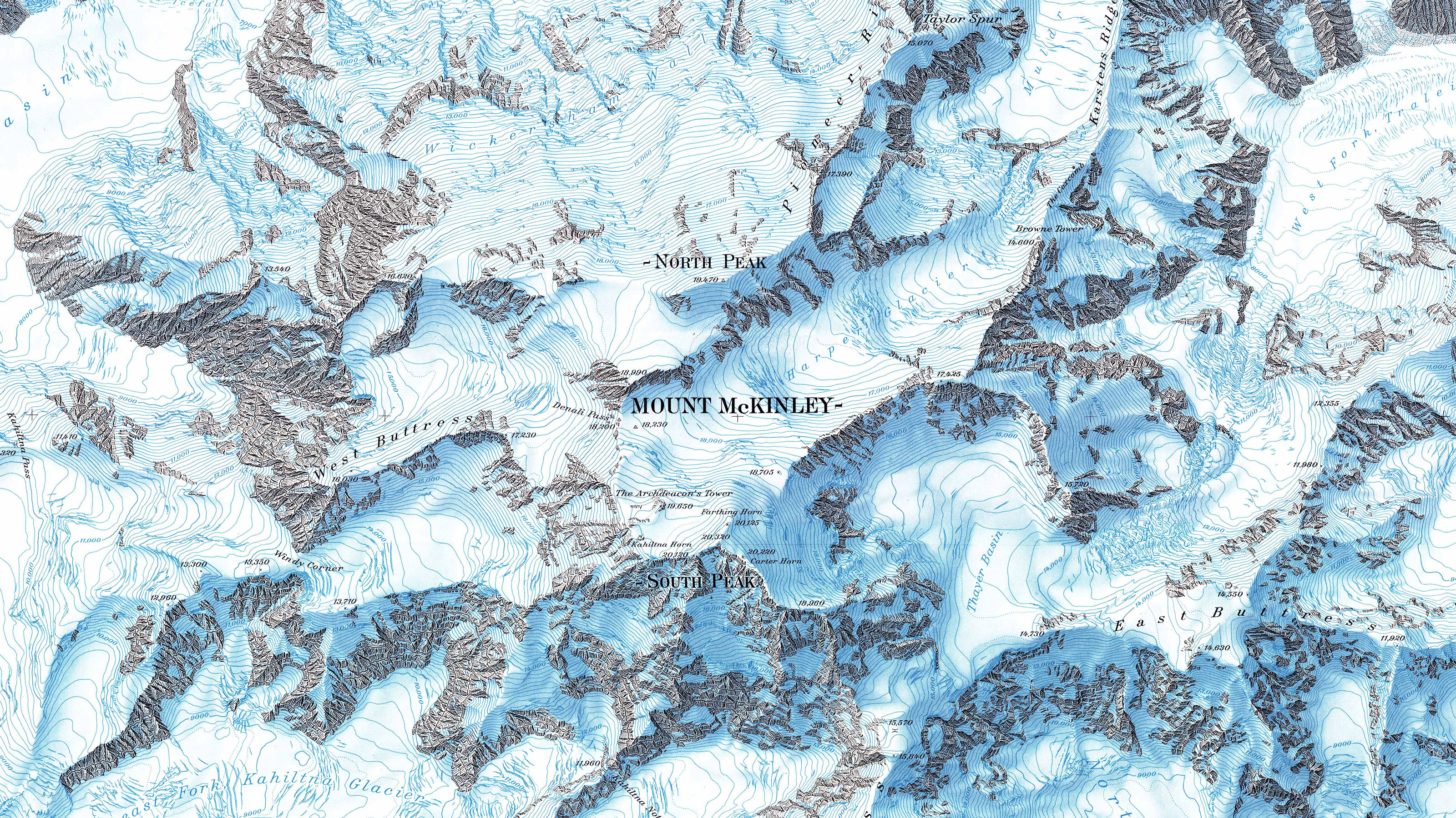
A very special national map
After three years of intensive exchange through letters, telegrams and personal meetings, the time had come in July 1960: the Federal Office of Topography printed the McKinley map in Wabern near Berne. The edition included 31,642 copies, a good third of which went to the Boston Museum of Science and thus to the US market. Bradford Washburn travelled from Boston to Switzerland especially for this great moment. He wanted to be present at the printing and have a last say in the final corrections, especially in the colouring.
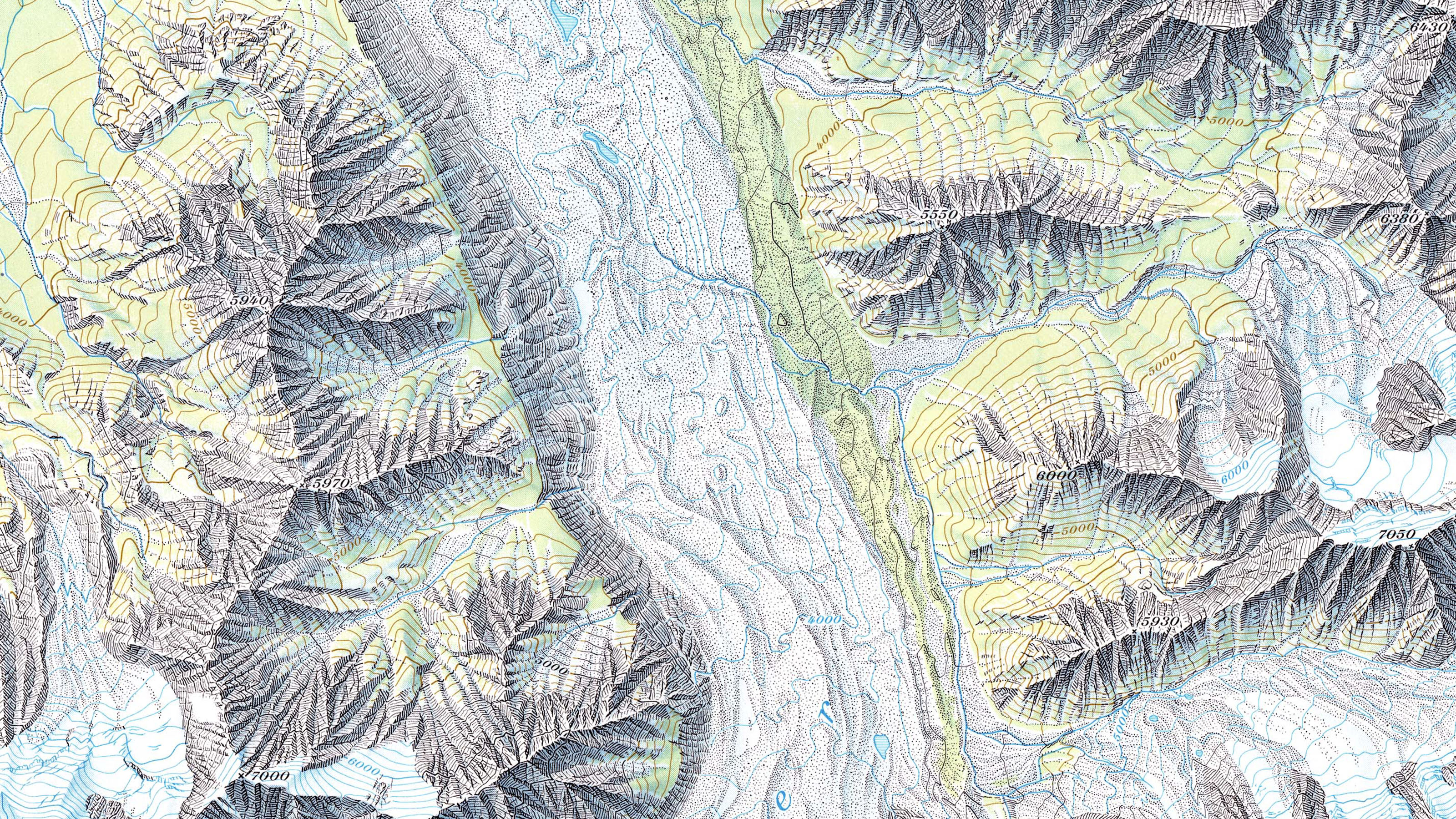
The product that emerged after about ten years of hard work was something to behold: at first glance, it was confusingly similar to a Swiss national map. A look at the details, however, put this impression into perspective. For example, the McKinley map had stronger, more vivid colours than the national maps and the elevations were given in feet instead of metres. The map content could not have been taken from any national map either: as the Director of the Federal Office of Topography, Ernst Huber pointed out in 1960 that there is no stretch of land in Europe “where rock and ice have united to form a glacier world covering such an extensive area”. He had high hopes with regard to the unifying power of the map: “If we have succeeded in bringing our American comrades closer to their own magnificent mountain world, then our cooperation, which has clocked up many thousands of hours, has achieved its goal.”
The fact that the cooperation was indeed perceived as successful by all sides is evidenced by several mapping projects of a similar constellation that followed the McKinley project. The best known of these is probably the Mount Everest map of 1988, which you can learn more about here.
Links
Federal Office of Topography swisstopo
Seftigenstrasse 264
3084 Wabern