
Scanned Aerial Images for Download
The self-service geodata offering from swisstopo is expanding with the integration of scanned aerial images. For the past few weeks, these images have been gradually made available for direct download. The integration of over 350’000 images will take several months and is expected to be completed by the end of 2024. Aerial images can be accessed through the map viewer of the federal geoportal.
Relevant Data
The newly added freely accessible aerial images are part of swisstopo's photographic collection, captured between 1927 and 2010 using analogue cameras. The integration of these images occurs in several stages. Initially, the «swisstopo black and white aerial images» (technical name «ch.swisstopo.lubis-luftbilder_schwarzweiss") are made available. Subsequently, the integration will continue with other collections (see "Outlook» chapter). These collections currently comprise approximately 350’000 aerial images, with new scans of analogue images continuously enriching the database. The latter will be directly available for download, while already digitized images are gradually integrated into the STAC download infrastructure. This integration occurs semi-automatically in blocks of around 2’000 images each. Blocks are defined based on the inventory number rather than the year of flight, making it challenging to determine which images are available for download before an entire collection is integrated.
Access to Data
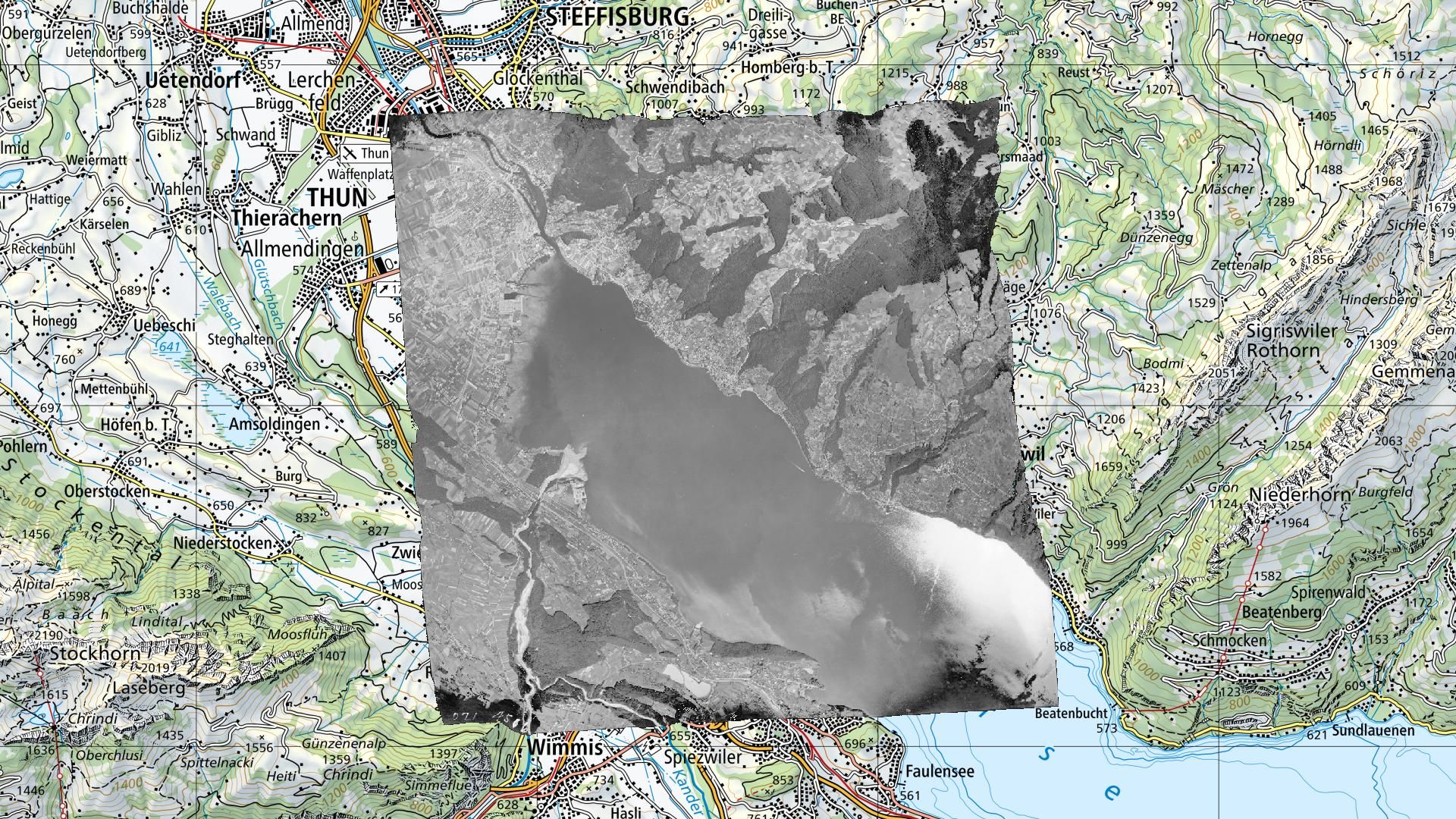
The map viewer of the federal geoportal www.map.geo.admin.ch is the main platform for visualizing swisstopo's aerial images. The distinction between images available for direct access and those not yet integrated can be found in the object information, accessible by clicking on the symbol representing the centre of the image.
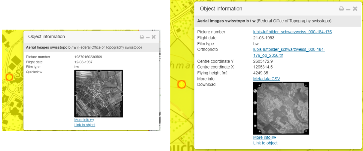
Images not yet available for download can be viewed in full resolution in an external viewer by clicking on the preview. To obtain these images, a request must be made to geodata@swisstopo.ch. Provision fees will be charged.
For images available for direct download, there is no external viewer. By clicking on the preview or various displayed links, the aerial image (format Cloud Optimized GeoTIFF - COG), metadata with orientation elements (in CSV format), and, if available, an orthophoto (in COG format) can be downloaded directly.
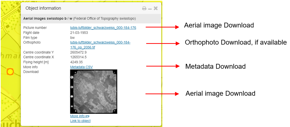
Depending on data processing, an image may only be oriented and not yet orthorectified. If no orthorectification has been performed, the «orthophoto» field in the object information is empty. Regardless of whether the image is only oriented or already orthorectified, the COG format allows immediate integration of images into GIS software or online viewers that support the COG format.
Data download is also possible via the STAC API of the federal geographic data infrastructure. Instructions for using this API are available on the website.
The STAC Browser interface allows for a simpler examination of all data contained in the STAC download solution, such as black and white aerial images.
Free Use
Aerial images can be used freely, like all other swisstopo data. Usage conditions are described here.
Outlook
Already scanned aerial images are gradually being integrated into the STAC infrastructure to enable direct download. This began with the collection «swisstopo black and white aerial images,» technical name «ch.swisstopo.lubis-luftbilder_schwarzweiss,» which will be completed by spring 2024. Following that, until the end of 2024, the collections will include:
- «Color aerial images from swisstopo,» technical name «ch.swisstopo.lubis-luftbilder_farbe»
- «Infrared aerial images from swisstopo,» technical name «ch.swisstopo.lubis-luftbilder_infrarot»
- «Oblique aerial images from swisstopo,» technical name «ch.swisstopo.lubis-luftbilder_schraegaufnahmen»
All future scanned aerial images from swisstopo will be directly integrated into the download infrastructure.
In the course of 2024, there are plans to develop a tool to easily obtain download links for multiple aerial images based on geometric and/or temporal selection, similar to other swisstopo geodata such as SWISSIMAGE.
Furthermore, as part of the development of the federal geographic data infrastructure, it is planned to soon be able to visualize aerial images directly in the de www.map.geo.admin.ch map window.
Federal Office of Topography swisstopo
Seftigenstrasse 264
3084 Wabern