
Photogrammetry
With photogrammetry, survey images and photographs are used for determining the spatial location or three-dimensional form of an object.
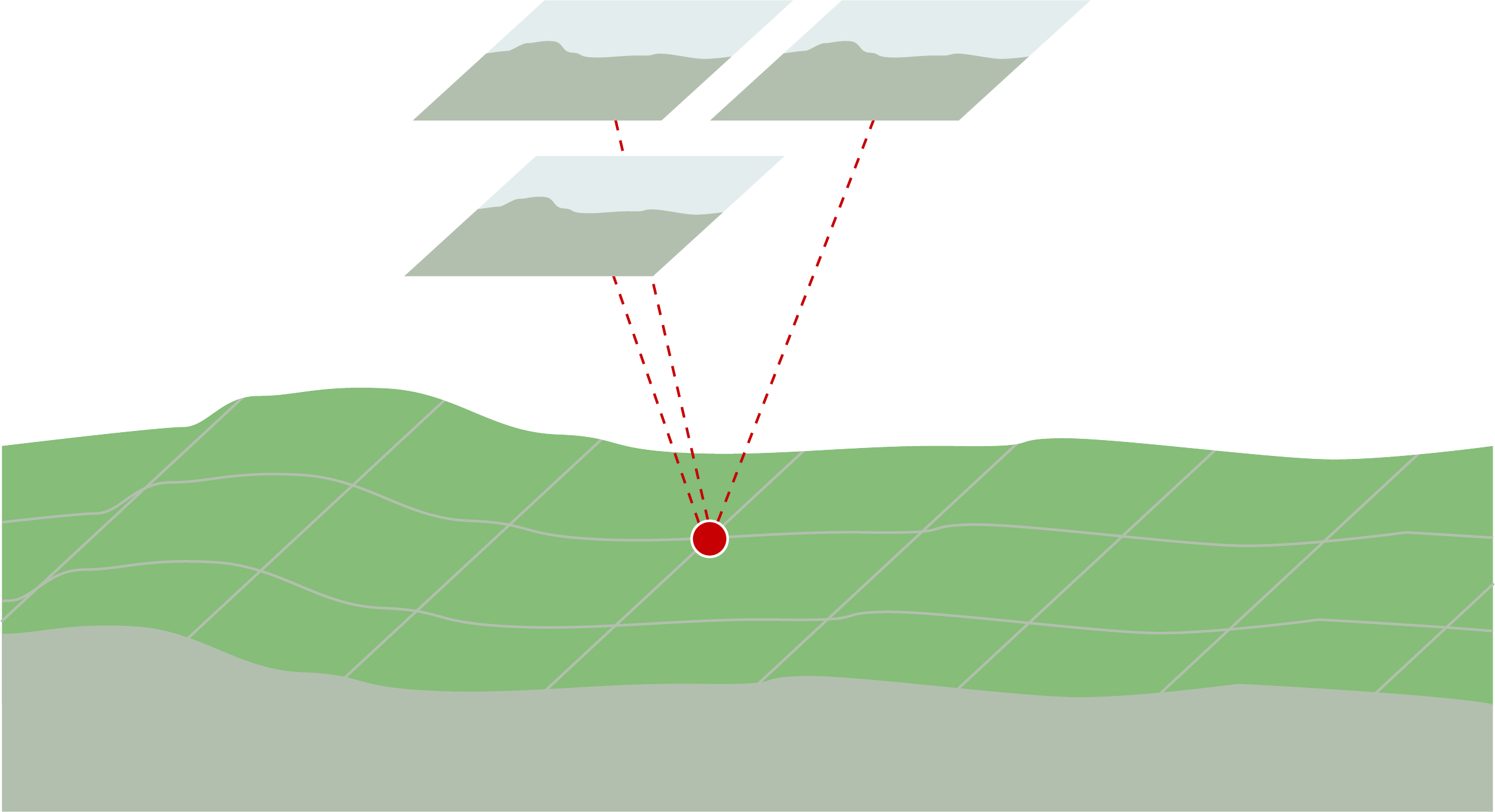
The photogrammetric surveying method involves flying systematically over a terrain and photographing it with a digital surveying camera. A distinction is made between:
- terrestrial photogrammetry (i.e. from the ground) and aerial image photogrammetry
- recording of stereoscopic and conventional images
- photography with a surveying and normal camera
For the purpose of compiling geodata (2-dimensional or 3-dimensional vectors, height models) and topographic maps, as well as for the cadastral survey, the terrain has to be photographed extensively. In view of this, the survey of the terrain is carried out using aerial image photogrammetry and a digital surveying camera. The aerial images are analysed stereoscopically and facilitate the measurement of 3-dimensional objects in the surveyed area.
Today, drones are also used for recording aerial images. Here the applied procedure is based on the method of aerial image photogrammetry.
Federal Office of Topography swisstopo
Seftigenstrasse 264
3084 Wabern