
Discover the ideal dog walk with the national map
A walk with your dog offers not only fresh air and exercise but also a wonderful chance to explore your surroundings more deeply. Using swisstopo’s national maps, every excursion can be perfectly planned. By understanding map reading and its symbols, you can visualise the terrain in detail before setting off. In this post, discover which key symbols will help you plan the ideal dog-friendly adventure.
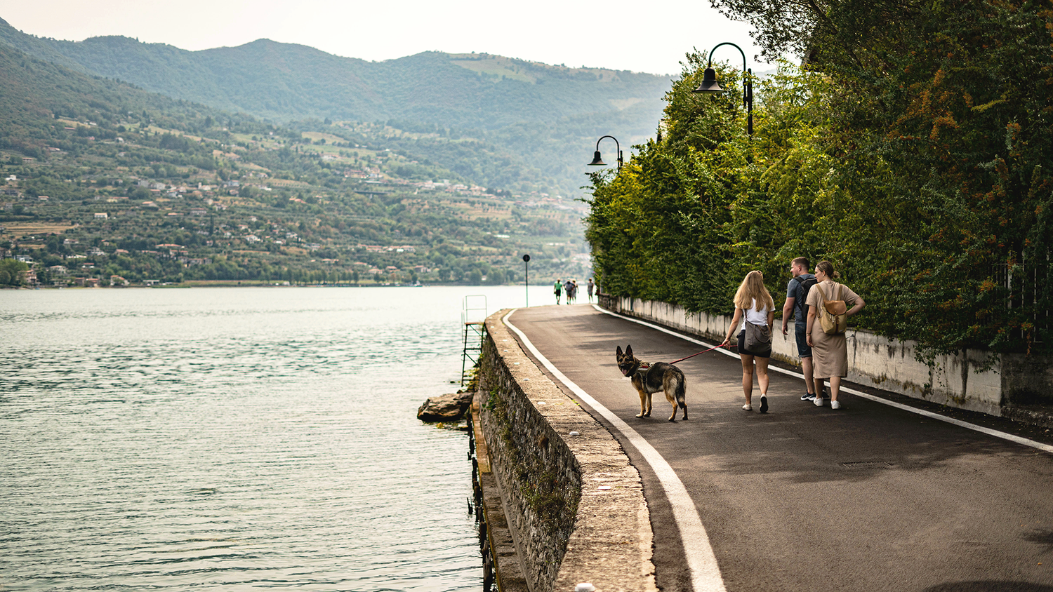
Elisa and Oli's dog wants to go out for a walk. With the national map, they plan an exciting walk.
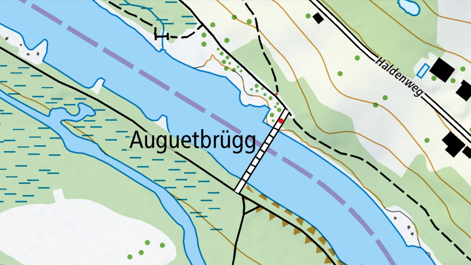
When venturing into an unfamiliar area with your dog, a quick glance at the map is all it takes. A path marked along a river promises variety, and you’re ready to go. But it’s wise to study the map more closely: before starting, check for a bridge at one end of your planned loop to cross and return on the opposite bank.
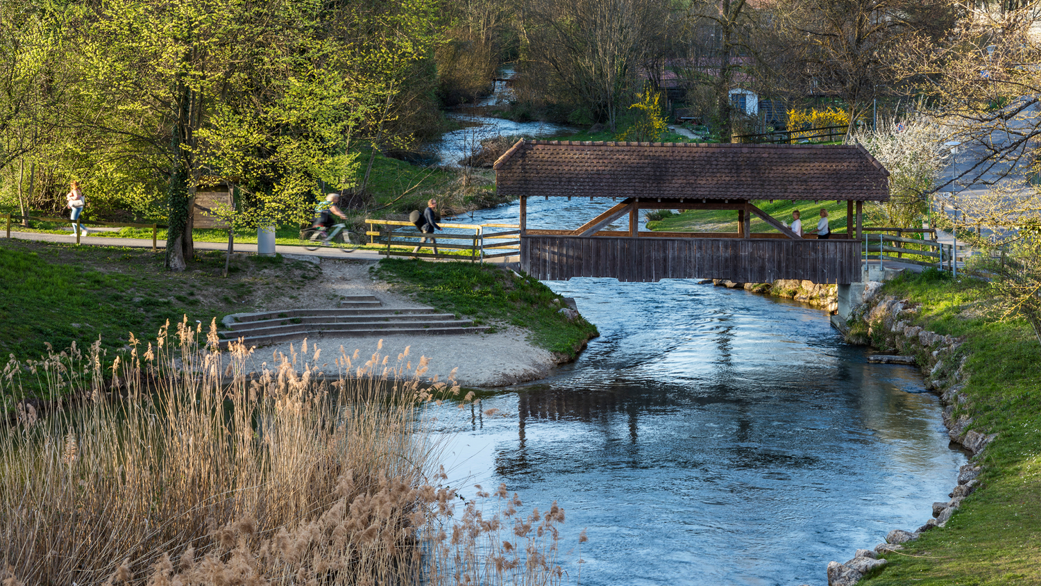
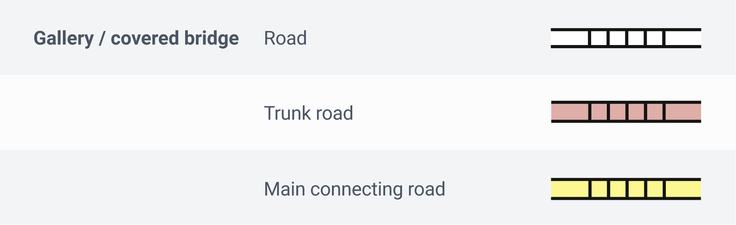
A road crossing a stream or river on the map indicates a bridge – it’s as simple as that. Covered bridges are identifiable by additional crosslines.
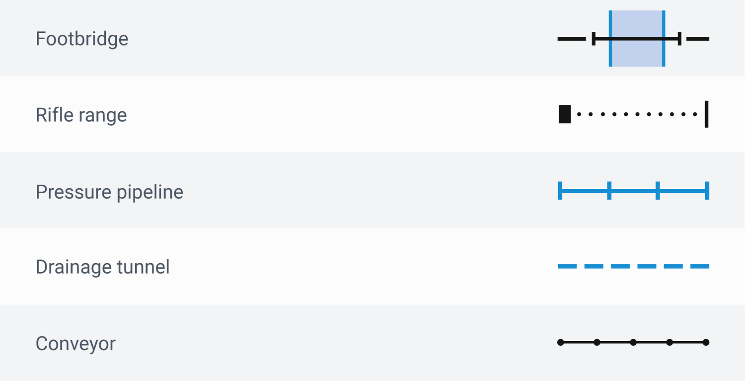
A footbridge, however, is trickier to spot: depicted as a black line, it might be confused with a shooting range, pressure pipeline, or conveyor belt, as they can also cross a waterway.
Some bridges feature a red dot. Don’t be deterred. This just denotes a vehicle barrier, passable by pedestrians and cyclists only but not cars, lorries, or tractors. This detail is valuable, as it signals a route with little to no traffic.
Footbridges, by design, aren’t accessible to vehicles. A red dot here occasionally appears but represents stairs. The dot’s size varies depending on the obstacle.
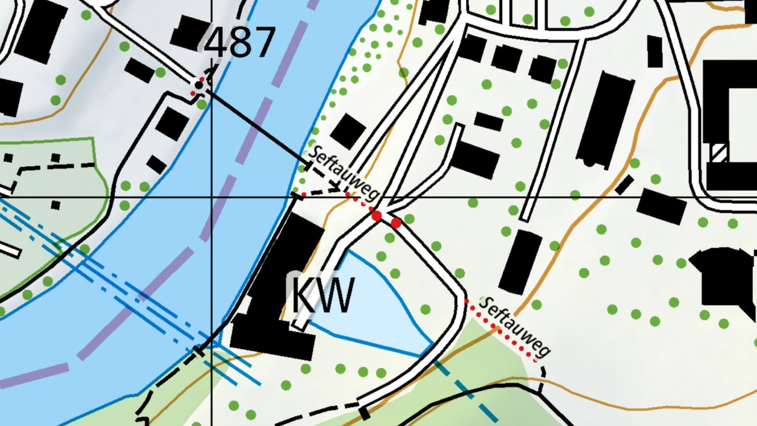
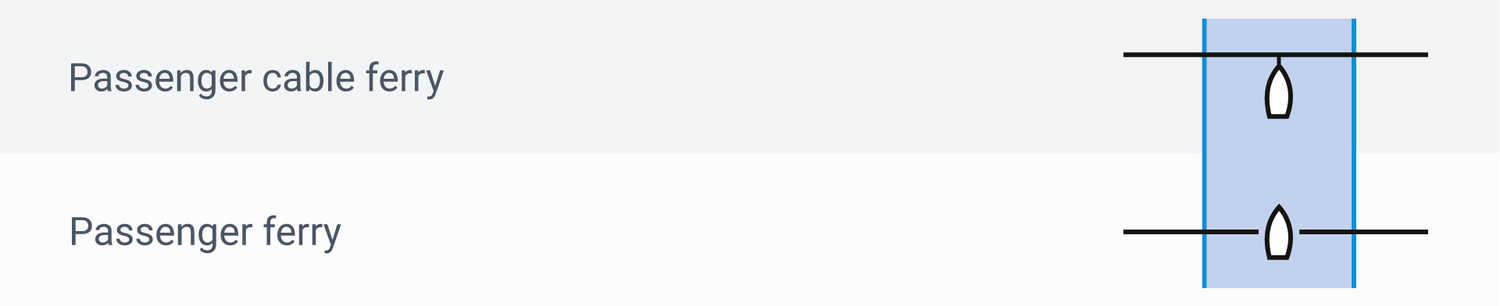
Bridges and footbridges are not the only way to cross a river. To shorten your route, look for pedestrian ferries. Though often requiring a fee, they offer a memorable experience for both you and your dog.

The classic dilemma: a nervous glance at your rucksack to check if supplies will last. But don’t worry! National maps also show where you can stop for refreshments along the way.

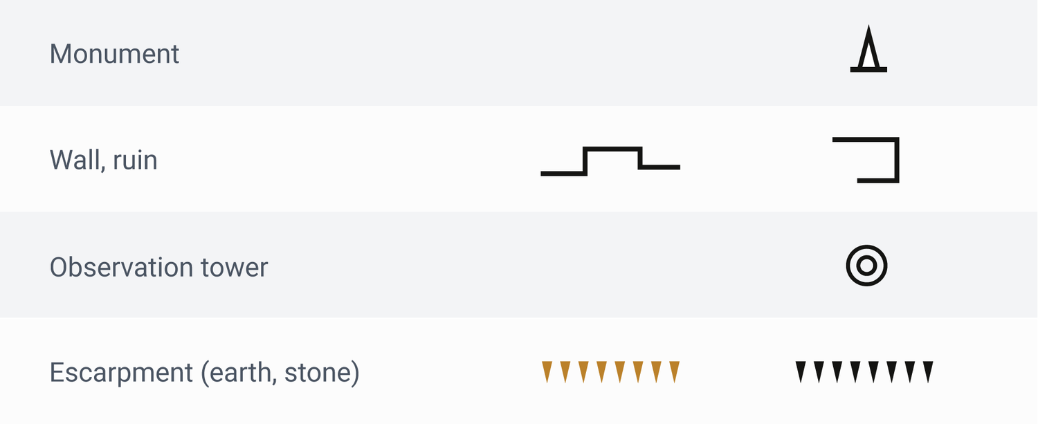
With these essential symbols, planning a riverside stroll or a hike becomes effortless. Add monuments, mysterious ruins, or scenic towers to your route, or use embankment symbols to find idyllic waterside rest spots – every excursion transforms into a highlight.
Map reading is in!
Being able to read maps is not just a useful skill for outdoor enthusiasts, it's helpful when planning a trip, too. With a bit of practice and the right information, you can organise your trips even better and impress your friends with your expertise. What's more, our famed Swiss national maps are among the most detailed and precise in the world. By the way: it does not matter whether you use swisstopo maps on your smartphone or on paper, as the key is always the same.
Want to learn more? You can find more information in the signs and symbols list (also known as a key) for all swisstopo maps: Map reading | swisstopo online shop (admin.ch)
Federal Office of Topography swisstopo
Seftigenstrasse 264
3084 Wabern