Transportation network CH
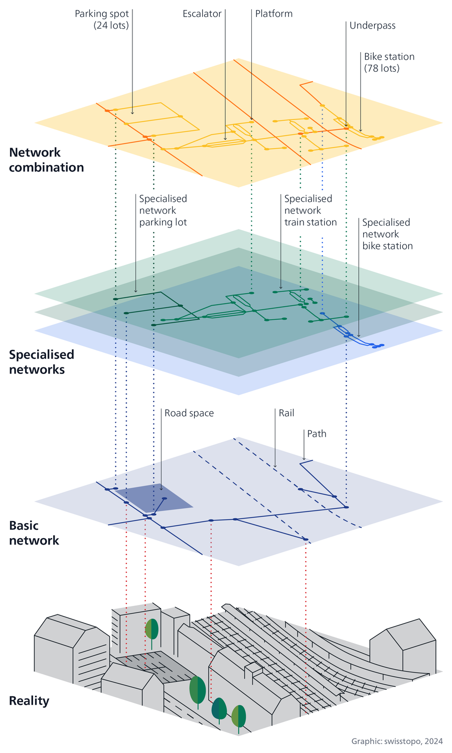
The national geodata infrastructure for mobility is being built with the Transportation network CH. This means that spatial data on Switzerland's transport system can be exchanged, linked and used more easily and efficiently in the future - even across national borders.
What is at issue?
Switzerland's mobility system is to become more flexible, more intelligent and more sustainable. There is still great potential here: the better networked the mobility system is and the more accessible the information is, the more efficiently infrastructures can be planned and utilized. This requires a reliable database.
Much of this data on Switzerland's transport network is already available in high quality. However, datasets are distributed across different levels of government and usually cannot be linked to each other. Some of them are duplicated and maintenance is time-consuming. Transportation network CH makes it possible to reference this spatial data on transport infrastructure and mobility on a common basis and link it in a highly automated manner. In this way, useful data combinations are created that were previously not possible or only possible with great effort.

What benefits does the Transportation network CH create?
Transportation network CH
- optimizes and expands the public sector’s traffic data infrastructure
- creates a common reference for transport infrastructure and mobility data
- makes the data on transport infrastructure and mobility combinable and general usable
- provides reliable basic data and makes it freely accessible to everyone
- promotes efficient data exchange and ensures transparent data origin
- ensures consistent and efficient data maintenance with clear processes
- forms the basis for innovations
- is interest-neutral
- ensures high quality of data and makes it sustainably available.
What has been achieved so far?
The implementation of the Transportation network CH system is underway and operations are being prepared. The first elements have been developed and operational. Among other things, a comprehensive basic network «swissTNE Base» is available as a common reference and is already used by various public sector actors and third parties.
The Transportation network CH is being built gradually in close coordination with DETEC's work on the future Federal mobility data infrastructure (MODI).
Index
Seftigenstrasse 264
3084 Wabern


