
Rapid Mapping
Rapid Mapping is a federal government service that collects and makes available geodata such as aerial or satellite imagery following natural disasters, in order to manage and document these events. The relevant authorities at all federal levels (federal government, cantons, communes) are actively supported in assessing and documenting the impacts of natural events.
Cooperation between authorities
In case of large-scale or nationally significant events, the Federal Office for the Environment (FOEN), together with the National Emergency Operations Centre (NEOC), coordinates the requirements of federal offices and cantonal agencies as well as any other stakeholders. Based on the requests received, the FOEN decides whether or not to deploy Rapid Mapping. If so, it instructs the Federal Office of Topography swisstopo to provide the data.
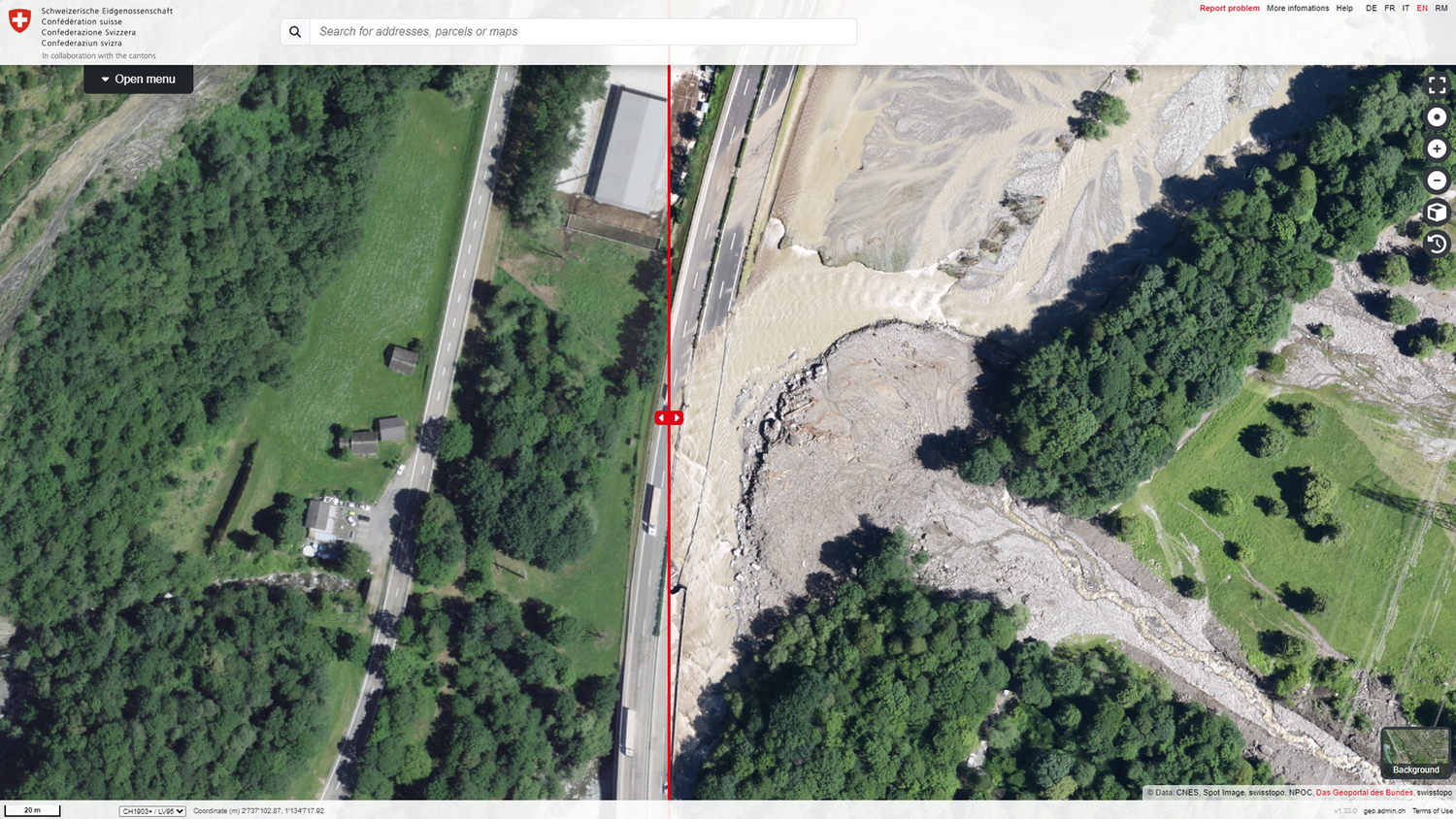
swisstopo obtains the required image data and makes the processed data available as Rapid Mapping products. In addition to the newly recorded (post-disaster) data, swisstopo also supplies the periodically updated basic geodata (pre-disaster) as a basis for comparison.
More information about Rapid Mapping
Federal Office of Topography swisstopo
Seftigenstrasse 264
3084 Wabern