
Siegfried Map
The original surveys for the Dufour Map were used for the publication of the 1:25,000 / 1:50,000 Topographic Atlas of Switzerland (Siegfried Map), which was produced between 1870 and 1926 as a co-operation between the federal government and the cantons, based on two Federal Acts dating from 1868.
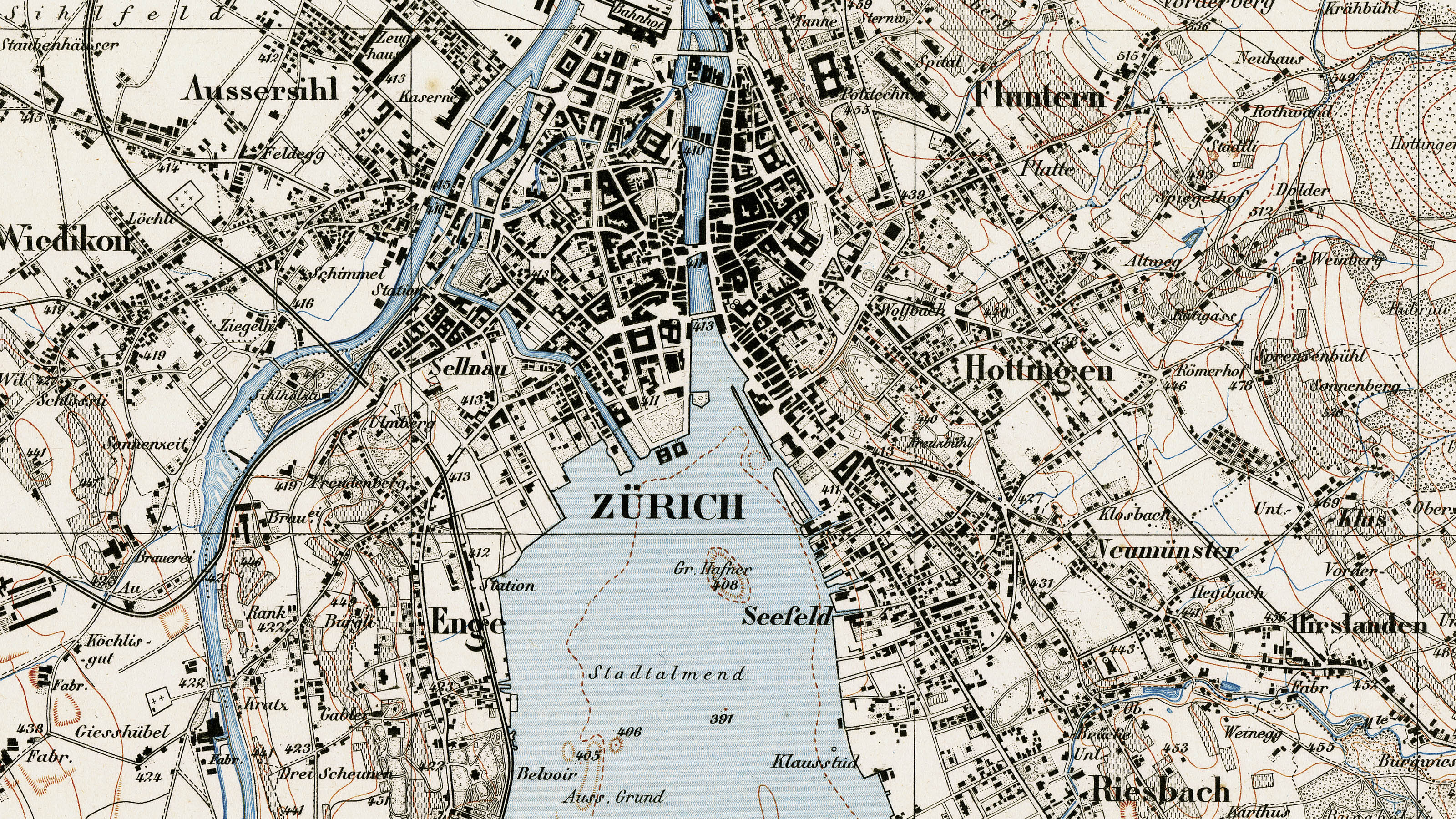
While work was still in progress on the Dufour Map, geologists, railway construction engineers as well as the Swiss Alpine Club (which was founded in 1863) were already expressing the wish for the original surveys to be published in their respective original scales of 1:25,000 (Jura, Central Plateau, southern Ticino) and 1:50,000 (region of the Alps). At the same time, the military department was restructured to create a new Staff Bureau based on the French model (Dépôt de la Guerre) and headed by Hermann Siegfried (1819-1879) from Zofingen. One of his main duties as Chief of Staff was to prepare and publish the 1:25,000 / 1:50,000 Topographic Atlas of Switzerland, which is also referred to as the Siegfried Map in his honour.
Design
The Siegfried Map was modelled on the Map of the Canton of Zurich, which was published between 1852 and 1865 as a 1:25,000 contour map. As a consequence, the areas of the country where the basis maps for the Dufour Map were using shading would have to be resurveyed for the Siegfried Map. Furthermore, a decision had to be taken whether the existing data only needed to be revised or a new survey was required, particularly in connection with sheets for the mountain regions.
Legal bases
On 18 December 1868, two Federal Acts entered into effect governing the continuation and the publication of topographic surveys.
Geodetic reference system
The Siegfried Map is based on the same geodetic reference system as that used for the Dufour Map. The only change was the introduction of 376.86 metres as the “Repère Pierre du Niton” (i.e. the reference point for altitude measurement). When this was replaced by a new reference point of 373.6 metres in 1903, both the elevations and the contours of the Siegfried Map remained unchanged in the old system.
Surveying process
Because Siegfried had only one or two full-time topographers allocated to him in the first few years, a lot of the topographic data had to be surveyed by private topographers on a contractual basis. The contractors had to strictly observe the specified instructions so that uniformity could be assured as far as possible. Special instructions also applied to revisions.
In areas to be newly surveyed, the first step was to geodetically determine the coordinates and altitudes of a sufficient number of points (3 to 5 kilometres apart) using third-order triangulation. These points were transferred in survey scale to the reference map sheet before the actual topographic surveys were carried out. In the field, the topographers had to compress the number of fixed points on the reference map by means of graphic triangulation before the surveys themselves could be carried out. The terrain forms were illustrated by means of contours, the equidistance of which was 10 metres for the Central Plateau and Jura and 30 metres respectively for the region of the Alps. The final steps were to draw the map in Indian ink and compile the (usually) three information sections (altitude register, index of roads and routes, nomenclature).
Division into sheets
The sheet division of the Siegfried Map is based on the criteria that were already specified for the Dufour Map. In addition to the sections with their own numbering, a sheet numbering method was also specified, but this was not structured systematically. In addition to their actual sheet numbers, some sheets are also suffixed with “-bis” or even “-ter”.
Reproduction
The 1:25,000 sheets of the topographic atlas were reproduced as copperplate engravings in three colours (black, brown, blue), while the 1:50,000 sheets in the Alpine regions were reproduced as lithographs. Publication commenced in 1870, and the first editions were completed in 1922 (1:25,000, 462 sheets) and 1926 (1:50,000, 142 sheets, 118 of which were processed by Rudolf Leuzinger) respectively. The entire map collection was updated until 1949, though no actual revision cycle is apparent.
Accuracy
The guidelines dating from 1888 for the 1:50,000 scale required that the mathematical average of deviations of ten points from their correct location did not exceed 0.7 millimetres (35 metres) in the projection. Errors of 1.5 millimetres (75 metres) were not acceptable. For the 1:25,000 scale, the maximum permissible deviations were 0.5 millimetres (12.5 metres) and 1.2 millimetres (30 metres) respectively. The guidelines contained differentiated information. It is therefore essential to take these accuracy factors into account when superimposing the Siegfried Map with the modern national map in a geographic information system (GIS).
Praise for the Siegfried Map
If the Dufour Map can be described as the map of the newly created confederation, the Siegfried Map may be regarded as the map of the 1874 revision of the Constitution. With its depiction of terrain using contours, the map is characterised by scientific sobriety. The cliff illustrations in particular received widespread praise thanks to the high degree of geological know-how of some of the topographers (above all the so-called “genetic” cliff drawings by Fridolin Becker and Xaver Imfeld, both of whom were pupils of renowned Alpine geologist Albert Heim)
Federal Office of Topography swisstopo
Seftigenstrasse 264
3084 Wabern