
Sion - the 1831 baseline
The magnificent cultural and historic achievement of the Dufour map is due among other things to the fact that this work was created against the background of an as yet ununited nation. Dufour therefore had to rely on a major collaborative effort of experts from the individual cantons.
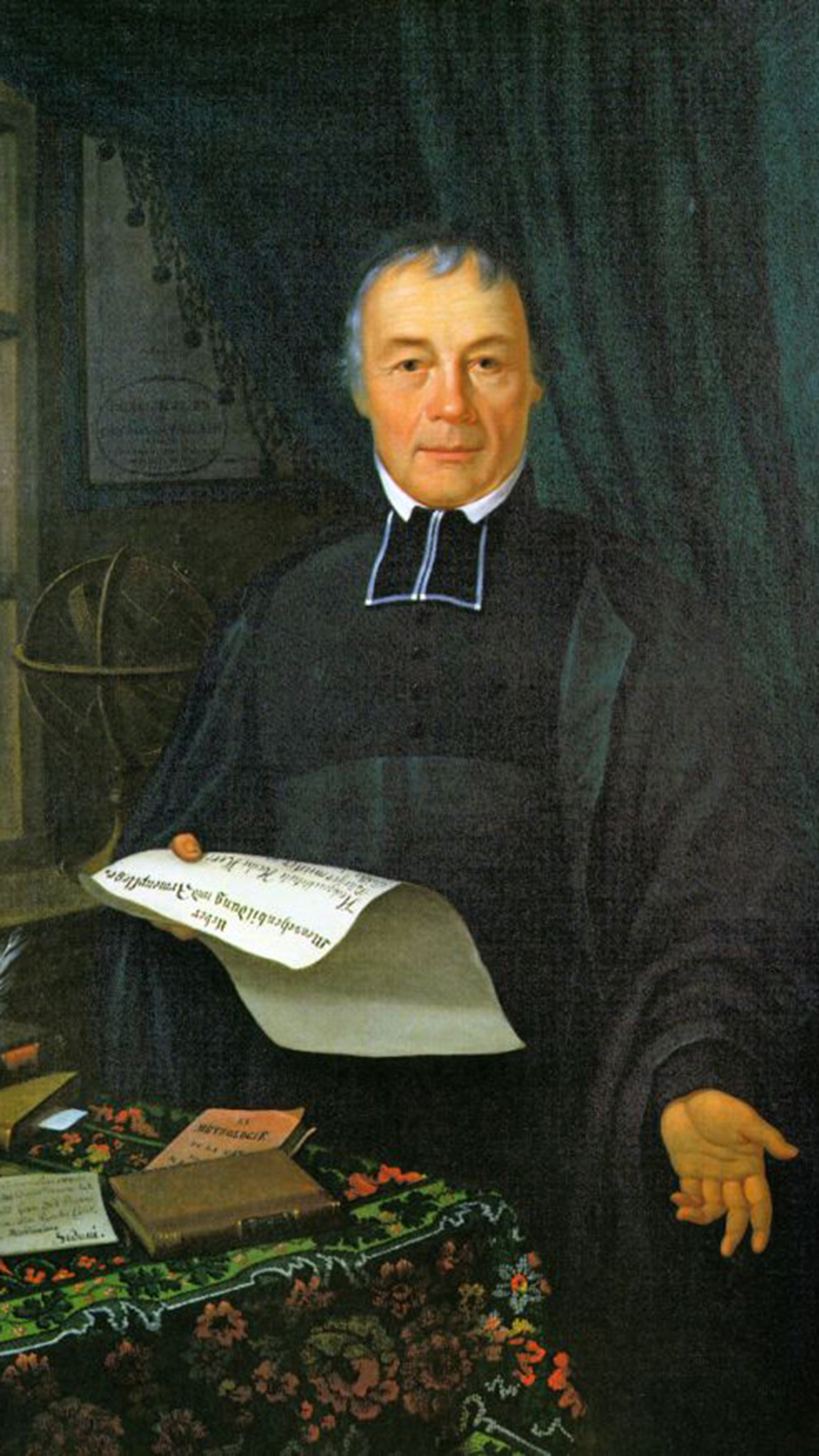
One example of this principle of federal cooperation is the work of the Sion-based Canon Josef Anton Berchtold (1780-1859). Following the rejection of his theological writings, he dedicated himself to mathematics and natural science studies. He began the preparations for his magnum opus, the trigonometric survey of his native canton, around 1826.
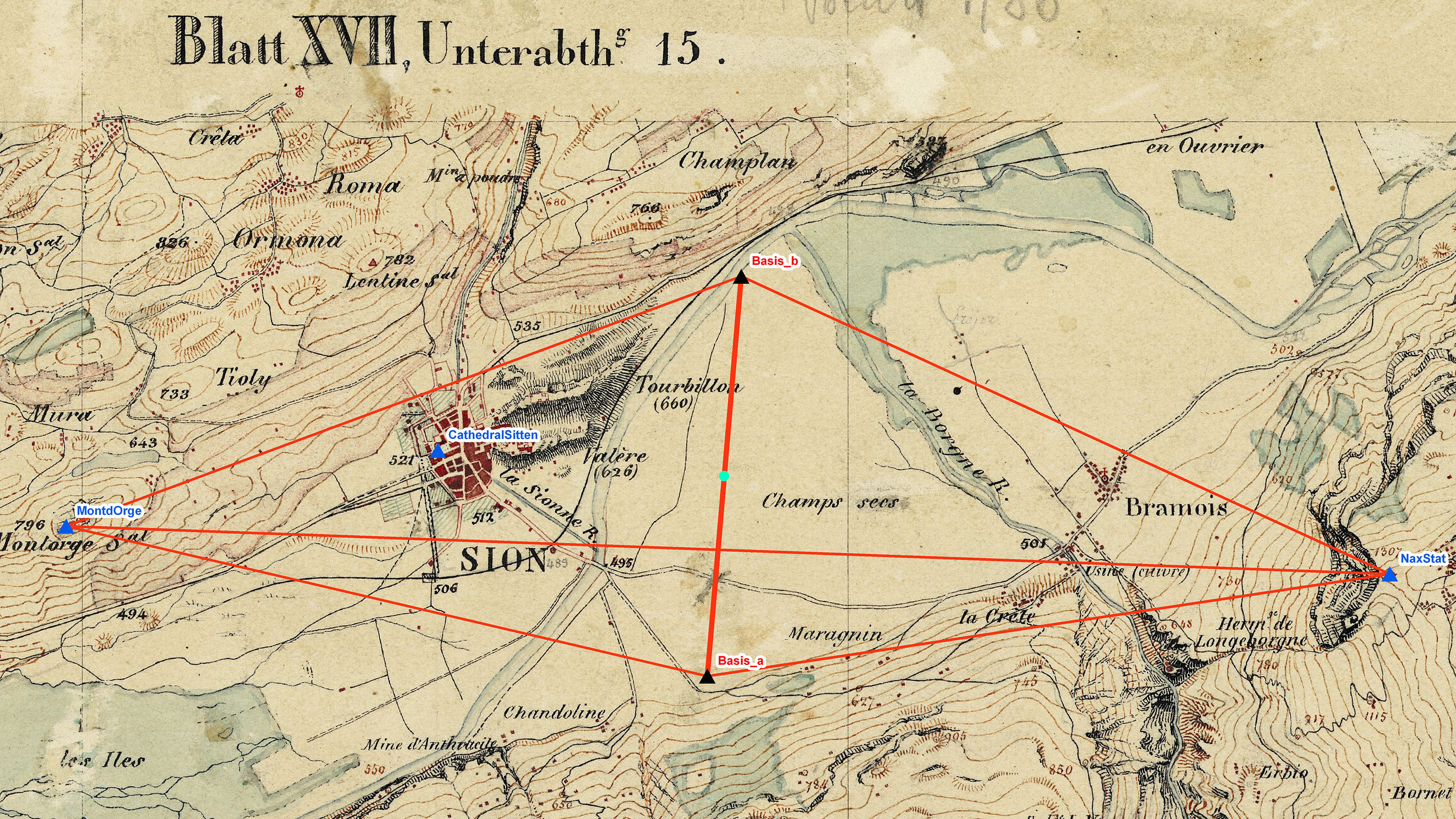
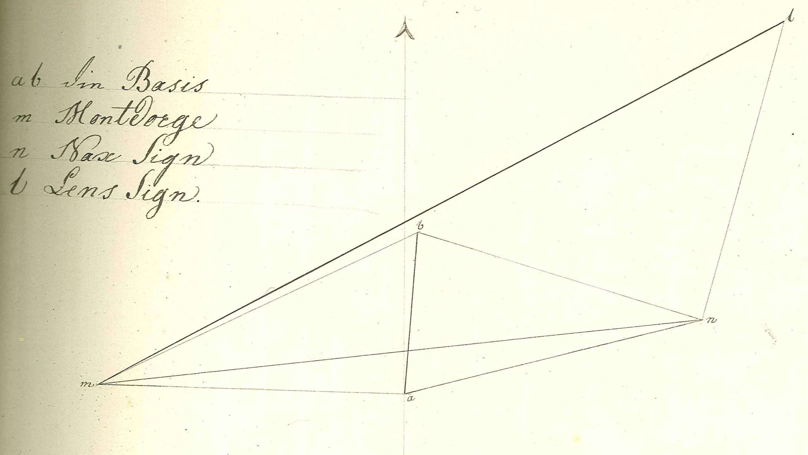
Berchtold was already 51 years old when, in March 1831 in Champsec, east of Sion, he measured a baseline of 2,095.82 metres with iron poles. It is from this baseline – put simply – that the dimensions of the Valais were measured. He was able to measure horizontal and vertical angles with a theodolite. As shown in Figure 2, the length of his baseline (a-b) over the mid point at Nax (n) was transferred to the triangle side Mont d'Orge-Lens marker (m-l). In his first grid, he even surveyed the Cathedral of Sion where, two years before, he had still conducted mass. He wanted the coordinates for the canton of Valais to be referenced by it.
It was first necessary to integrate the “Base de Sion aux Champs secs” baseline, which previously had no identifiable location. A GIS (geographic information system) showed that it did not match the national map and was thus not to scale. A small triangular grid was set up on the basis of Berchtold's notebooks from the federal archives. The triangulation grid was equalised following translation of the data into the input format of LTOP, the triangulation adjustment software. The results of this “free grid” (Figure 3) substantiate the high quality of Berchtold's observations: the maximum directional correction was 18.8 mgon and the maximum transverse deviation 117 mm over a distance of 16.2 km.
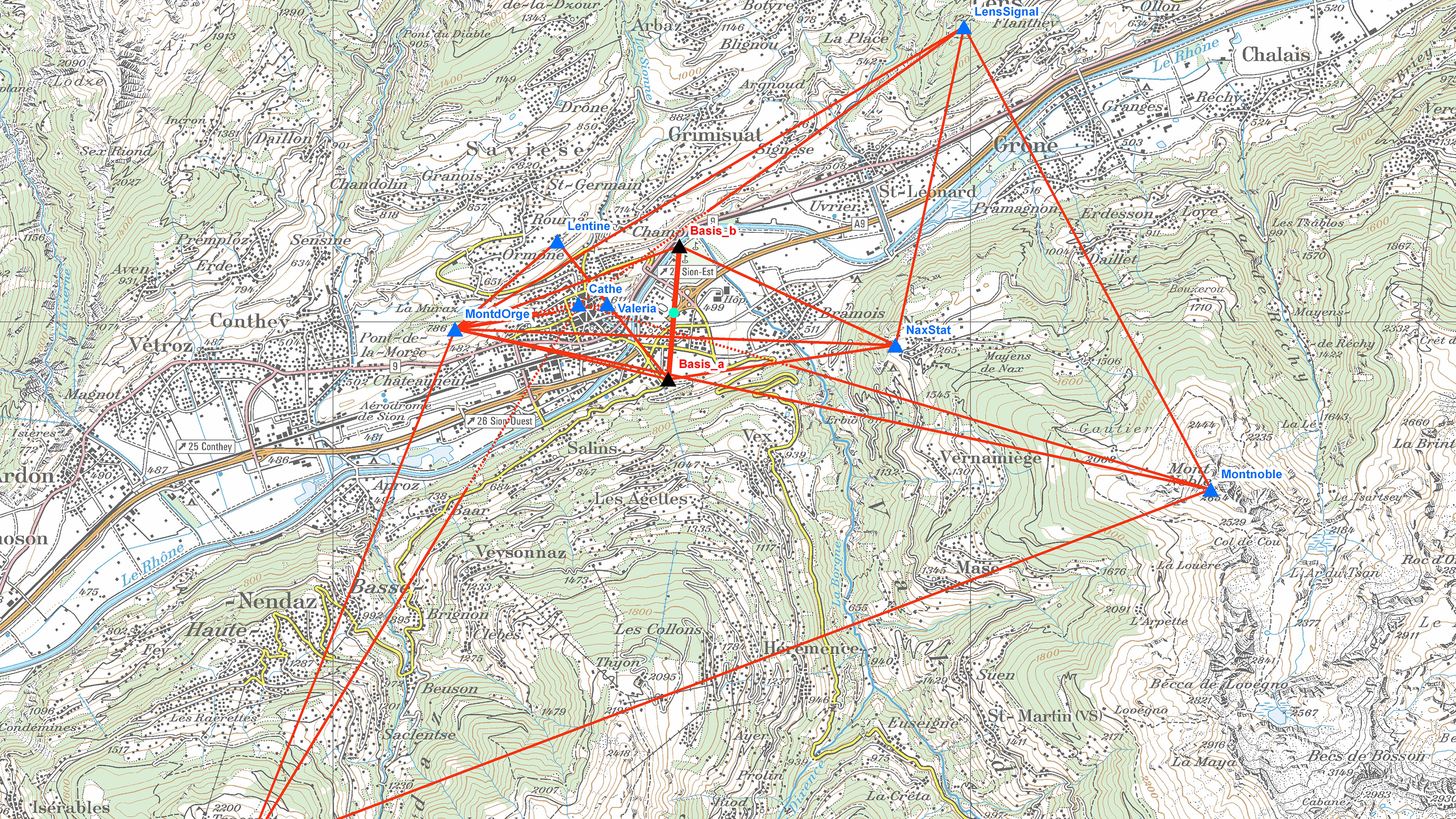
Fig. 4 shows how the direct measurements of the baseline on the ground were transferred to the Mont d'Orge–Nax triangle side in such a way that the distances between all trig points and their coordinates could then be calculated. From 1836, Berchtold was energetically supported by his nephew Josef Anton Müller (1816–1881), who was only 20 at the time. In 1844, uncle Berchtold and nephew Müller were able to complete the triangulation of the canton of Valais. The incredibly comprehensive work is collected in the Valais state archive. The 1,500 pages of calculations contain the 153 trig points and 7,500 angles measured along with the calculations for 850 points.
Following the conclusion of the work, the canton of Valais was ready for the topographic survey relating to the Dufour map.
Federal Office of Topography swisstopo
Seftigenstrasse 264
3084 Wabern