
Snow Sports Maps 1:50'000
Proper preparation for any ski or snowshoe tour is essential. The snow sports maps published in collaboration with the Swiss Alpine Club form the basis for this.

Order the 1:50'000 snow sports map as printed version

The 1:50'000 snow sports maps from swisstopo are an essential accessory for every ski or snowshoe tour, whether during the planning stage at home or when help is in need on the slopes.
Order the 1:50'000 snow sports map
Order mySwissMap with snow sports map

The familiar national maps, the snow sports map or an aerial map made to measure - with mySwissMap you can design your own personal paper map with just a few clicks. Create your own piece of Switzerland!
Order your mySwissMap with snow sports map
Digital supplementary information
Detailed additional information on avalanches and wildlife protection, as well as details for each route, are available digitally.
Digital supplementary information for the snow sports map 1:50 000
View topic «Snowsport» online

Discover the swisstopo maps and geodata conveniently on your screen. Retrieve route information directly by clicking on the route, measure distances and areas, compare current and historical aerial photos or add a drawing. You can print out the result or share it with your friends.
View the «Snowsport» theme in the map.geo.admin.ch viewer
swisstopo app for winter sports fans
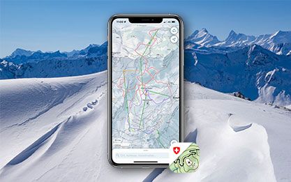
The swisstopo app shows all National Maps from the scale of 1:10'000 to 1:1 million, as well as aerial photographs, aeronautical maps and historical maps covering the whole of Switzerland. The maps are supplemented by additional information relating to public transport, hiking, cycling, snow sports and aviation. In addition to the official routes of the Swiss hiking trails, the app also contains SwitzerlandMobility routes.
Index
Map reading
The brochure “Map reading” and the explanation of symbols provide useful information for users of the national maps and for teaching purposes.
You can order the brochure in paper form here: Map reading | swisstopo Online Shop
Federal Office of Topography swisstopo
Division Cartography
Seftigenstrasse 264
3084 Wabern
Seftigenstrasse 264
3084 Wabern