
Swisstopo geodata for glacial purposes
The GLAMOS Glacier Monitoring network observes the development of around 120 Swiss glaciers. Basic geodata from swisstopo in the form of aerial photographs, orthophotos, elevation models and vector data enable high quality content and facilitate research work.
During the last Ice Age about 20,000 years ago, a large part of Switzerland was covered by glaciers. Today, the melting of these glaciers is one of the most obvious consequences of climate change. According to measurements taken by the Glacier Monitoring network in Switzerland, two percent of Switzerland’s total ice volume disappeared again last year. Initially, the melting ice provides more water for agriculture and hydroelectric power. In the longer term, however, less water is available and it is more poorly distributed, which could lead to a shortage of drinking water in the dry summer months. Glacier melt also triggers natural hazards such as floods, landslides or mudslides and causes sea levels to rise.
Glacier Monitoring in Switzerland
GLAMOS (Glacier Monitoring in Switzerland) observes and documents long-term glacier changes in the Swiss Alps. Data is systematically collected on the development of area, volume, snow accumulation and ice melt, as well as glacier flow and ice temperatures. This information is important for understanding the interaction between glaciers and the climate. It is also used to estimate water resources, natural hazards and future sea level rises. The project is run jointly by ETH Zurich and the Universities of Fribourg and Zurich, and works closely with the Cryospheric Commission (CC). It is supported by the Federal Office for the Environment FOEN, MeteoSwiss, the Swiss Academy of Sciences SCNAT and the Federal Office of Topography swisstopo.
TLM as a new basis
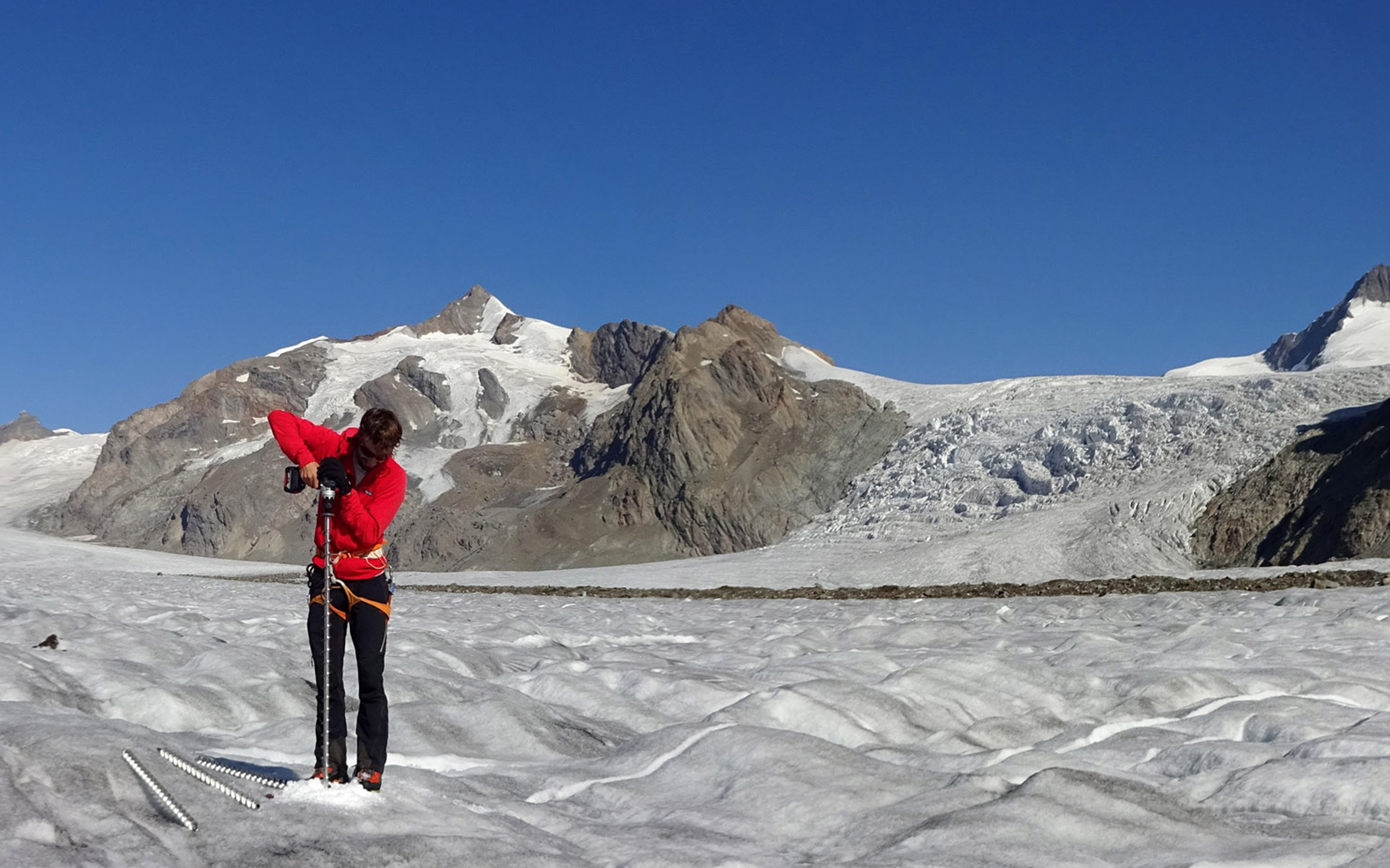
Every year, the swisstopo flight service conducts special flights over selected glaciers, tailored to the needs of GLAMOS. The resulting aerial photographs and orthophotos are used to document and visualise glacier changes and to measure glacier length and extent. The elevation models derived from the aerial photographs make it possible to determine changes in ice volume. In the case of an exceptional event, such as the breaking off of part of the Trift glacier above Saas-Grund in September 2017, swisstopo carries out extraordinary aerial surveys in consultation with the parties involved in order to document the event.
Another important task of GLAMOS is the compilation of a glacier inventory which records the areas and contours of all Swiss glaciers. Due to the great effort required in compiling them, there have only been three detailed and comparable glacier inventories for the territory of Switzerland up to now, namely for the years 1850, 1973 and 2010. The glacier inventory of 1850 is based on a reconstruction of the glaciation expanse with moraine. Aerial photographs from swisstopo were used to create the inventories for 1973 and 2010. Since 2018, GLAMOS has been using the swissTLM3D topographic landscape model to update the glacier inventory as the perimeters of the glaciers are recorded there as independent objects. Thanks to the use of swisstopo's TLM data, Switzerland's glacier inventories can be compiled much more quickly, more comprehensively and to a very high level of detail. Another advantage is that the continuity of the data set is ensured over a long period of time, which enables the inventory to be constantly updated.
The new Swiss Glacier Inventory (SGI 2016) was compiled on the basis of swissTLM3D data and covers the period between 2014 and 2018. Visualisation of the data is already available at map.geo.admin.ch.
Further information
Seftigenstrasse 264
3084 Wabern