
swisstopo makes its geodata BIM-compatible
Ever more geodata now have to meet the requirements of building information modelling (BIM). With its geoBIM strategy, the Federal Office of Topography swisstopo is addressing this issue, has defined various fields of action and formulated corresponding measures. The aim is to develop national standards for coordinated high-quality data that can be widely used.
What is at issue?
In the field of building information modelling (BIM) the situation is highly dynamic: on the one hand, the Digital Switzerland Action Plan1 requires federal building and real estate organisations to plan, construct and operate their buildings using BIM by 2025. On the other hand, swisstopo repeatedly receives requests to provide geodata for BIM processes.
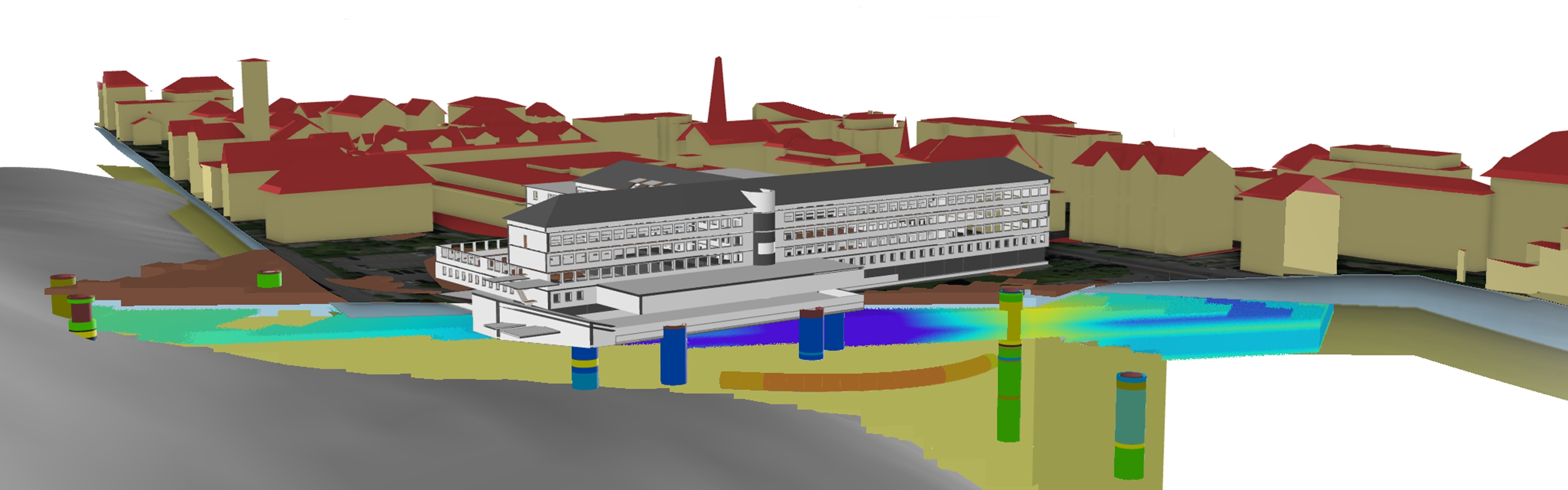
Buildings are always embedded in a real environment, which is replicated in digital form with the aid of geodata. The combination of geodata and BIM project data is referred to as geoBIM. This involves the combination of mostly 3D projects from CAD systems with data from geographic information systems.
swisstopo possesses comprehensive know-how in the field of modelling and standardisation of geodata models, both with its own data and with data from other sources that first have to be coordinated and processed as necessary – for example, from the geodata inventories of various cantons.
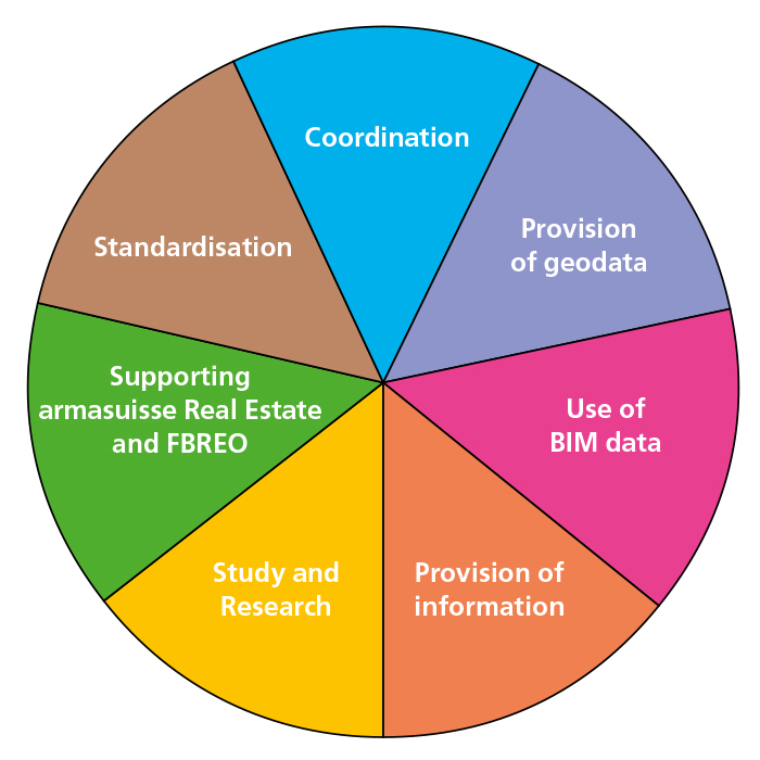
With its geoBIM strategy, swisstopo now aims to apply its technical expertise and experience in the field of standardisation of geodata in the area of geoBIM – throughout the country and to the benefit of the whole of society.
The geoBIM strategy does not stand alone, but is based on swisstopo geoinformation strategy for Switzerland, swisstopo Strategy 2025 and the cadastral survey strategy for the period from 2020 to 2023.
swisstopo’s management board approved the geoBIM strategy in April 2022.
Index
Seftigenstrasse 264
3084 Wabern