The history of the cadastral system: From Theodolite to Satellite Measurement
From the first cadastral maps in the 17th century to satellite measurement: Swiss surveying techniques have continually evolved over time. Today, they provide data with centimetre-level precision and will soon make it possible to create three-dimensional models.
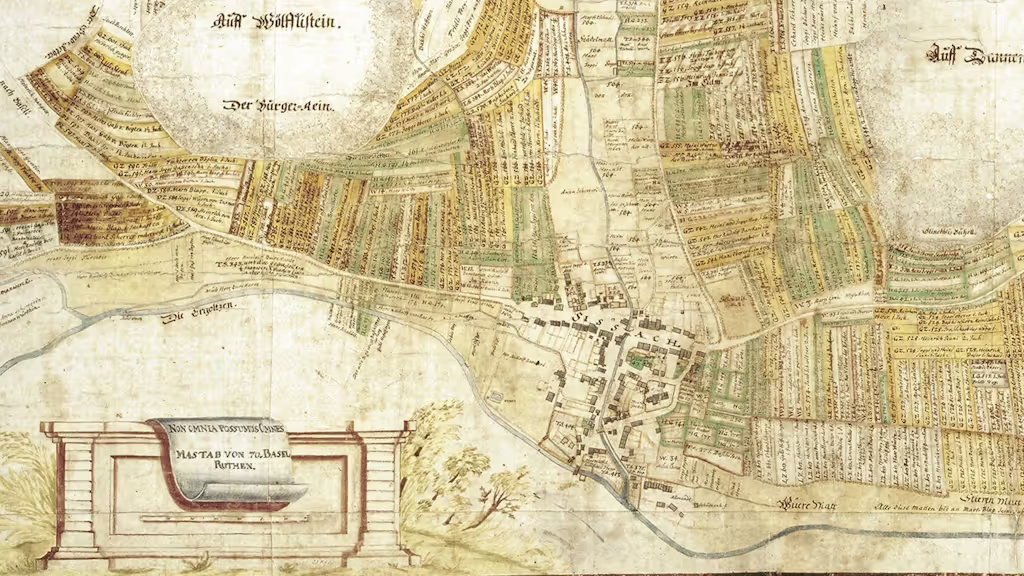
The first cadastral maps in Switzerland were created in the 17th century. Their purpose was to collect taxes on land ownership. Starting in the 19th century, some cantons ordered topographic surveys of municipalities, but there were no uniform rules for the cadastre. This changed in 1912 with the introduction of the Swiss Civil Code, when it was decided to establish a federal land register. Cadastral surveying then became a federal responsibility, with implementation delegated to the cantons—a practice that still continues today.
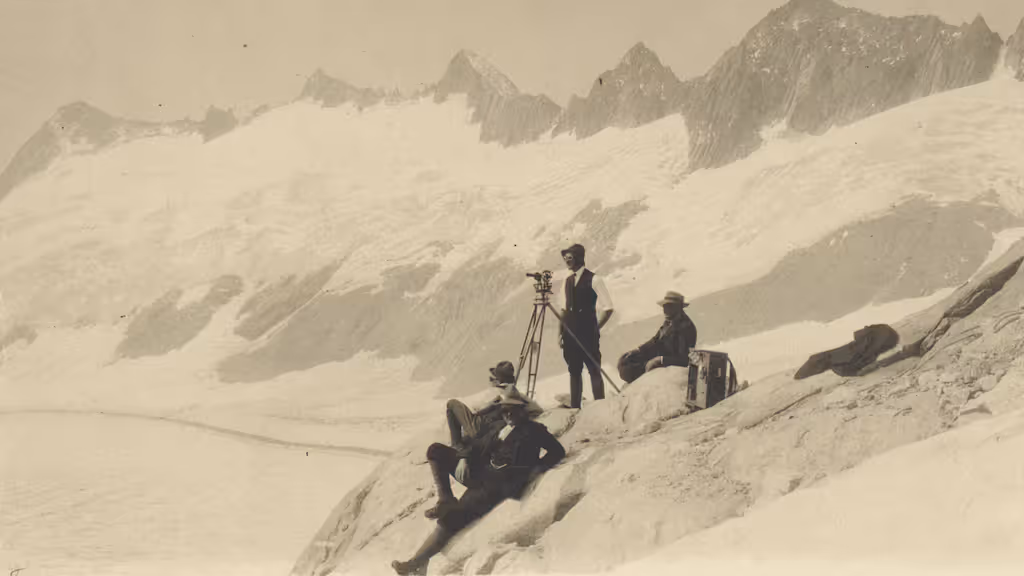
As early as 1903, the geodetic reference framework for national surveying in Switzerland was established. A first network of fixed points covering the entire country was created, based on around 5,000 triangulation points. These were often located on mountain peaks, hills, or church towers—places visible from far away. Many of these points still exist today, for example on the Gurten, the iconic hill in the city of Bern, or on the Chasseral. At that time, Switzerland’s zero point was located at the old observatory of the University of Bern.
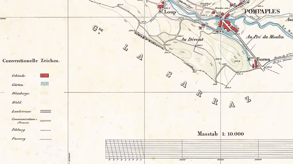
In the past, theodolites and leveling instruments were sufficient to obtain measurements as precise as possible, although deviations of more than a metre were not uncommon. Over time, technical capabilities have greatly advanced. Today, satellite measurements allow for centimetre-level accuracy. In 1995, the new geodetic reference frame LV95 was introduced, and since then the reference point has been located in Zimmerwald. The result: data is significantly more accurate.
A 3D Model for the Future
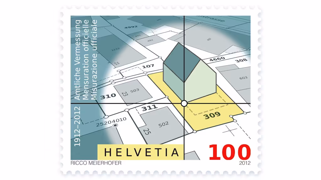
And development continues. In the future, elevation will also be included in the cadastral system, explains Christoph Käser, head of official surveying and the ÖREB cadastre at swisstopo. Currently, height is not yet taken into account in cadastral surveying; only the position of an object is recorded. However, surveying also allows for the determination of an object’s elevation and therefore the creation of three-dimensional models. In the future, this capability will also be incorporated into cadastral measurement.
Additional content (only available in French, German or Italian)
1650–1840: Les débuts du cadastre suisse
Les premiers plans cadastraux servaient à des fins fiscales. Jusqu’au milieu du XIXème siècle, les mensurations se faisaient différemment d’un canton à l’autre.
1841–1923: Du concordat des géomètres à la mensuration cadastrale fédérale
La mensuration officielle organisée au niveau cantonal devient une tâche commune de la Confédération et des cantons dans le but de garantir la propriété foncière.
A partir de 1920: Vers une mensuration officielle couvrant l’ensemble du territoire avec un libre choix de la méthode
Le développement de la technologie conduit au libre choix de la méthode et à la numérisation dans la mensuration officielle. La couverture du territoire doit être atteinte grâce à un programme de mensuration à l’échelle nationale.
A partir de 1993: Nouvelles bases pour le système cadastral
Avec de nouvelles normes juridiques pour la mensuration officielle, ses données deviennent des géodonnées de référence: pour la protection de la propriété foncière et bien d’autres applications.
A partir de 2014: Extension du système cadastral suisse
Outre la mensuration officielle, le registre foncier et le cadastre RDPPF, le système cadastral suisse doit être complété par un cadastre des conduites.
The Swiss cadastral system – the invisible foundation of our land ownership
The Swiss cadastral system provides clarity: it protects land ownership, creates transparency and guarantees legal certainty – a one-of-a-kind model worldwide.
Folio 2025 – For a safe Switzerland
Security extends far beyond the military sphere. It encompasses issues such as the prevention of natural hazards, the sustainable management and supply of resources, the protection of property rights, the stability of infrastructure and the provision of information to the public. Geodata plays a key role in all these areas.