
The more, the better
The current network of geodetic points in Switzerland has been operated by swisstopo for 30 years. These points form the reference frame for all surveys carried out in the country. Repeatedly monitoring a point over several years shows whether and in which direction a region of Switzerland may be moving. The collected data simplifies the monitoring of natural hazards such as earthquakes or landslides.
Resurveying
Surveying data gathered over several years at a certain point (i. e. time series) is valuable. Frequent resurveying ensures the significance and reliability of the collected data. This continuous approach provides data for evaluations and analyses of specific places and regions.
Better Safe than Sorry
Hazard Prevention
The results of the repeated surveys are used to create velocity models. These models show how fast Switzerland, or a region thereof, is moving in a certain direction. Within the country, persistent movements of the top layers of the earth’s crust may cause problems. Movements in the earth’s crust in any directions generate tensions. Earthquakes occur when these tensions are released abruptly. Accelerating points are indicative of risks such as landslides.
Everything is in Motion
Movement occurs not only horizontally but also vertically (see map below). The Alps were formed by moving tectonic plates or, more precisely, by the collision of the African and the Eurasian tectonic plates. This process is still ongoing and the Swiss Alps continue to rise to this day, as is indicated by the values measured at geodetic points in the Alps. The Lower Engadine in the very east of the country, is rising the quickest at 1.4 millimetres per year. Nevertheless, due to continuous erosion, the mountains are not becoming any higher while the geodetic points on the valley flanks are rising.
This model illustrates the vertical movements of the country in millimetres per year.
Outlook and Forecasts
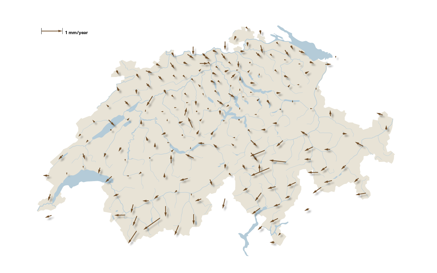
Lateral shifts in Switzerland are very constant. It is highly probable that the geodetic points – and thus the terrain – will continue to move in the same way in the future. However, not all areas of Switzerland are moving at the same speed or in the same direction. The area near Les Haudères at the end of the Val d’Hérens (VS) is moving the quickest at 1 millimetre per year in direction south-west. The Alpine regions generally move faster than the Swiss Plateau.
Time Series
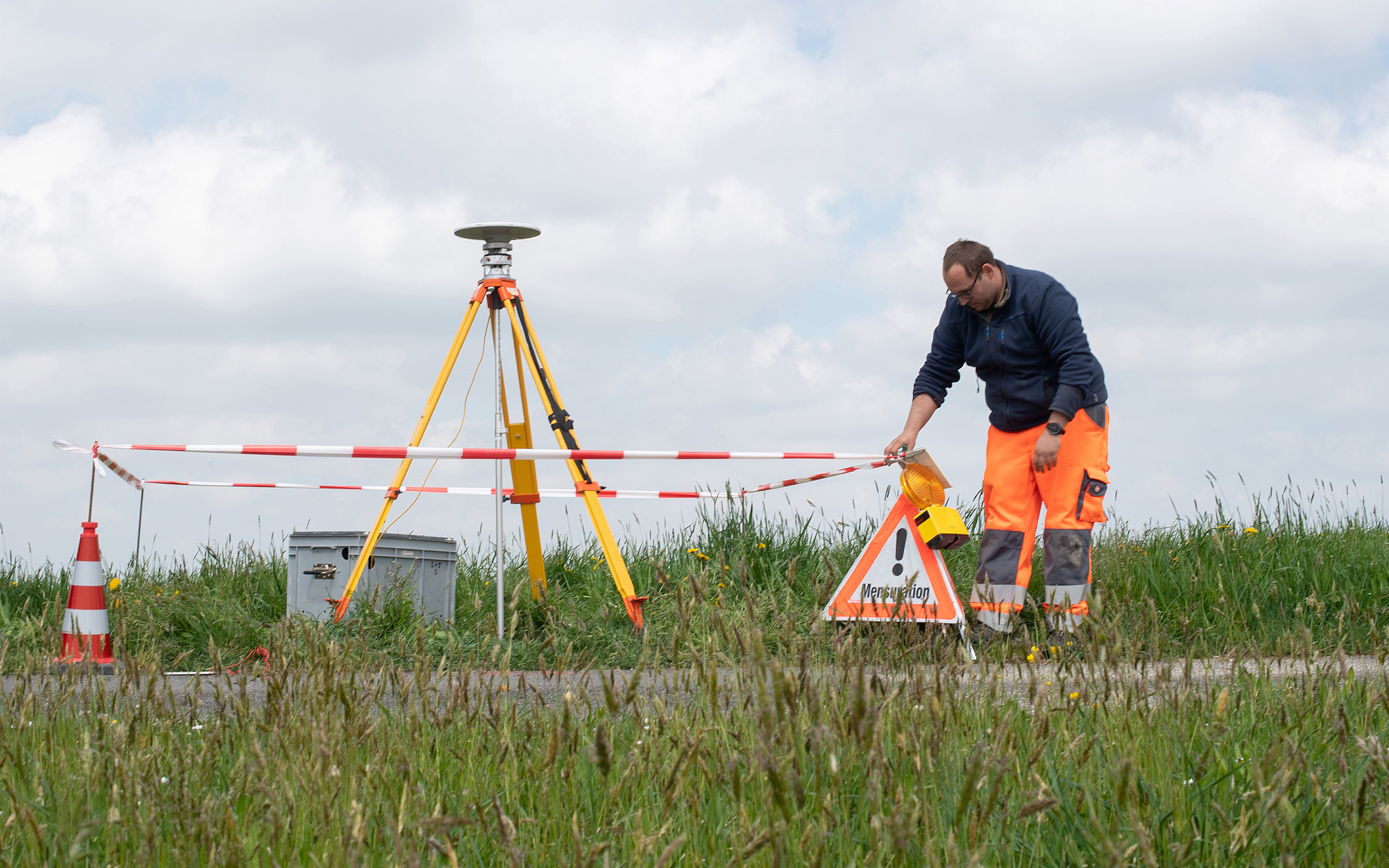
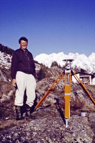
A time series is a temporal sequence of data of an object. For over 175 years, swisstopo has been producing data on the same topics and areas at regular intervals. The oldest dataset is the geodata used to create national maps. At that time, a geodetic point network used to create the first maps was already in place swisstopo experts have been surveying and monitoring Switzerland’s 220 geodetic points since 1992. By measuring the same locations over time, it is possible to create a velocity model. This model illustrates the horizontal and vertical movements of the country.
Read more about the GNSS survey 2022
- Good planning is half the survey
- Switzerland is moving
- The more, the better
- Hammering to millimetre precision
Federal Office of Topography swisstopo
Seftigenstrasse 264
3084 Wabern