The Theodolite. A high-tech instrument on the Alpine summits
The theodolite was a key instrument in the production of topographic maps. The heavy, bulky, and complex instrument demanded a great deal of the porters and engineers but also took them to wild spots with breath-takingly beautiful scenery. But what exactly did theodolites do?

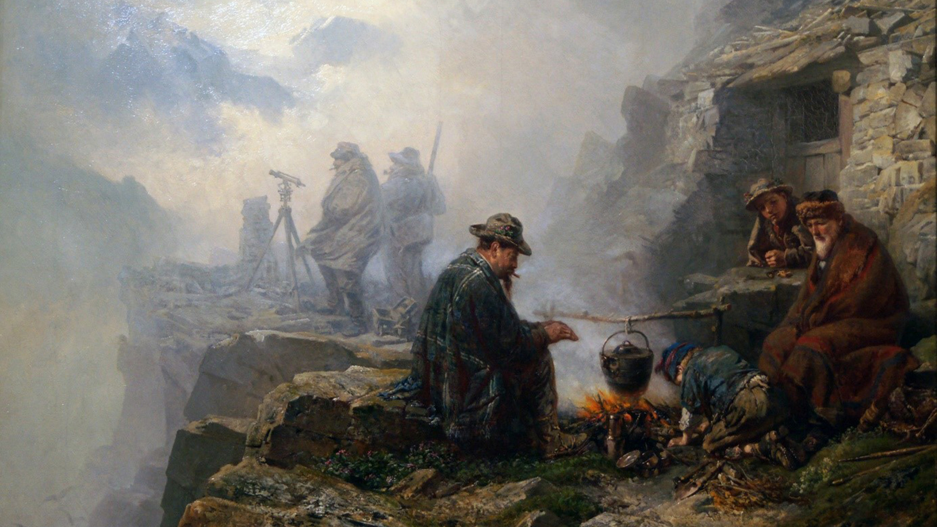
In 1870, painter Raphael Ritz from Valais created an atmospheric painting. It shows six people in a misty, rocky landscape engaged in different activities. A group of men gather around a campfire to warm themselves and cook a meal. In the background are two shadowy figures using an instrument which, at first glance, looks like a telescope on a tripod. They are keeping an eye on the weather and waiting for a clear view: The Engineers in the Mountains, as Ritz's work is called, are waiting to survey the Swiss mountains.
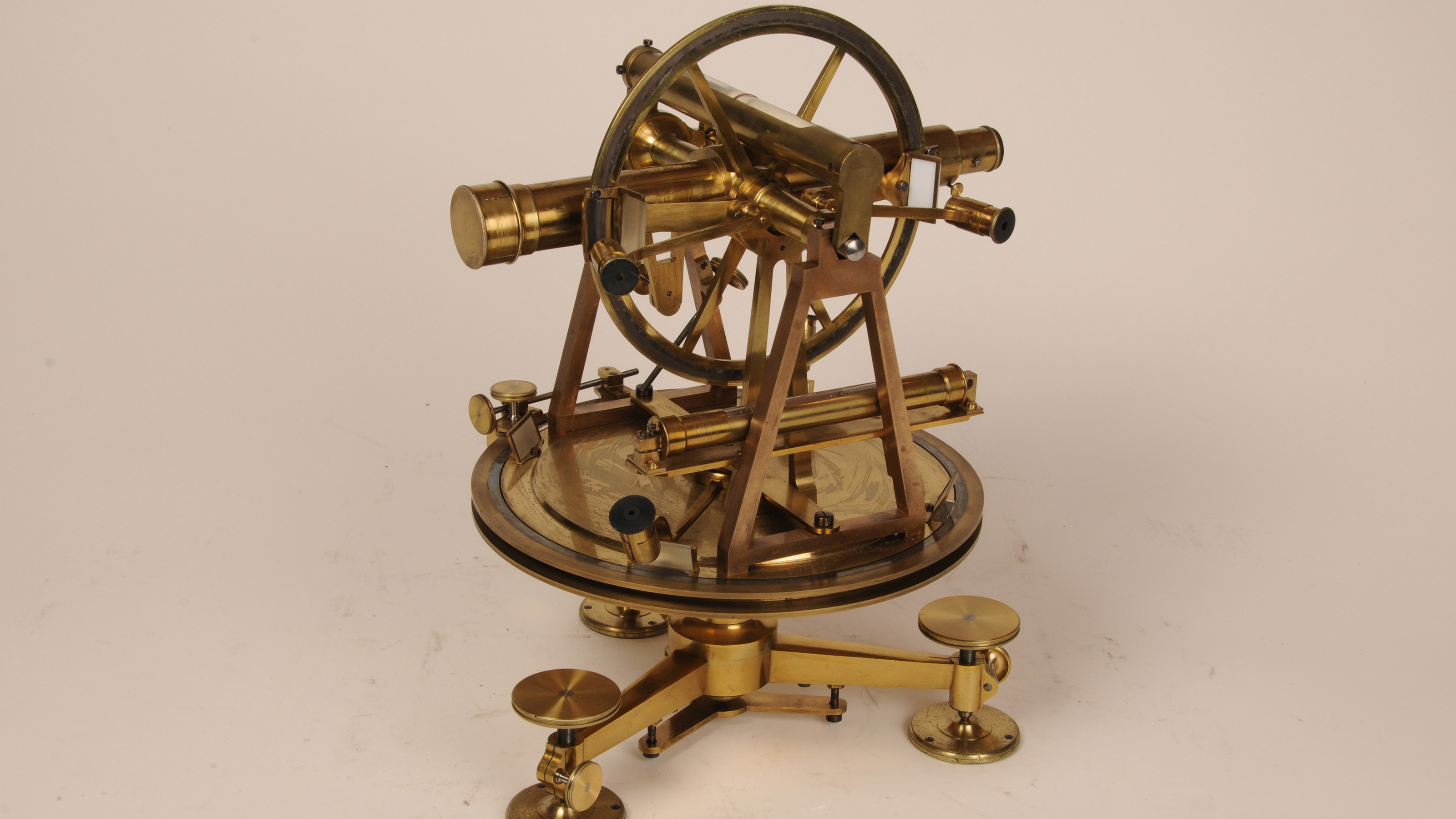
The instrument is what is known as a theodolite which enables the measurement of horizontal and vertical angles. Although in the painting it almost melts into the sea of clouds, it is the actual protagonist of the scene: without the theodolite, the six men would not be in this location; their wanderings through the mountains are determined by the demands of this instrument.
Task and function of the theodolite
Theodolites were key instruments in the production of topographic maps and they were also used in construction projects. This was particularly the case in the construction of the Gotthard tunnel (1872-1882) where measuring instruments contributed to the successful breakthrough. But what exactly did theodolites do?
The principle of the theodolite is abstract but at the same time characterised by a fascinating simplicity. It is based on the laws of triangle calculation (trigonometry). If the side length and two angles of a triangle are known, the two remaining side lengths and the third angle can be determined precisely. Thanks to the theodolite, this was not only achieved on paper in a warm office but also out on the open terrain.

In an ideal triangulation, engineers and their assistants first measured an imaginary distance (base line) on a flat field with the best possible accuracy. In this way, one side length and two angle points of an invisible triangle can be accurately identified. In Switzerland, the baseline measurements for the Grosse Moos and Sihlfeld (both 1834) were of the greatest importance.
The theodolite was then used after the baseline measurement. Positioned vertically above one of the two end points of the baseline, the engineers directed the instrument's scope to the point they had selected as the third corner of the triangle. This point should be clearly visible but also not too close. For this reason, mountain peaks, church steeples or other prominent landscape elements were often chosen as target points.
On the circular disc of the theodolite, the engineers read off the two directional angles which connected the third corner point with the two end points of the baseline. A triangle with comprehensively determined side lengths and angles was now invisibly embedded in the landscape.
The sides and corners of one triangle could be used as a starting point for the measurement of other triangles. Triangle thus joined triangle, gradually covering regions, countries and even continents with a network of known location points.
It should be noted that historical triangulations mostly deviated from the typically ideal procedure described here. Often angles between prominent points in the landscape were determined without first measuring a baseline. Instead, the geodesists used older, known baselines or were connected to the sides of foreign triangle networks.

At high altitudes
The corner points of the surveying triangle were often located on mountain tops in remote places and at high altitudes. The hike which accompanied the angle measurement was accordingly full of privation - Ritz's painting bears witness to this.
Since a theodolite with accessories could weigh several hundred kilos, it had to be disassembled for transport and reassembled at the place of use. This "carpentry work", as a noticeably annoyed forest surveyor called it in 1863, took up more time than the actual angle measurement. Porters accompanied the surveyors to transport the valuable instrument to the often-adventurous locations where it was used on mountain peaks, glaciers and steep slopes. Once at the site, they were dependent on visual contact with neighbouring points up to 60 kilometres away. Bad weather often led to long waits in uncomfortable surroundings.
In 1878, Dufour biographer Walter Senn impressively described the arduous surveying work on difficult terrain:
In order to be able to appreciate the colossal difficulties [...] one has to consider that first of all the whole country had to be surveyed down to the furthest corners and up over the highest glaciers down to the smallest detail, no one who has not already wandered for days on end, freezing in fog and rain in the inhospitable heights above, all through the day far away from any human dwelling and exposed to the danger of death with every misstep [...] can imagine the enormous amount of work that the mountainous nature of our country represents.
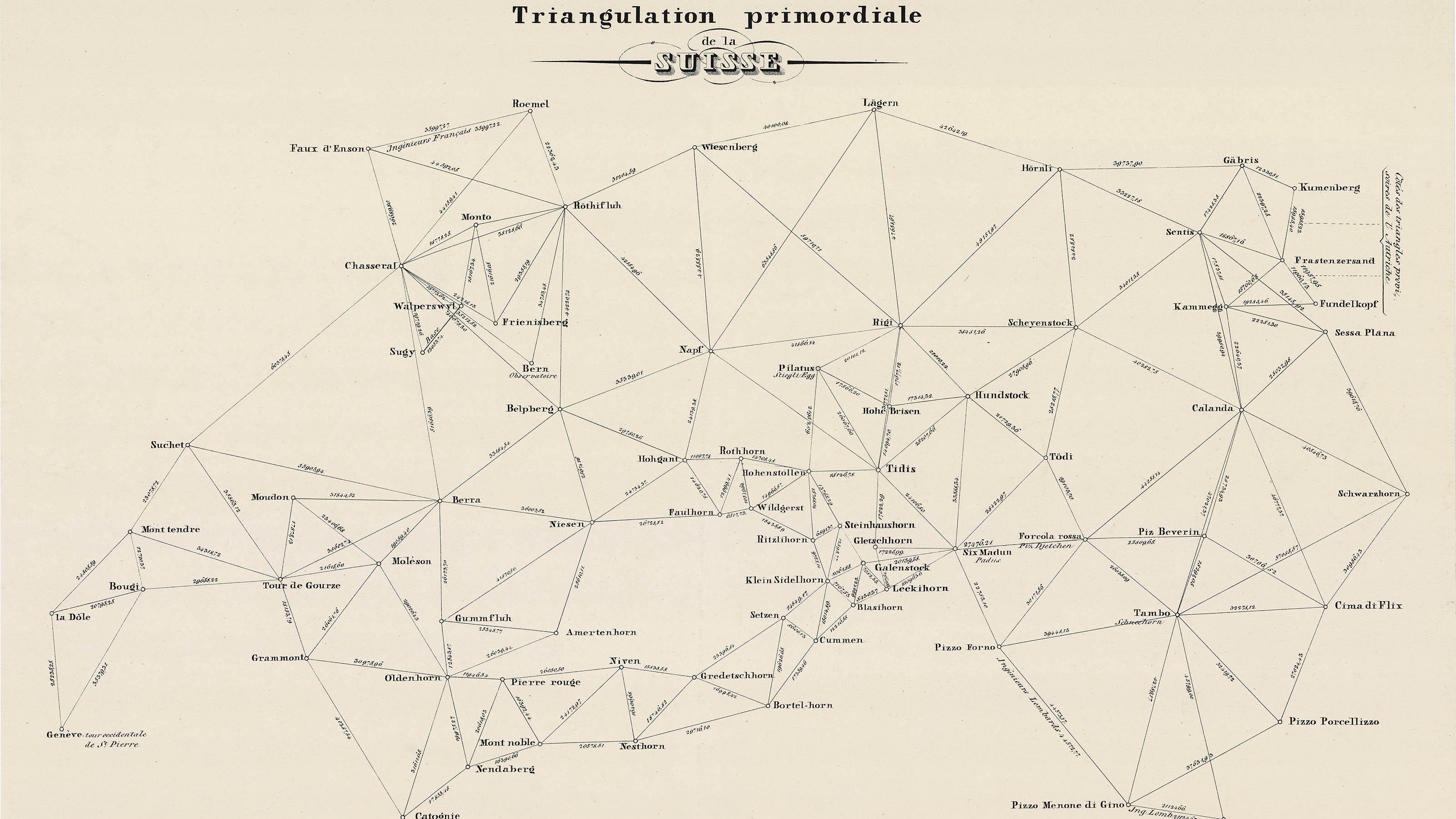
Here, Senn also referred to the so-called Triangulation primordiale with which geodesists covered Switzerland until 1837 using a wide-meshed triangular network of points of known position. The Triangulation primordiale formed the basis on which the Topographic Map of Switzerland (Dufour Map) was produced.
Man and instrument, "intimately familiar”
In the adverse circumstances "at inhospitable heights" as described by Senn, the surveyors had to operate the theodolite with the greatest possible concentration: it could only serve as a high-precision surveying instrument if people used it correctly as such. ETH Professor Fritz Baeschlin (1881-1961), for example, emphasised that the theodolite was "the most important instrument of the surveying engineer". The latter must therefore be "intimately familiar with its use both theoretically and practically".
Disassemble, transport, assemble, set up, take aim, turn, look through, read the angle, disassemble, transport: the numerous steps for operating a theodolite also create numerous sources of error. Only a precisely working, concentrated group of engineers and porters could produce satisfactory results with the theodolite precision-instrument. Measurement of angles saw man and instrument merge together.
The heavy, bulky, and complex instrument demanded a great deal of the porters and engineers but also took them to wild spots with breath-takingly beautiful scenery. As a result, the theodolite enabled the triangulation of wide spaces. It was therefore not only the secret protagonist in Ritz's painting but also played a central role in the mapping of Switzerland.
Links
Federal Office of Topography swisstopo
Seftigenstrasse 264
3084 Wabern

