
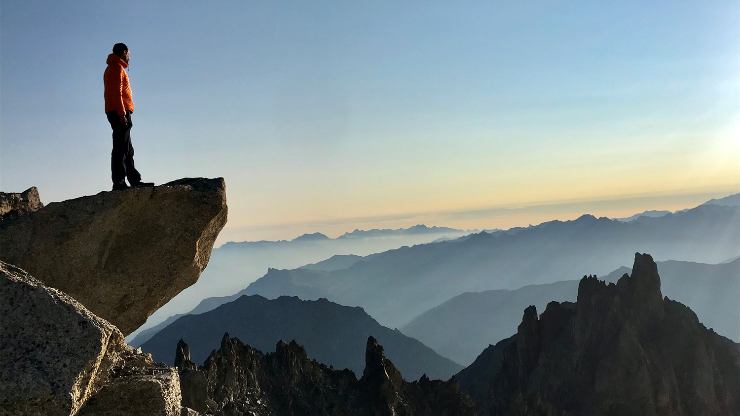
How much time should I allow for my route?
Even experienced hikers face this dilemma: you plan a hike and estimated the route and terrain, yet time passes faster than expected. Good time management is crucial when hiking to avoid missing the last train or get back after dusk.Even experienced hikers face this dilemma: you plan a hike and estimated the route and terrain, yet time passes faster than expected. Good time management is crucial when hiking to avoid missing the last train or get back after dusk.
With the following tips and tricks, you can better estimate your hiking time and fully enjoy your outdoor adventure, whether you’re on familiar trails or exploring unknown terrain.
With the following tips and tricks, you can better estimate your hiking time and fully enjoy your outdoor adventure, whether you’re on familiar trails or exploring unknown terrain.
A handy rule of thumb
A proven method for estimating hiking time uses a simple that takes into consideration both distance and elevation differences:
- For 1 km of hiking: allow approximatively 15 minutes.
- For 100 m of ascent: add an extra 15 minutes.
- For 200 m of medium-steep descent: add another 15 minutes .
Background
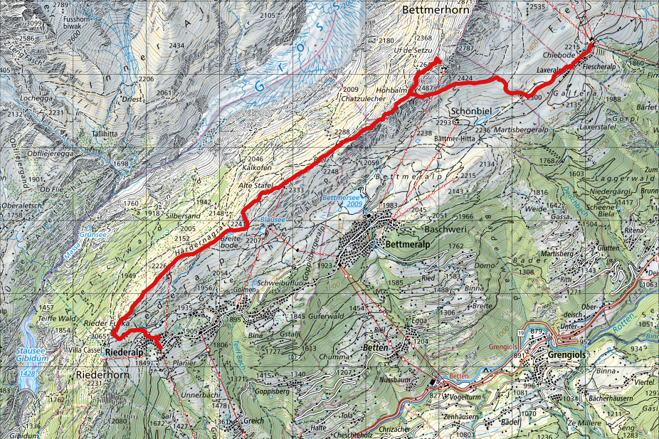
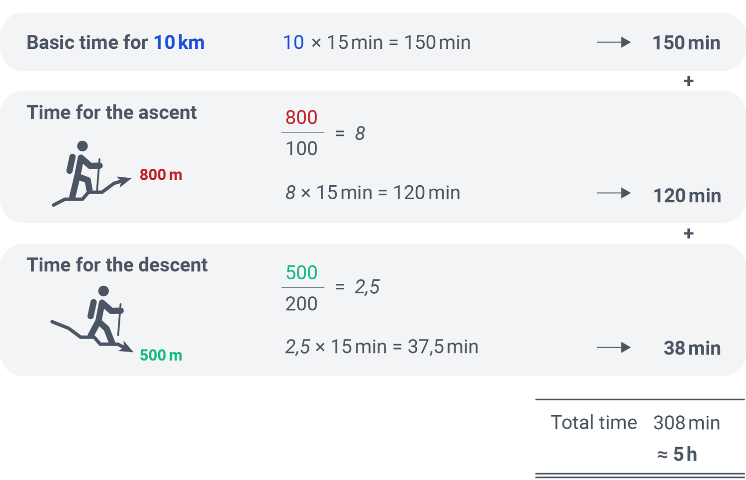
You plan a hike from Bettmeralp to Fiesch, via mountain station Bettmergrat. The route is approximatively 10 km long, with an ascent of 800 m and a descent of 500 m.
Calculating hiking time only
Calculate the base time for the distance and add the extra time for elevation changes.
Always leave a buffer
Breaks, enjoying the view, and taking photos are part of the experience. Always allow yourself a little more time than strictly necessary. This way, you can hike at a relaxed pace and soak in the scenery without constantly checking the clock. This ensures you won’t miss your last train, bus, or cable car! So, use this guideline to help you along:
→ allow 5-10 minutes per hour for breaks.
To calculate a realistic buffer, consider the Bettmerhorn hike example:
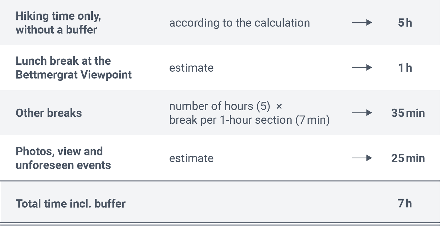
All in all, plan for a 7-hour-Hike from Bettmeralp via the Bettmerhorn to Fiesch.
Practice makes perfect! The more routes you plan, the better your time management will become.
Another useful hiking tip
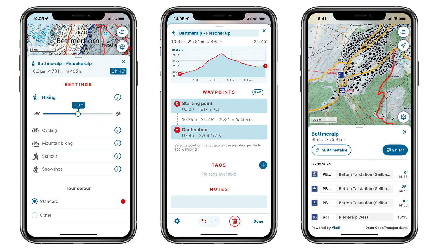
The swisstopo app lets you quickly check precise distances and elevation profiles. It automatically calculates time estimates for hiking, cycling, biking, skiing, or snowshoeing routes, which you can adjust to your fitness level. Note that app-generated times may differ from the rule of thumb (the latter is intentionally generous).
The app also includes all public transport stops, making it an ideal companion for planning and navigating.
More on the swisstopo app: swisstopo app (admin.ch)
Map reading is in!
Map reading is not only a useful skill for all outdoor enthusiasts but also helpful for planning. With a bit of practice and the right information, you can organise your trips even better and impress your friends with your expertise. Incidentally, our famous Swiss national maps are among the most detailed and accurate in the world. By the way: it doesn’t matter whether you use the swisstopo map on your smartphone or as a paper map, as the legend stays consistent.
Would you like to know more? Further information can be found in the legend (also called the “key”) for all swisstopo maps: Map reading | swisstopo Online Shop (admin.ch)
Federal Office of Topography swisstopo
Seftigenstrasse 264
3084 Wabern