
Planimetric and 3D transformations
The simple and precise transition between different reference systems and reference frames is crucial for the efficient processing of geodata. This is why swisstopo offers suitable transformation methods for all applications, either through online services over the Internet or commercially available geodetic software.
When is a coordinate transformation necessary?
Coordinate transformations are necessary when geodata from different systems or reference frames need to be combined or compared. This is the case, for example, when updating older cadastral data to a more recent reference system, or when using data from multiple countries together. Depending on the level of precision required and the systems involved — whether it is a matter of going from LV03 to LV95, from CHTRS95 to ETRS89, or from one time frame to another — different methods are applied, ranging from simple translations to kinematic models taking into account tectonic movements.
Coordinate transformation ETRFyyyy <-> CHTRFyyyy
The reference systems ETRS89 and CHTRS95 are identical for the epoch t0 = 1993.0. The two reference frames may therefore be regarded as identical for applications requiring reduced accuracy (ETRFyyyy ~ CHTRFyyyy). For applications requiring higher accuracy, a transformation in time is necessary. For this purpose, the kinematic model CHKM95 is applied, which takes into account the temporal changes of the coordinates and heights due to the tectonic movements in the Alpine region.
Coordinate transformation CHTRFyyyy <-> LV95
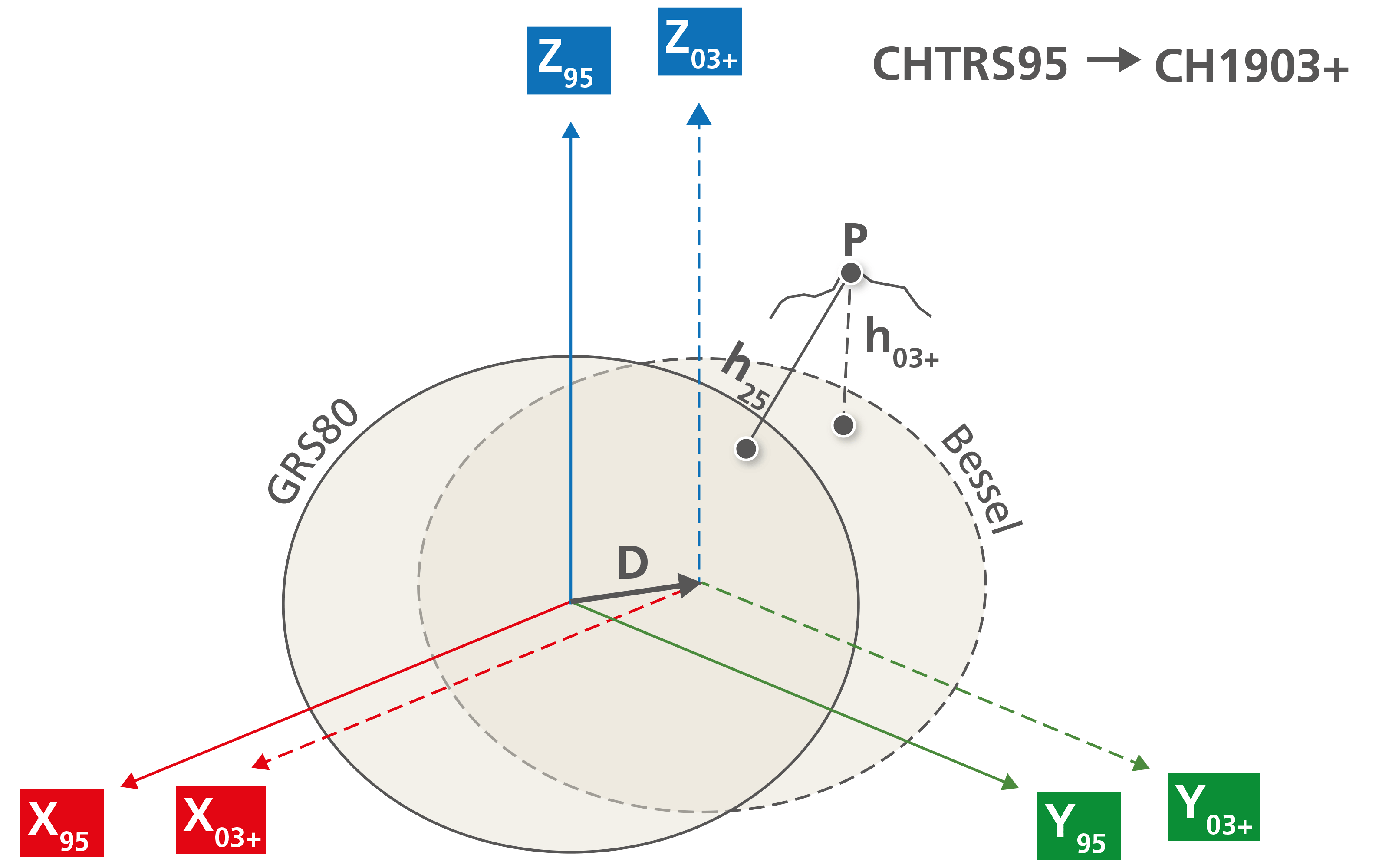
The three-dimensional Cartesian reference systems CHTRS95 and CH1903+ can be transformed exactly from one to the other with a simple translation (3 shifts). This method may also be applied without reservations to coordinates from the reference frames CHTRFyyyy and LV95. Only the different ellipsoid dimensions and the map projections must still be taken into consideration
Coordinates transformation LV95 <-> LV03
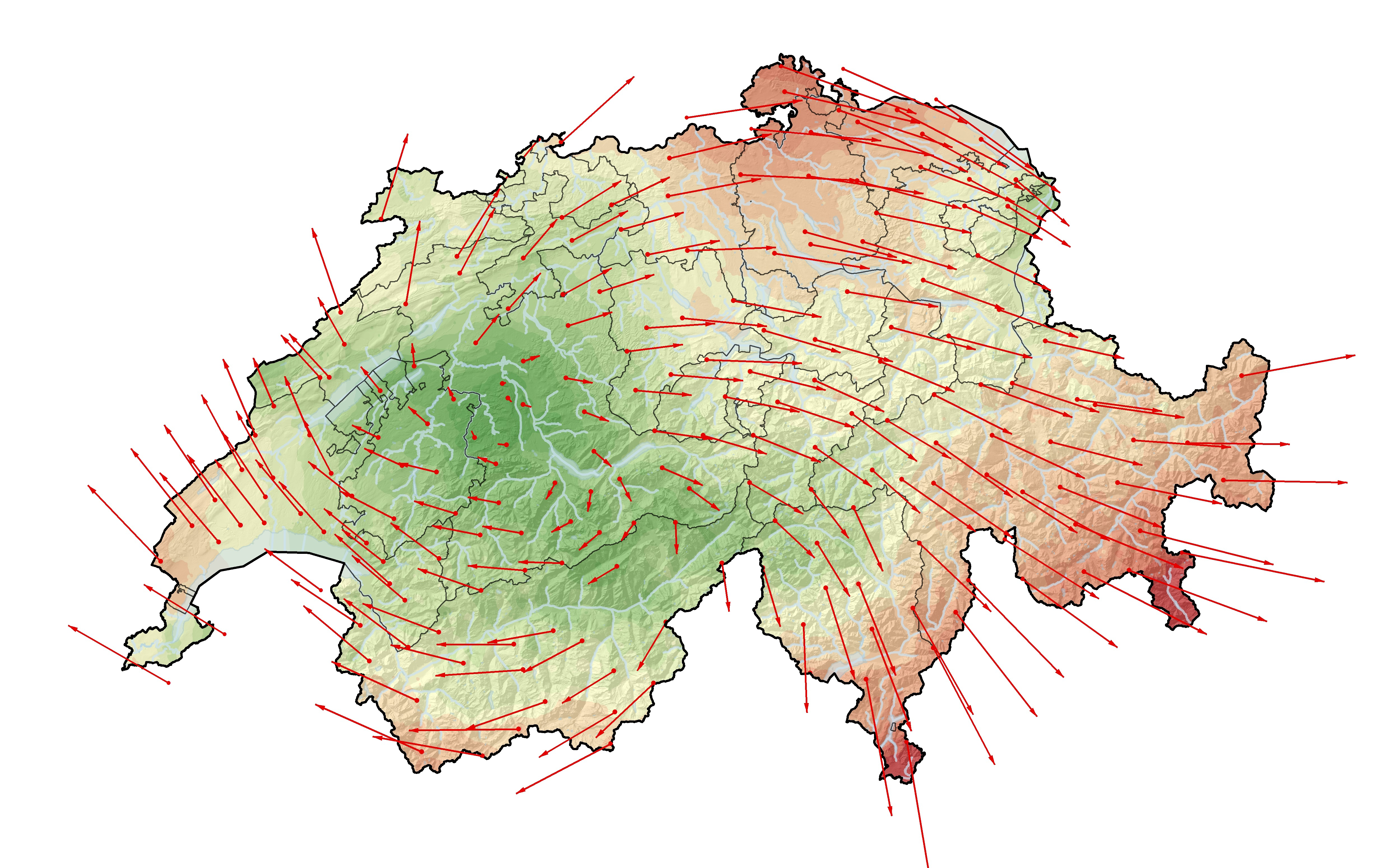
An exact transformation is not possible because of the large distortions (up to 1.6 metres). The distortion may be approximated with an affine transformation using finite elements. An approximation to LV03 with a degree of accuracy within a few centimetres in the Central Plateau and below 1 decimetre in the Alps can be calculated with the REFRAME programme and using the CHENYX06 dataset from the triangular transformation network.
A NTV2 grid data set for transforming to ETRS or to LV95 is distributed unter «GIS Tools and Applications (FME)» (NTv2 grid CH1903/LV03 -> CH1903+/LV95 or NTv2 grid ETRF93/ETRS89 -> CH1903/MN03) or under open data licence Creative Commons CC0.

Federal Office of Topography swisstopo
Seftigenstrasse 264
3084 Wabern