
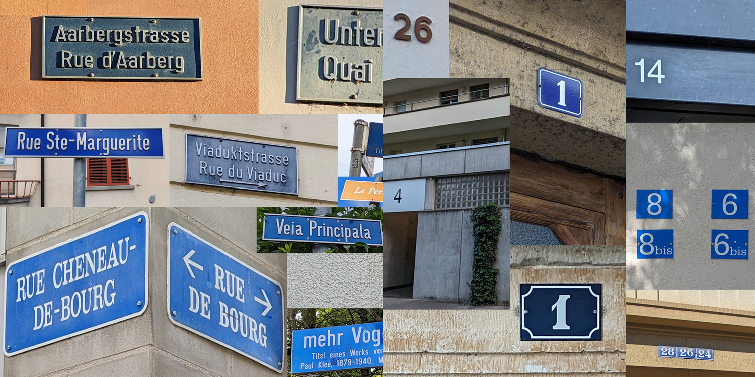
Official directories of streets and building addresses
Major changes to the official street and building address directories will take place in March 2025. To help you prepare, these changes are listed below. Technical documentation will be updated accordingly.
Changes for March 2025
Data model
For both directories:
- STN_LANG will become STN_LANGUAGE in all formats where the attribute is present. This attribute indicates the language of the street name.
- STN_SHORT will be deleted (it will also be removed from the FSO's 2025 “Merksmarlkatalog/Catalogue des caractères”) in all formats where the attribute is present.
For the official directory of building addresses:
- The COM_NAME attribute with the name of the municipality is added to the CSV format.
For the official directory of streets:
- Introduction of STR_PARENT and STR_CHILDREN attributes, see after «ghost streets».
- Introduction of the STR_PNT attribute, so that streets can also have point geometry. This will make it possible to accept around 10,000 streets that today only have point geometry (which it is not planned to change to linear or surface geometry). These point streets have been created when an address in GWR refers to a street that does not exist in GWR. This change will also have an effect on streets along communal boundaries (where buildings on several different municipalities are addressed to the same street), see «ghost streets» below.
Visualization
For the official directory of building addresses:
- Removal of the distinction in the symbolization between «Official» «Yes» (dark gray) and «No» (light gray). This distinction is more or less arbitrary and varies greatly from canton to canton. This feature is new to GWR, and the data is still processed in a very inconsistent way. The «official» attribute will always be present in the Infobox.
- Change of address colors: light blue dots for wide and medium zoom. Until now, addresses were shown in the same color as streets.
- The representation of building numbers remains in black (close zoom).
For the official directory of streets:
- «Point» street geometries will now be visible.
- The display of named places will be adapted according to zoom:
- Wide zoom: a point at the surface centroid
- Medium zoom: only the name of the named place
- Close zoom: the outline of the named place and its name
Ghost streets
Streets that run along a municipal boundary, and therefore have buildings addressed in the municipalities concerned, have several ESIDs. This is due to the fact that each municipality is responsible for assigning the street names used to address the buildings in their municipality. For these particular streets, each will have a «main» ESID (which is the primary street), as well as «secondary» ESIDs. Two new attributes, STR_PARENT and STR_CHILDREN, have been created to deal with this particularity. The figure below illustrates the situation.
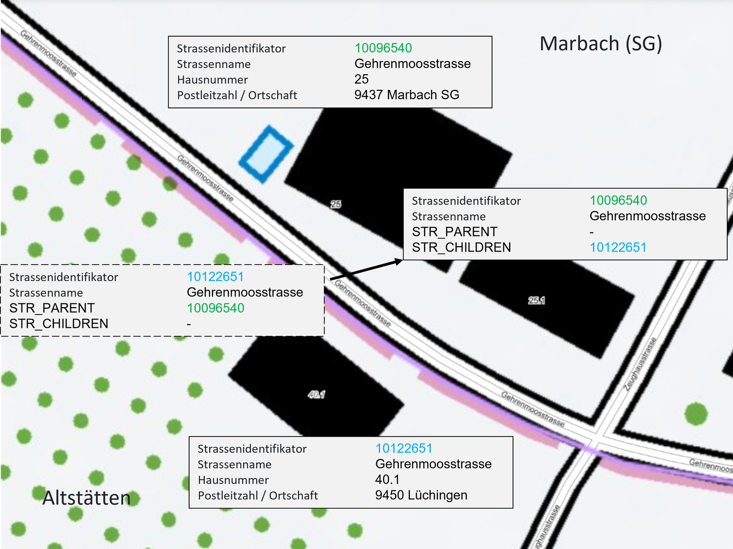
Gehrenmoosstrasse is located in the municipality of Marbach (SG). However, building 40.1 in Altstätten is also addressed to Gehrenmoosstrasse. Each of the two municipalities must assign an ESID to the street. The ESID 10096540 assigned by the municipality of Marbach (SG) is what we will call the «parent» ESID. It is the geometry linked to this ESID that will be displayed on map.geo.admin.ch. The 10122651 ESID is a «child» ESID. The geometry of this ESID will be a point.
In CSV format, the situation will be as follows:

It is now possible to find street affiliations with several ESIDs. The «parent» and «child» information will also be shown in the Infobox when such a street is clicked.