
swisstopohistoric.ch
In the swisstopohistoric.ch web application, stories from swisstopo's history are translated into digital formats such as podcasts, videos and interactive maps. An annually-changing focus topic determines the content of the contributions; an agenda also provides information about past and upcoming events.
Current theme: 100 years of swisstopo Flight service 1926–2026
In order to survey Switzerland using aerial photographs, the Federal Office of Topography swisstopo established its own flight service in 1926. It laid the foundations for maps, the land registry plan and photographic plans, which have had a significant impact on our image of Switzerland and continue to do so today.
To mark this anniversary, a richly illustrated book has been published for the first time, chronicling the hundred-year history of the flight service. In addition, an online chronicle provides a schematic overview of the history of the air service and features testimonials from contemporary witnesses.
Link

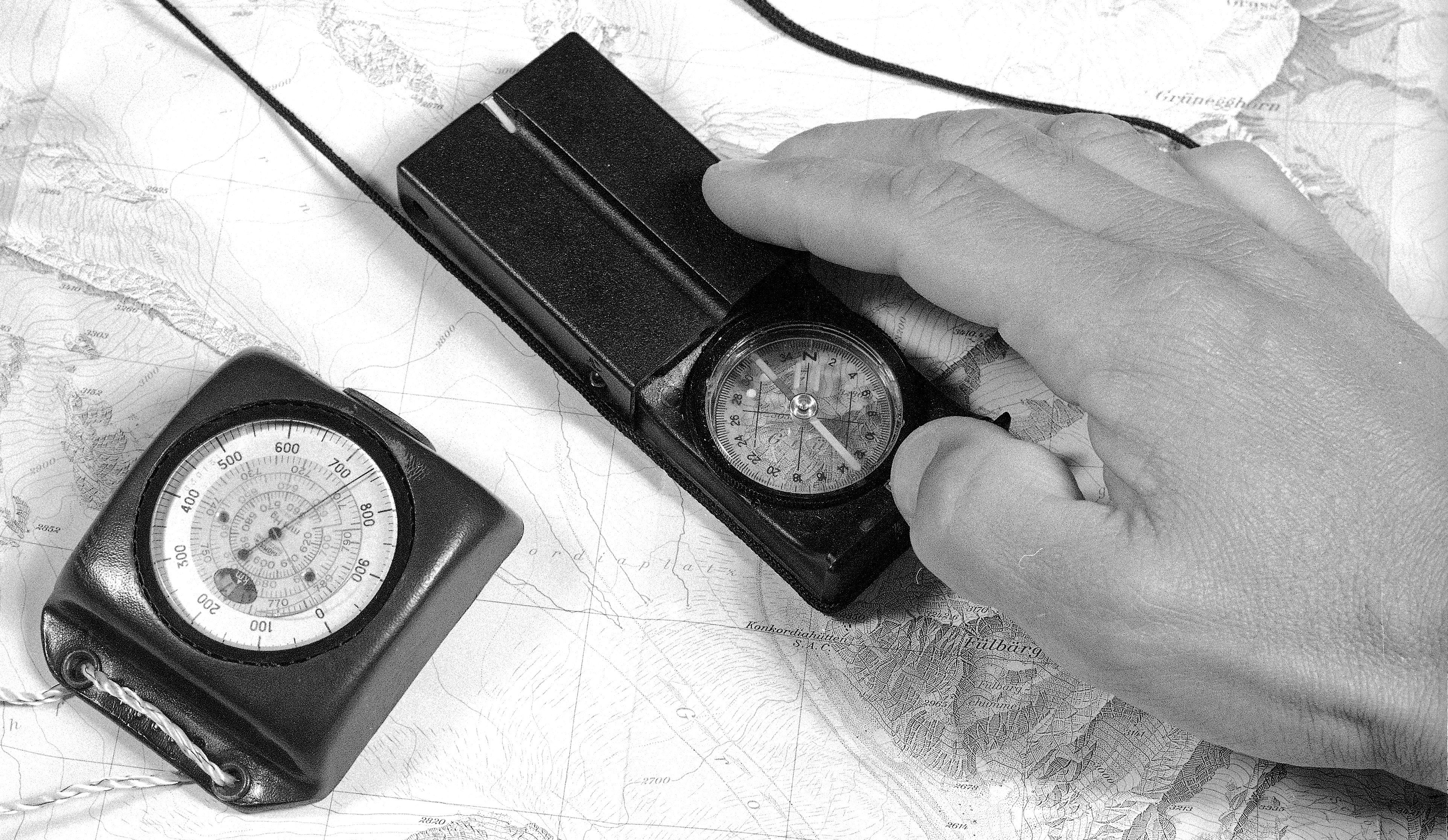
2024: On paper and at the screen. The digitization of mapreading
Users have always had a major influence on swisstopo geodata. Their needs not only shape how maps and other products look, but also determine which geodata are produced at all. With digitization, new forms of geodata have emerged. Use has also changed due to the screen. However, many fundamental aspects have remained the same in both analogue and digital formats.
2024: The last craft
2001 saw one of the biggest changes in swisstopo's map production. After 163 years of use on copper, stone and glass, the engraving craft came to an end. Glass? From 1953 to 2001, swisstopo engraved its map originals in a layer of lacquer on glass. You can find out how this came about in this story about layer engraving on glass, the last cartographic craft at swisstopo.
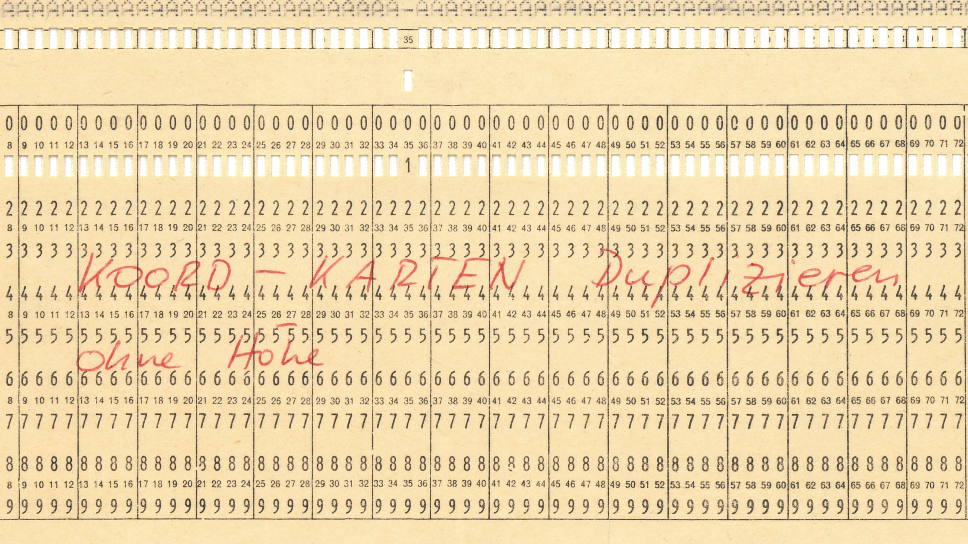
2023: Maps in the computer: Digitization at swisstopo, 1980-2000
Today, digital spatial data are the indispensable basis for countless applications. Between 1980 and 2000, swisstopo took decisive steps towards digitization. In the online exhibition, first-hand witnesses tell how the maps came into the computer.
2022: «The future begins at every moment» – The Digitization of the Federal Office of Topography 1960 – 1980
Today it is impossible to imagine geodata production without computers. This is a result of decades of effort: The origins of digitization at swisstopo go back to the 1960s. In our online exhibition, first-hand witnesses tell the story of how digitization started at swisstopo.
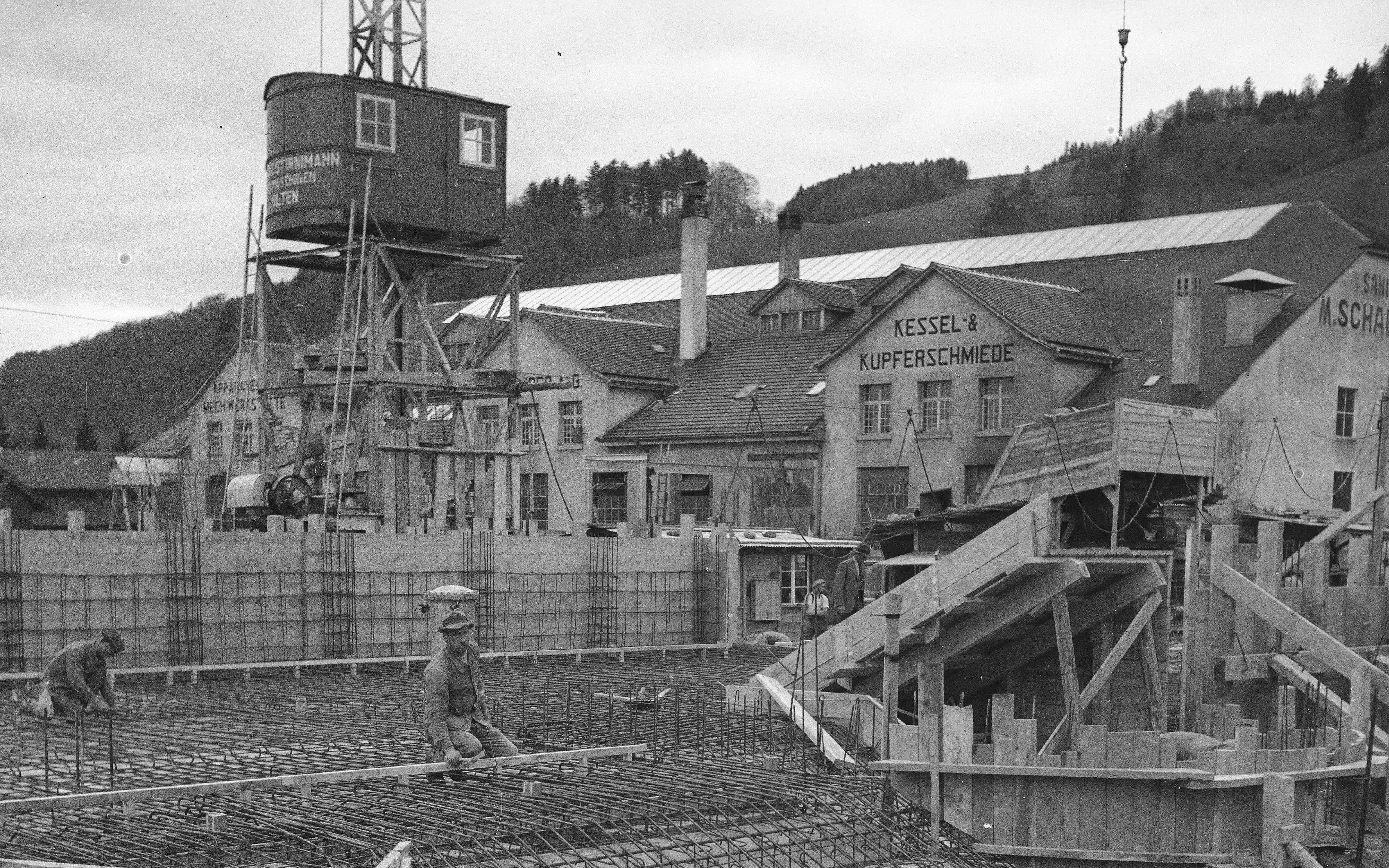
2021: The House of Maps. The Topographical Service builds in times of crisis
In 1941, the Federal Topographical Service opened its headquarters in Wabern, near Bern. The change of location was closely linked to a major cartographic project: in 1935, the Federal Parliament had commissioned the Topographical Service to create the National Map Series. In order to carry out this important work, it seemed inevitable that the engineers' working space would have to be centralized and expanded, and optimally adapted to the demands of their work. Not an easy task in the midst of an economic crisis and in times of unemployment and war.
2020: the 175th anniversary of the Dufour Map: “Map memories” web application
The production of the Dufour Map involved geodesists and topographers as well as countless assistants travelling all over Switzerland. We followed in their footsteps and recorded relevant points along with stories about the creation of the Dufour Map in an interactive web application.
Federal Office of Topography swisstopo
Seftigenstrasse 264
3084 Wabern